Early Los Angeles City Views (1800s)
 |
|
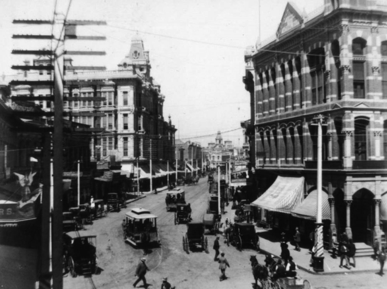
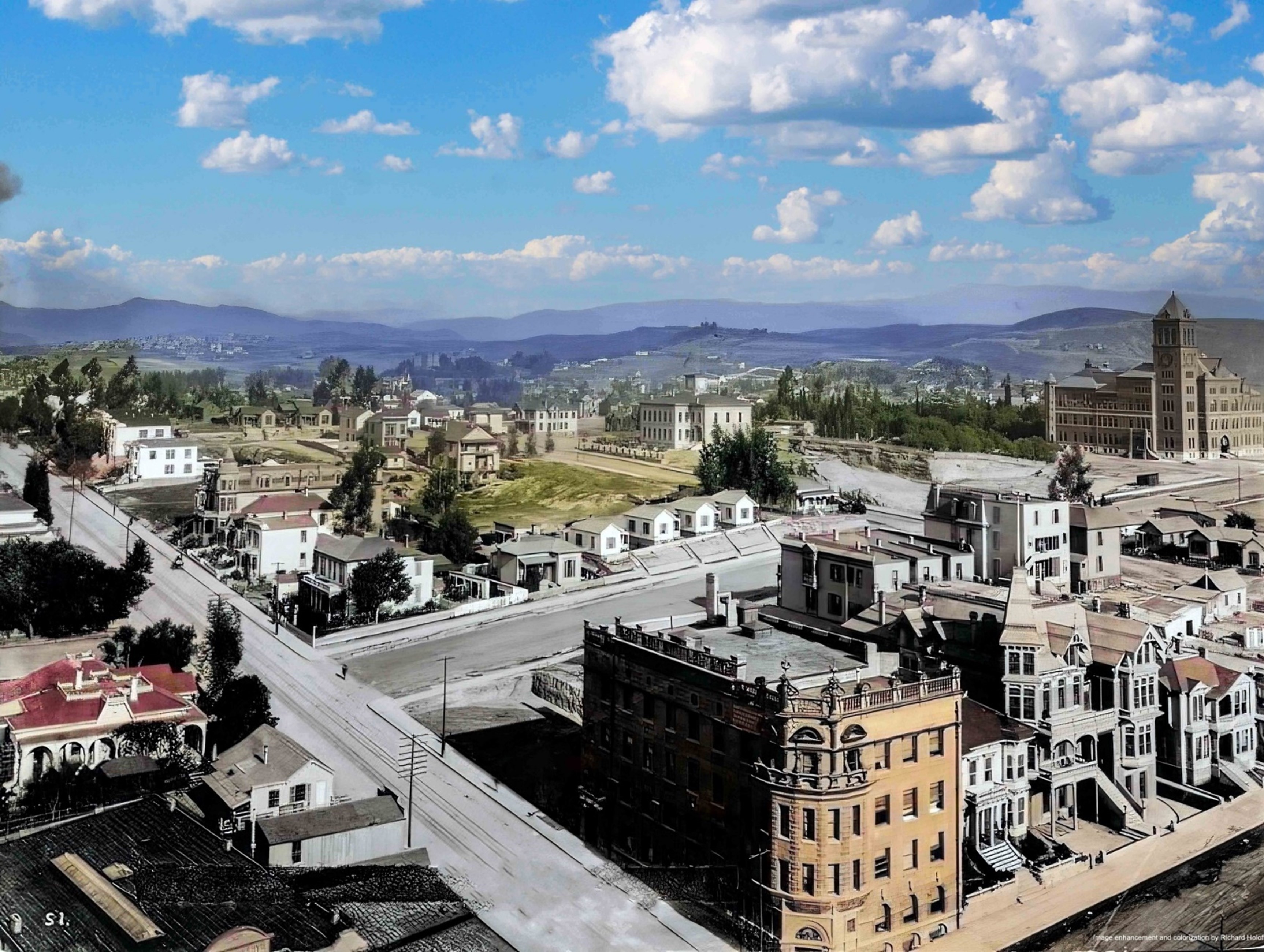
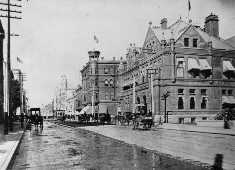
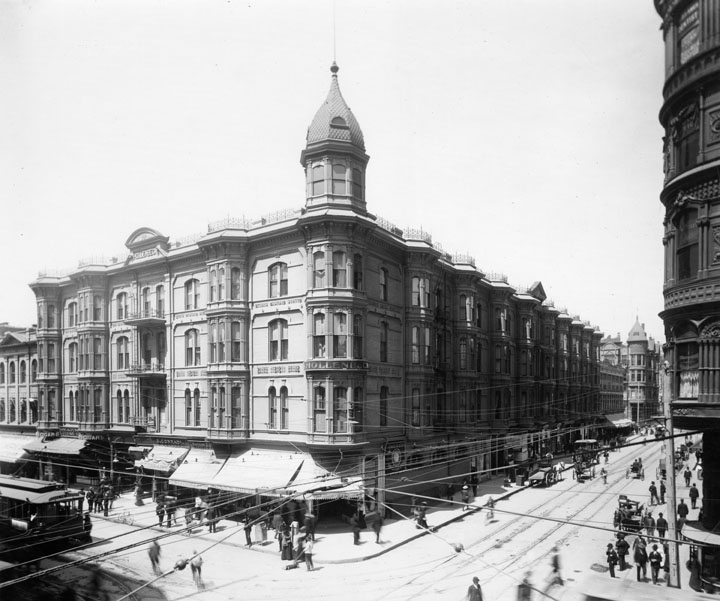
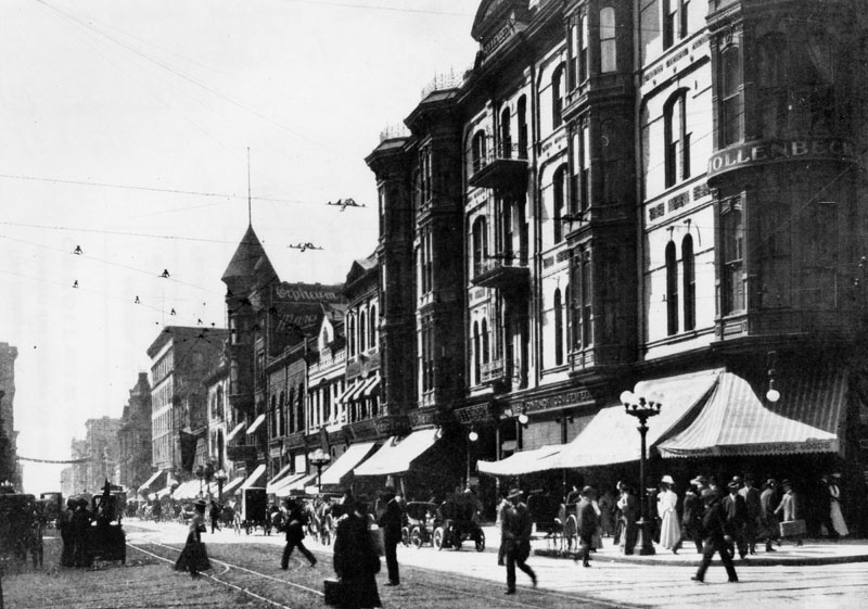
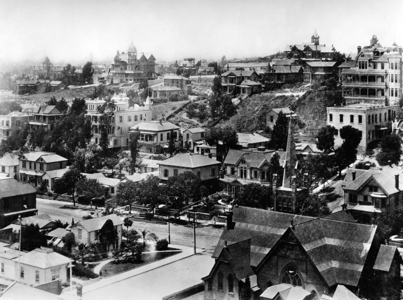
| (ca. 1890)* - View looking east down unpaved 4th Street from Hill Street. |
Historical Notes This view captures downtown Los Angeles at the edge of transformation. Fourth Street is still unpaved, and daily commerce depends on horse drawn wagons making deliveries to neighborhood stores. On the northeast corner of Hill and 4th stands the Brighton Hotel, with Meuschke’s Grocery operating at street level beneath a long awning that shelters customers from sun and dust. In the distance, the Grant Hotel rises as one of the area’s more prominent early structures. During the 1880s, Los Angeles experienced one of the fastest population growth rates in its history. Between 1880 and 1890, the city grew from roughly 11,000 residents to more than 50,000. This growth was driven by railroad connections, land speculation, and aggressive promotion of Southern California as a destination for health, opportunity, and investment. Streets like 4th and Hill sat at the crossroads between a small frontier town and an emerging city. |
 |
|
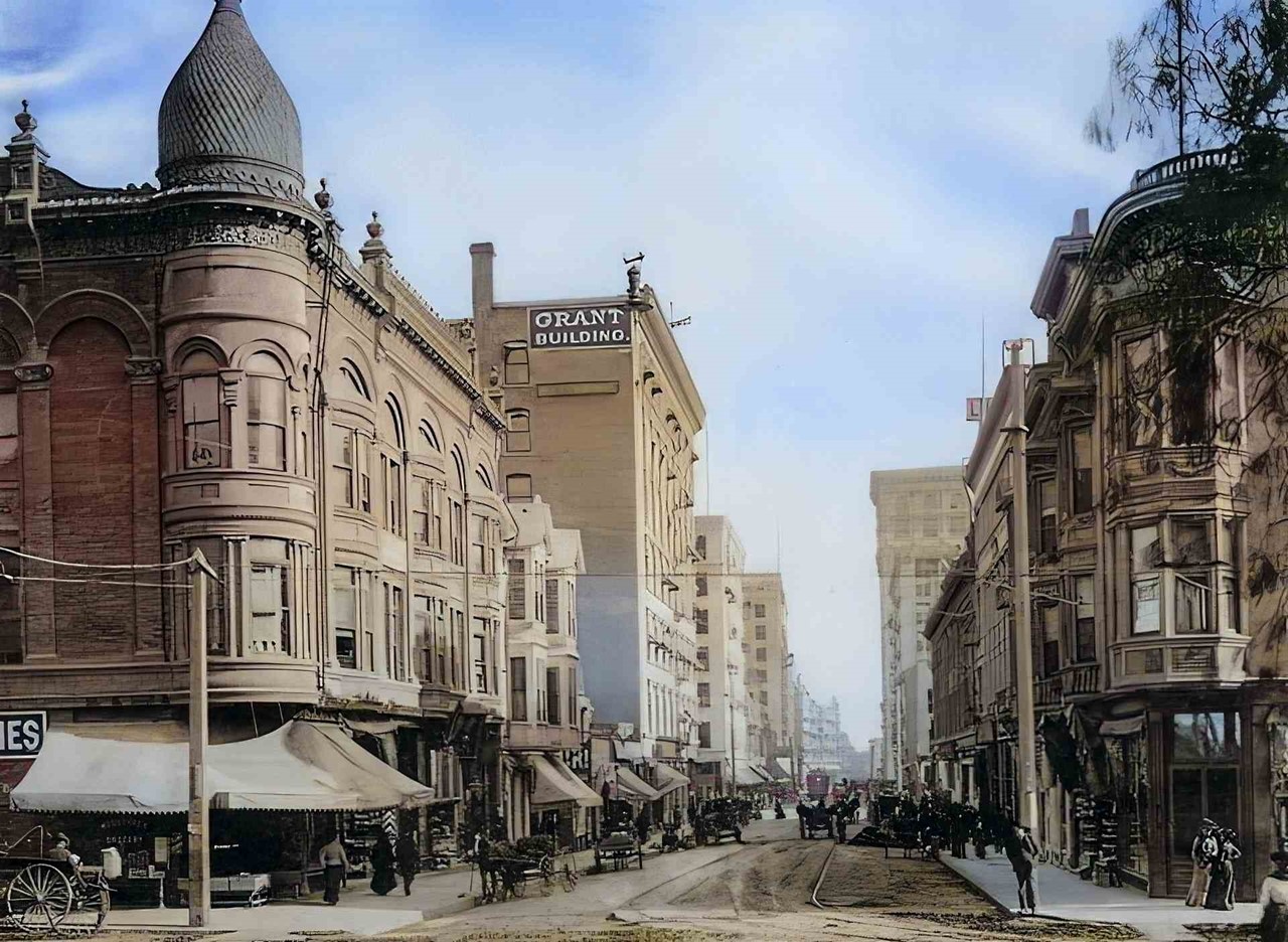
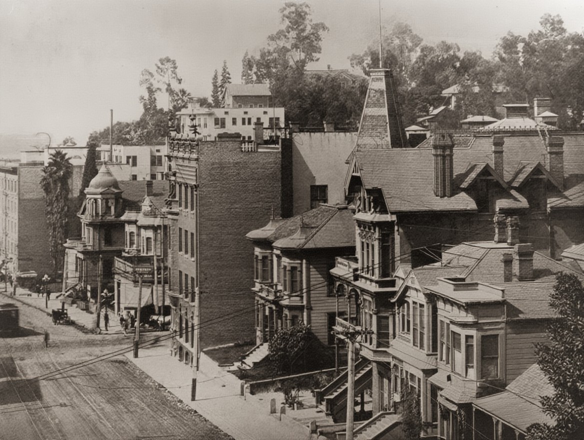
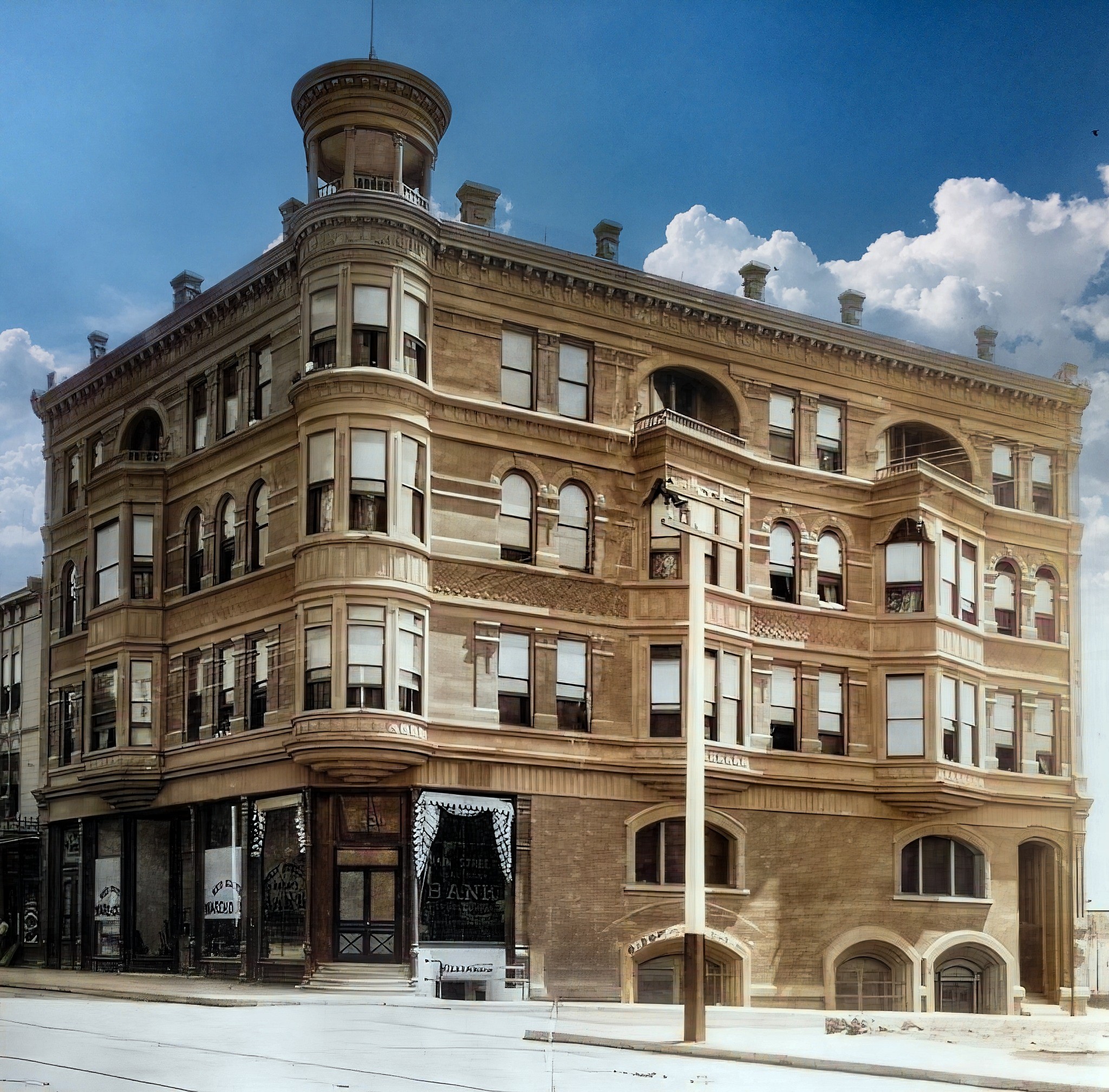
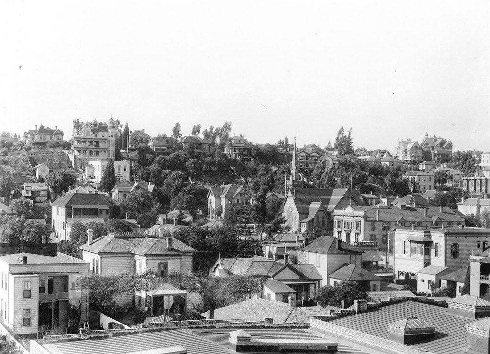
| (ca. 1890)* - View looking east on 4th Street at Hill Street with the Brighton Hotel on the northeast corner. Image enhanced and colorized by Richard Holoff. |
Historical Notes This image presents a clearer and more detailed view of the same intersection seen in the earlier photograph, made more legible through modern enhancement and colorization. The Brighton Hotel remains the dominant feature on the northeast corner, its bay windows and turret emphasizing the ambition of late nineteenth century commercial architecture in a rapidly growing city. Colorization helps highlight the contrast between permanent structures and a still unfinished streetscape. Dirt roadways, wooden sidewalks, utility poles, and horse drawn wagons reflect a city whose buildings were advancing faster than its infrastructure. Together with the earlier image, this view reinforces how Los Angeles in the 1890s balanced forward looking development with the practical realities of a frontier town in transition. |
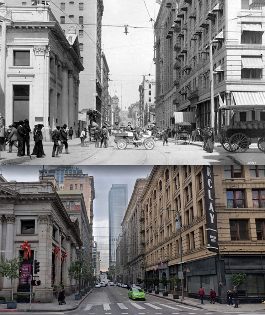
Then and Now
 |
|
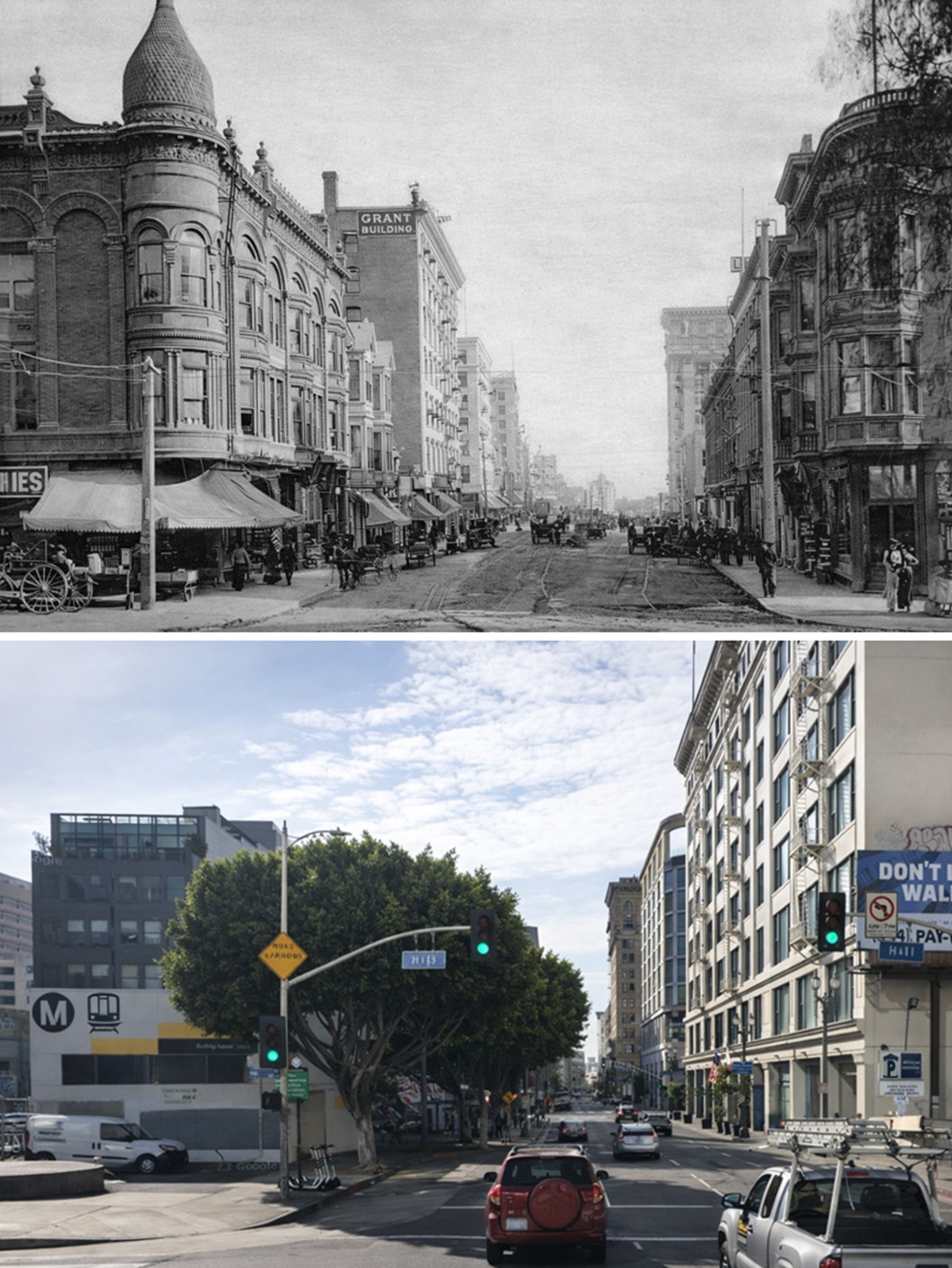
| (1890 vs 2022)* - Looking east on 4th Street at Hill Street. Photo comparison by Jack Feldman. |
Historical Notes The 1890 image shows an intersection defined by low rise buildings, dirt streets, and a human scale that reflects a town becoming a city. Architecture stands out individually, with hotels and shops clearly legible as separate landmarks. Young street trees line portions of the roadway, offering early shade and hinting at civic efforts to soften what was still a dusty commercial corridor. Movement is slow, and the street itself remains the dominant feature of the scene. In the modern view, the street has been fully absorbed into a dense urban environment. Paved roadways, taller buildings, and layered infrastructure reflect more than a century of growth and redevelopment. Mature trees now blend into the urban fabric rather than standing out as new additions. While the original structures are largely gone, the alignment of the street remains unchanged, anchoring the present city to its nineteenth century origins. |
30 Years Later
 |
|
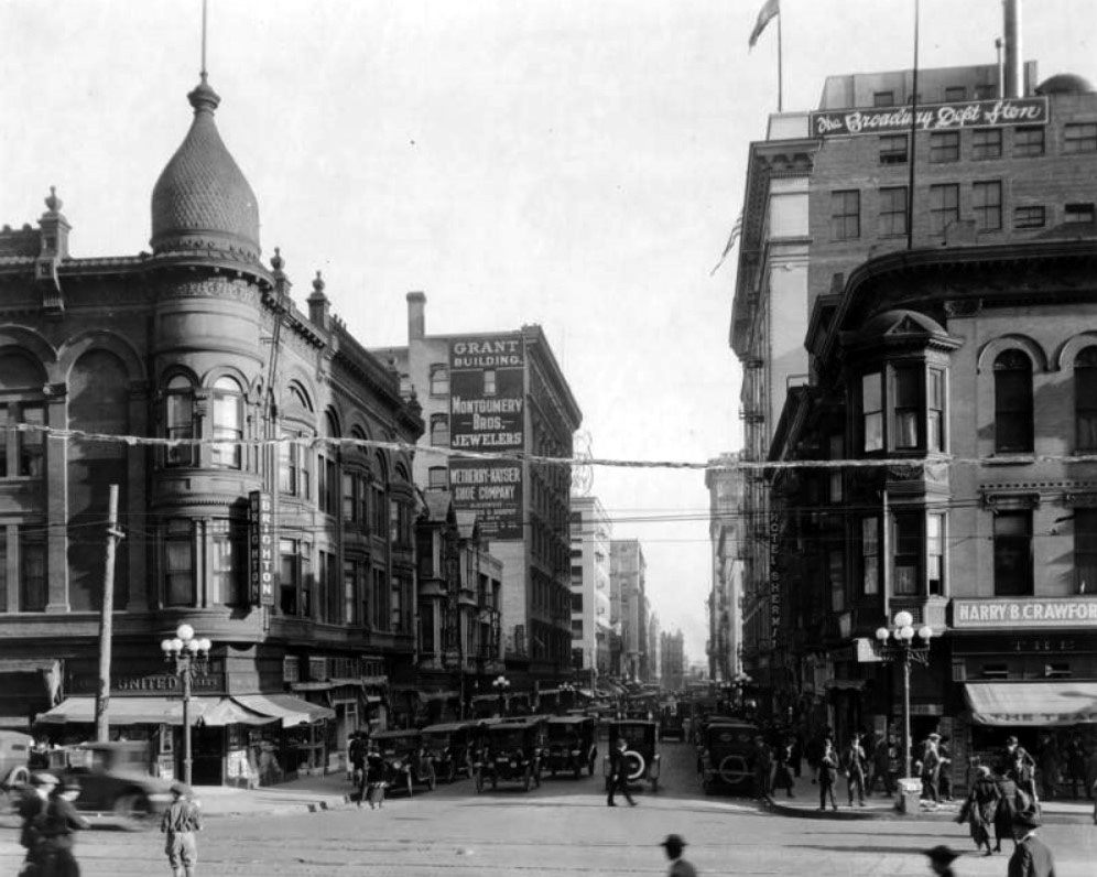
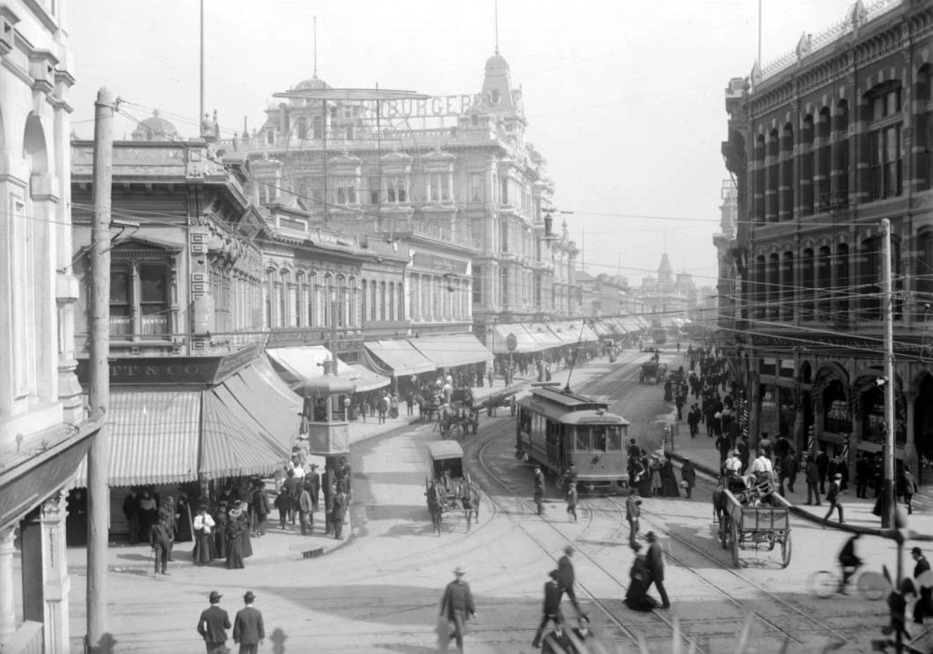
| (ca. 1920)* - View looking east down busy 4th Street at Hill Street. |
Historical Notes By 1920, the intersection of Hill and 4th had become part of a fully urban downtown. The street is now paved and crowded with automobiles, street activity, and dense pedestrian traffic. United Cigar Stores occupies the ground floor beneath the Brighton Hotel, while across the street the Grant Building stands opposite the Broadway Department Store. The Hotel Sherman rises nearby, with Teague Drug Company and other businesses operating at street level. This image reflects a city that has fully embraced modern commerce. Cafeterias, clothing stores, dentists, and national retail chains line the street, serving a population that had grown dramatically. Between 1890 and 1920, Los Angeles expanded from just over 50,000 residents to more than 575,000, an increase of over ten times in only three decades. Hill and 4th had evolved from a dusty crossroads into a bustling commercial artery. |
Then and Now
 |
|
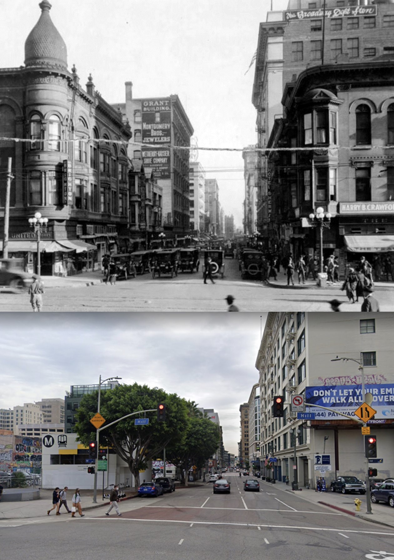
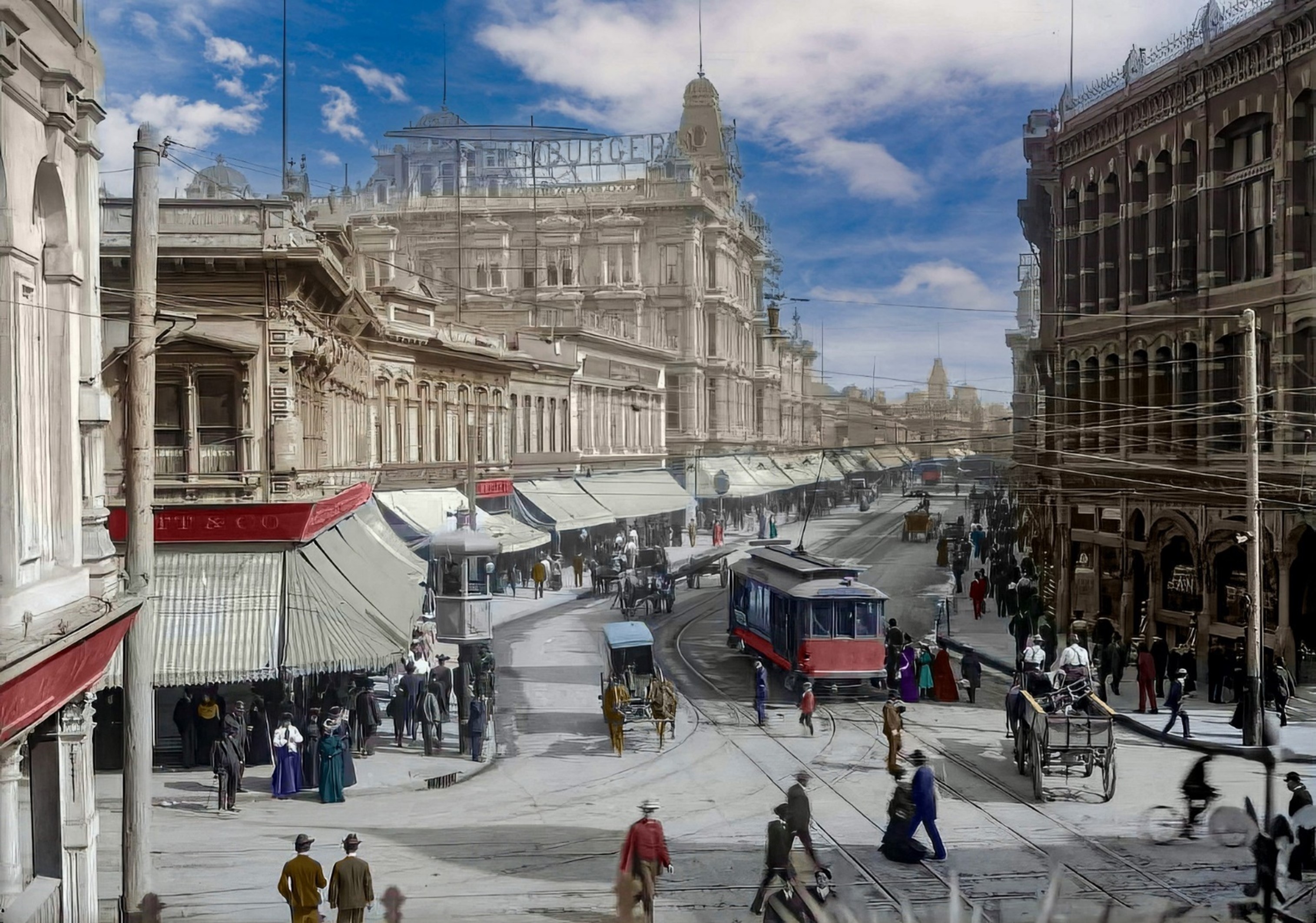
| (1920 vs. 2021)* – Looking east on 4th Street at Hill Street. Photo comparison by Jack Feldman. |
Historical Notes In the 1920 view, the intersection functions as a major downtown crossing, with crowds waiting at the curb and automobiles competing for space. Buildings are taller, signage is bolder, and the street reflects a confident, fast moving city. The architecture expresses permanence and commercial ambition, marking Los Angeles as a regional center. The modern comparison shows a quieter but more layered streetscape. While many early twentieth century buildings have been replaced or altered, the intersection continues to serve as a key downtown connector. Traffic patterns, street width, and orientation remain consistent, offering continuity amid constant change. Together, the images show how Los Angeles reinvented itself repeatedly while building upon the same urban framework laid down in the nineteenth century. |
* * * * * |
Spring and 1st Street
 |
|
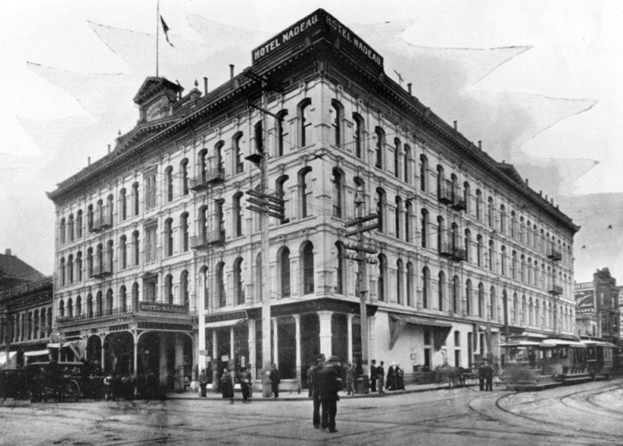
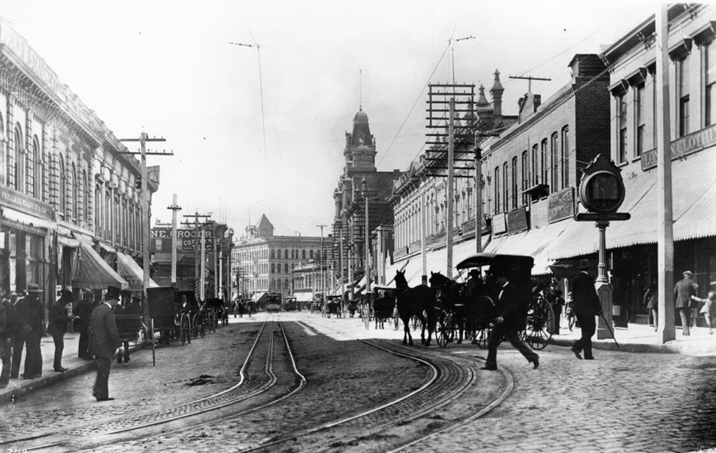
| (ca. 1888)* - Postcard view looking north on Spring Street from 1st Street. Los Angeles National Bank Building is on the northeast corner on the right. Down the block (center-left) is the 1887-built French Renaissance-style Phillips Block who's main tenant was the Hamburger & Son's People's Store. In the far distance can be seen the main cupola of Baker Block located on Main Street. Note the Horse-Drawn Streetcars (in operation from 1874 to 1888). |
Historical Notes With a thriving population of 50,395 (1890), 1st and Spring Streets, where present-day City Hall now stands, was the heart of the city. At that time the downtown section extended north of 1st Street, while the residential section started about 4th Street to the south. Spring Street between Temple Street and 1st Street was a vital part of early downtown Los Angeles in the late 1880s. This section formed the heart of the central business district, with the intersection of 1st and Spring considered the city's center. The area was characterized by significant commercial development, reflecting the rapid growth of Los Angeles during this period. Notable buildings along this stretch included the Los Angeles National Bank Building, the Phillips Block (which housed A. Hamburger & Son's People's Store), and the Nadeau Hotel. Transportation evolved from horse-drawn streetcars to electric streetcars by the early 1890s, further enhancing the street's importance as a bustling hub. As Los Angeles experienced a population boom, increasing from 11,200 in 1880 to 50,395 by 1890, this section of Spring Street became increasingly busy and commercially vibrant. The area's significance in the 1890s laid the foundation for future development, though many of the original buildings were later demolished to make way for the Civic Center district in the 20th century. |
 |
|
| (ca. 1890s)* - View is looking north on a very busy Spring Street from 1st Street. A portion of the Nadeau Hotel (1882), LA's first 4-story building, is seen at far left (SW corner of Spring and 1st). Across the street (NW corner) stands the Larronde Block. A very large sign for Hamburger's Department Store can be seen on top of the 4-story Phillips Block (1887) at center of photo. To the right (NE corner) is the Los Angeles National Bank (also built in 1887). This is where City Hall stands today. Note that electric streetcars have now taken over for the Horse-Drawn Streetcars seen in previous photo. |
Historical Notes A. Hamburger and Sons was one of the first department stores to operate in Los Angeles. Originally known as A. Hamburger & Son's People's Store, the name later changed to Hamburger's Store. In 1908 the company relocated their store from Spring Street to a newer building located at Broadway and Eighth Street. May Department Stores acquired Hamburger's in 1923 and renamed it the May Company. Much later in the century, the May Company and Robinsons chains of department stores would affiliate under the name Robinsons-May; and this entity would be bought out by Macy's in 2005. |
 |
|
| (ca. 1890s)* - Looking north on Spring Street at 1st Street. Photo: C.C. Pierce / USC Image Library; Image enhancement and colorization by Richard Holoff. |
Historical Notes Note the elevated kiosk on the northwest corner of the intersection. Elevated booths like these were used by the Los Angeles Railway and the Yellow Cars as a switchman’s tower to control the flow and path of streetcars through the intersection. Many of these were still standing well into the 1920s. |
 |
|
| (1896)* – Passing of the Guard: A new electric streetcar is seen side by side with a cable streetcar at Spring Street and 1st Street in downtown Los Angeles. Cable streetcars, first introduced in the 1880s, were short-lived in the city. Just 16 years after L.A. celebrated its first cable railway as a technological marvel, the last of its cable cars rolled down Spring Street and into obscurity, replaced by the more modern electric streetcar. View is looking south. Photo courtesy of Ray Long. |
Historical Notes There were three cable railways in Los Angeles. The Second Street, which lasted but a few years, was tied into a real estate development west of Bunker Hill. It succumbed with the collapse of Echo Park Lake. LA Cable closed in 1896. The third line, Temple Street Cable Railway, survived until 1902 when it became Los Angeles Railway’s “A” Line. |
 |
|
| (1897)* - The Nadeau Hotel, showing the entire SW corner at 1st and Spring Streets, the present site of the LA Times iconic building. The hotel was built in 1882 as the first 4-story building in L.A. A paved street now visible. Horses, carriages, cars and trolleys, along with people are now visible. A sign giving the name of the hotel sets on the corner of the roof. The hotel advertises that it is heated by F.E. Brown's hot air furnace, and testimonials are available. Architects, Morgan & Walls. |
Historical Notes Remi Nadeau was a French Canadian pioneer who arrived in Los Angeles in 1861 driving a team of oxen. During the silver-mining excitement in the Cerro Gordo region of Inyo County his teamster operation brought tons of silver to Southern California and hauled back food and supplies to the miners. By 1873 he operated 80 such teams. He also built the Nadeau Hotel, Los Angeles's first four-story structure and the first building with an elevator. |
* * * * * |
Spring and Temple
 |
|
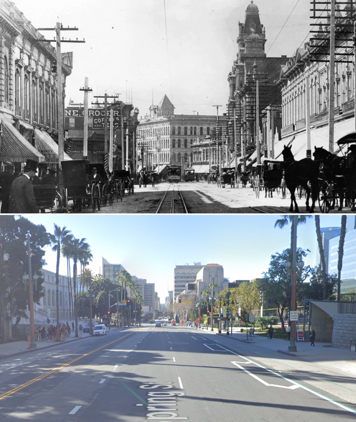
| (1896)* - Spring Street looking south from Temple. Horse-drawn vehicles are seen mainly parked along the curbs while pedestrians cross the cable car tracks. The two largest building seen in the distance are the Nadeau Hotel (SW corner of Spring and 1st) and the more ornate Phillips Block (25-37 N. Spring Street). The tower seen behind the Nadeau Hotel is the 1888-built City Hall located on Broadway. Photo by C.C. Pierce |
Historical Notes Spring Street between Temple Street and 1st Street was a vital part of early downtown Los Angeles in the 1890s. This section formed the heart of the central business district, with the intersection of 1st and Spring considered the city's center. The area was characterized by significant commercial development, reflecting the rapid growth of Los Angeles during this period. Notable buildings along this stretch included the Los Angeles National Bank Building, the Phillips Block (which housed A. Hamburger & Son's People's Store), and the Nadeau Hotel. Transportation evolved from horse-drawn streetcars to electric streetcars by the early 1890s, further enhancing the street's importance as a bustling hub. As Los Angeles experienced a population boom, increasing from 11,200 in 1880 to 50,395 by 1890, this section of Spring Street became increasingly busy and commercially vibrant. The area's significance in the 1890s laid the foundation for future development, though many of the original buildings were later demolished to make way for the Civic Center district in the 20th century. |
.jpg) |
|
| (1896)* - Spring Street looking south from Temple. Horse-drawn vehicles are seen mainly parked along the curbs while pedestrians cross the cable car tracks. The two largest building seen in the distance are the Nadeau Hotel (SW corner of Spring and 1st) and the more ornate Phillips Block (25-37 N. Spring Street). The tower seen behind the Nadeau Hotel is the 1888-built City Hall located on Broadway. Photo by C.C. Pierce |
Then and Now
 |
|
| (1896 vs 2023)* - Looking south on Spring Street from near Temple Street. Note: Spring Street was realigned in 1928 when LA City Hall was built. Photo comparison by Jack J. Feldman. |
* * * * * |
Broadway and Temple (1890-1905)
 |
|
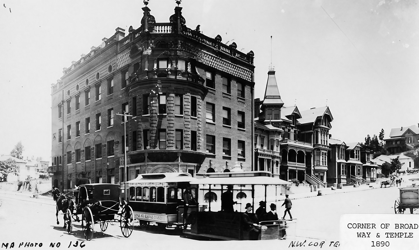
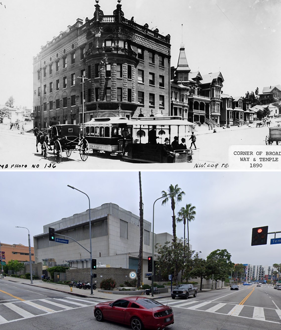
| (1890s)* - View looking NW from the top of LA County Courthouse located on the SE corner of Temple and Broadway. The original Los Angeles High School, which was moved in 1887, can be seen at center of photo. The New Los Angeles High School (built in 1891) is at right-center. In the foreground can be seen the Temperance Temple (WCTU), located on the northwest corner of Temple Street and Broadway. |
Historical Notes In the 1890s, the intersection of Broadway and Temple Street was a key focal point in downtown Los Angeles. The northwest corner was marked by the Women’s Christian Temperance Union building, also known as the Temperance Temple, a four-story brick structure completed in 1888. (Its top two floors were removed after the 1933 Long Beach Earthquake.) This landmark reflected the city's growing social movements and was a testament to the influence of the temperance movement at the time. The intersection served as a hub for transportation and commerce, with Temple Street hosting cable cars from 1886 until their replacement by Pacific Electric streetcars in 1902. Broadway, renamed from Fort Street in 1890, was evolving into a major commercial corridor lined with boarding houses and small businesses. Over time, it would attract significant developments, including banks, department stores, and hotels, solidifying its role in the city's expansion. |
 |
|
| (1890s)* - Another view from atop the LA County Courthouse, looking northwest toward Fort Moore Hill and the two Los Angeles High School buildings. Image enhancement and colorization by Richard Holoff. |
Historical Notes This colorized view offers one of the clearest looks at the Broadway and Temple district in the early 1890s, when the area was becoming the civic heart of Los Angeles. At center is the original Los Angeles High School building, which had stood at Temple and Broadway until 1887, when it was moved up onto Fort Moore Hill to clear the site for the new county courthouse. To the right stands the much larger new Los Angeles High School, completed in 1891, reflecting the city’s growing population and expanding educational needs. In the foreground, the prominent structure on the northwest corner of Broadway and Temple is the Temperance Temple, home of the Women’s Christian Temperance Union (WCTU). Built in 1888, it housed meeting rooms, offices, and social-reform organizations at a time when the temperance movement had major influence in Southern California. The landscape surrounding these buildings — steep slopes of Fort Moore Hill, scattered homes, and wide unpaved streets — captures a moment when downtown Los Angeles was shifting from a residential hillside community into a dense civic center filled with schools, public buildings, and transportation routes. Within a few decades, almost the entire landscape shown here would be erased and rebuilt as the Civic Center. |
 |
|
| (ca. 1890)^ - View looking south on Broadway toward Temple Street. The Temperance Temple stands on the N/W corner (center), surrounded mostly by boarding houses. |
Historical Notes In 1890, Broadway north of Temple Street in Los Angeles was still known as Fort Street, with the name change to Broadway applying only from 1st to 10th Street; the northern portion was later renamed North Broadway. The area featured the Women's Christian Temperance Union building (Temperance Temple) on the northwest corner, along with residential buildings and boarding houses. The Temple Street Cable Railway, operating since 1886, provided transportation, while Fort Moore Hill loomed just north, where the Broadway Tunnel would be built in 1901 to connect North Broadway with Buena Vista Street (today also part of North Broadway). Nearby, Sand Street (later California Street) intersected Fort Street just north of Temple. As Los Angeles grew from 11,200 residents in 1880 to over 50,000 by 1890, the neighborhood was poised for transformation from a primarily residential area into a major commercial corridor. |
 |
|
| (1890)* - The Temperance Temple of the Women's Christian Temperance Union (WCTU) is seen here on the northwest corner of Broadway and Temple Streets, 301 N. Broadway. A horse-drawn carriage passes a Temple Street Cable Railway 2-car trolley in the busy intersection. |
Historical Notes The Women's Christian Temperance Union (WCTU) Temple, located at the corner of Temple Street and Broadway in early Los Angeles, was a significant landmark in the city's history. Established after the Los Angeles WCTU chapter was founded in 1883, the Temple was built in 1888 as a $45,000 four-story brick structure. Despite financial challenges during its construction due to an economic downturn, the building was completed and served as the WCTU's headquarters for over five decades. Strategically positioned to overlook what was considered the "vilest dens in the city," the Temperance Temple symbolized the WCTU's mission to combat alcohol consumption and promote social reform. Its location was chosen to allow temperance sentiment to "crystallize" and influence the surrounding area. The Temple became a hub for philanthropic and feminist activities in Los Angeles, hosting meetings, educational programs, and advocacy work. For more than 50 years, the WCTU Temple played a crucial role in the organization's efforts to push for abstinence, prohibition laws, and various social reforms. It stood as a testament to the WCTU's influence in early Los Angeles until its demolition in the 1950s to make way for the Los Angeles Freeway. |
 |
|
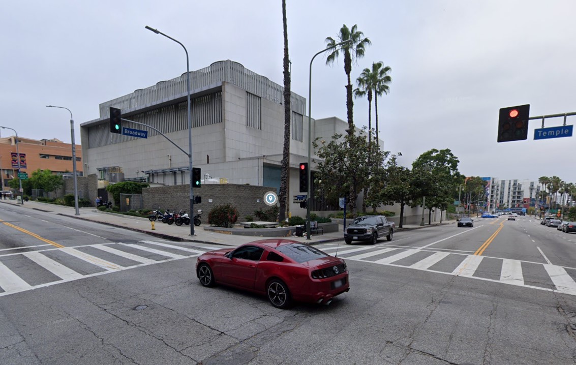
| (2024)* – Contemporary view of the northwest corner of Temple and Broadway showing the Los Angeles County Central Heating and Refrigeration Plant where the Temperance Temple once stood. |
Historical Notes The Los Angeles County Central Heating and Refrigeration Plant, built in 1958 at the northwest corner of Broadway and Temple Streets, replaced the Women's Christian Temperance Union Temple and serves as a key infrastructure hub for the Civic Center. It supplies chilled water and steam for heating and cooling to 14 major buildings, including the Cathedral of Our Lady of the Angels and Walt Disney Concert Hall. While it once generated electricity, this function is no longer economically viable. The plant’s original 1950s equipment is undergoing phased refurbishment to meet modern emissions and efficiency standards, with a total project cost of $46.1 million. Managed by the Los Angeles County Internal Services Department, it plays a vital role in maintaining county-owned facilities. The plant is primarily fueled by natural gas, which powers its boilers and chillers to produce steam and chilled water for heating and cooling. As part of ongoing modernization efforts, upgrades aim to improve efficiency and reduce emissions, ensuring compliance with current environmental regulations while maintaining reliable service to the Civic Center's critical buildings. |
Then and Now
 |
|
| (1890 vs 2024)* – A ‘Then and Now’ comparison of the northwest corner of Temple and Broadway showing the Temperance Temple, today’s site of the Los Angeles County Central Heating and Refrigeration Plant. Photo comparison by Jack Feldman. |
Historical Notes The WCTU Temple, also known as the Temperance Temple, was significantly damaged during the 1933 Long Beach Earthquake. As a result, the top two floors were removed due to the damage. The building remained in use until it was ultimately demolished in 1950 to make way for the Hollywood Freeway project. The Los Angeles County Central Heating and Refrigeration Plant was designed and engineered by M.A. Nishkian Company. It opened on August 21, 1958, and was the first of its kind in the nation. This plant supplies chilled water and steam for heating and cooling to various county buildings. |
 |
|
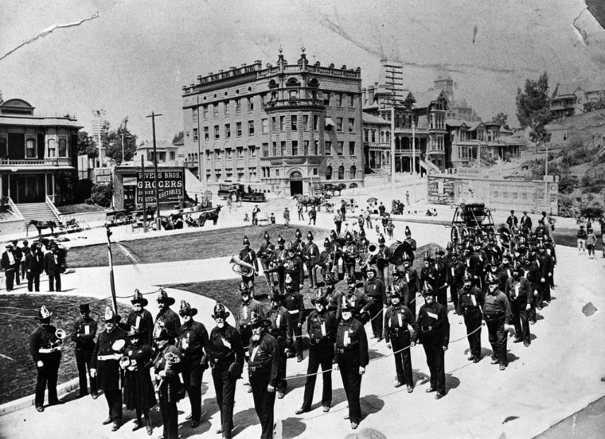
| (ca. 1900)* – View showing the San Francisco Fire Department brigade and band, in front of the Los Angeles County Courthouse (S/E corner of Temple Street and Broadway) with the Temperance Temple Building across the street. The tower of Los Angeles High School can be seen in the distance (top center-right). On the left is a clear shot of the Clifton (rooming) House (231-233 N Broadway) and the Rivers Bros. Grocery on the corner of Broadway and Temple Street (300 W Temple). The little house immediately above the Rivers Bros. sign is actually on N. Hill Street. |
Historical Notes Decades later, in 1947, the County of Los Angeles took the site where the Temperance Temple once stood by eminent domain and constructed a power plant in 1958. The Temperance Temple was completely razed in 1950. |
 |
|
| (1900)* - View looking north from the top of the County Courthouse located on Temple Street and Broadway. The tall building with a clock tower is Los Angeles High School. The Broadway Tunnel would be bored through Fort Moore Hill, at the end Broadway (center-right), within a year of this photo. |
Historical Notes The Broadway Tunnel was a tunnel under Fort Moore Hill, built in 1901, extending North Broadway (formerly Fort Street), at Sand Street (later California Street), one block north of Temple Street, northeast to the intersection of Bellevue Avenue (later Sunset Boulevard, now Cesar Chavez Avenue), to Buena Vista Street (now North Broadway). Buildings seen include the Hotel Aberdeen and the Women's Christian Temperance Union building with a rounded corner and a balustrade on the cornice. Signs read: "Hotel Aberdeen" "W.C.T.U, Temperance Temple, Furnished Rooms" and "Sanitarium and Health Office." Multi-story Victorian houses have half-timbering, dormers, and turrets. |
 |
|
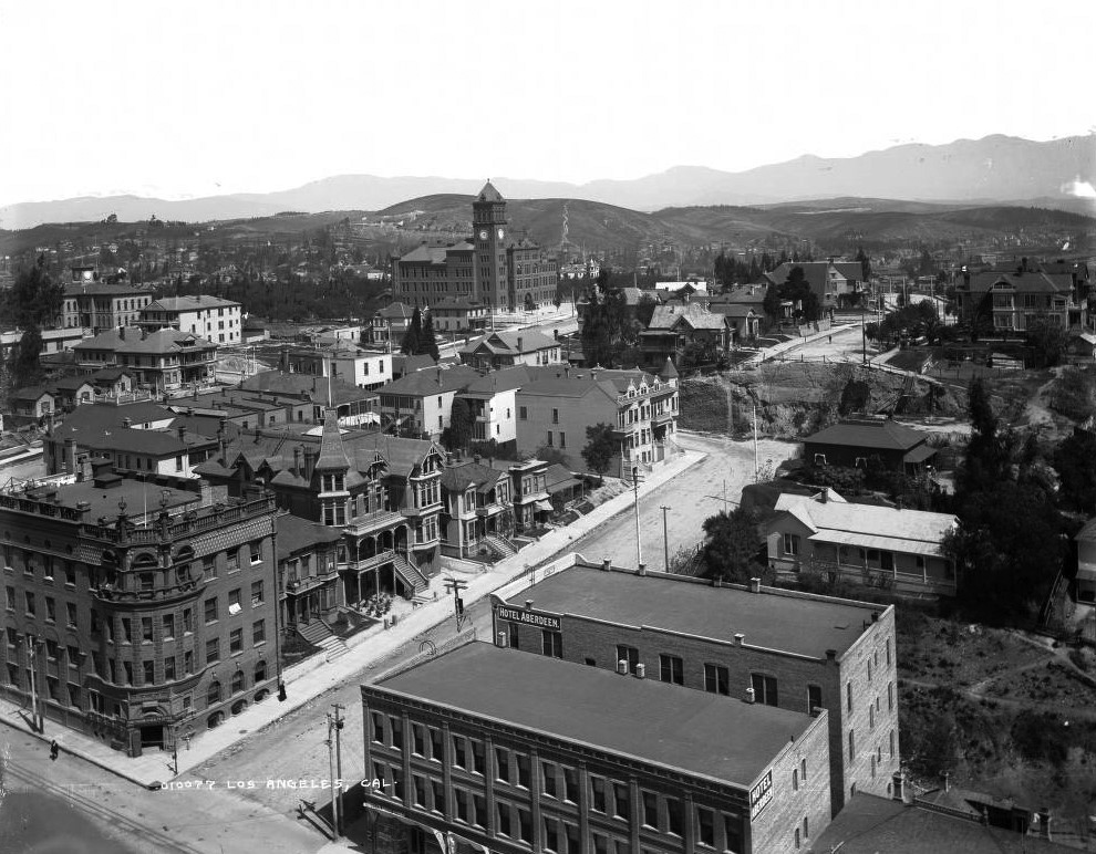
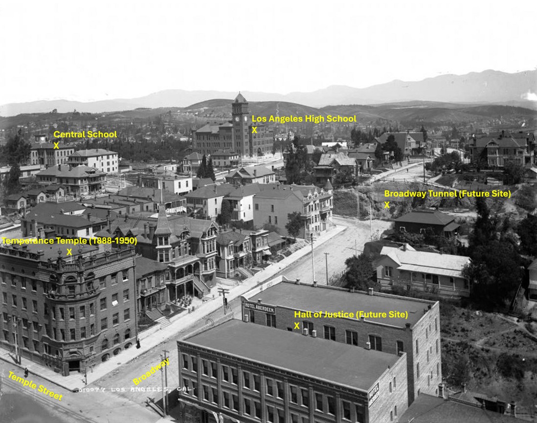
| (1900)* – Looking north from the County Courthouse at Temple and Broadway. The old Los Angeles High School and Central School building, moved from this corner in 1886 to clear the site for the courthouse, appears at upper left. The new Los Angeles High School with its clock tower stands on Fort Moore Hill at center. Broadway, running diagonally, still ended at the base of the hill until the Broadway Tunnel was bored through it the following year. The two large buildings at lower right were later removed for the Hall of Justice in 1925. Photo annotated by Jack Feldman. |
Historical Notes This north-facing view from the top of the County Courthouse captures Broadway and Temple at a moment of rapid transition. The building at upper left is the original Los Angeles High School and Central School structure, moved in 1886 from this very corner to make room for the courthouse. By 1900 the new Los Angeles High School, with its distinctive clock tower, dominated Fort Moore Hill above Broadway. At this time Broadway still stopped at the base of the hill. The following year, engineers would carve the Broadway Tunnel through Fort Moore Hill, finally linking the downtown civic center with the neighborhoods to the north. The tunnel became a major transportation artery and transformed Broadway into one of Los Angeles’ busiest thoroughfares. The two large commercial buildings at lower right mark the future site of the Hall of Justice, completed in 1925. The image also shows the steep terrain of Fort Moore Hill, scattered Victorian residences, and the early street grid—features that would disappear as the Civic Center was reshaped over the next few decades. |
 |
|
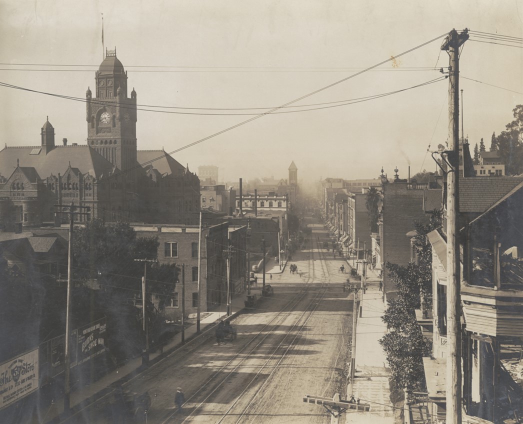
| (ca. 1905)* - Looking south on Broadway toward Temple Street showing the LA County Courthouse on the southeast corner and also the tower of the 1888-built Los Angeles Hall in the distance. |
Historical Notes By the early 1900s, Broadway had become one of the busiest streets in the growing civic center. The imposing red-sandstone courthouse on the southeast corner, completed in 1891, symbolized Los Angeles’ rapid transformation from a frontier town into a major American city. Just beyond it stood the ornate tower of Los Angeles Hall, a municipal building completed in 1888 that hosted public meetings, lectures, and city offices before the Civic Center was consolidated. The street still shows traces of its earlier era — horse-drawn wagons, dirt road shoulders, and wooden utility poles — but electric streetcars and taller brick structures were beginning to define the corridor. Within only a few years, the Broadway Tunnel would connect this stretch of Broadway to the north side of Fort Moore Hill, dramatically increasing traffic flow and accelerating commercial expansion. |
 |
|
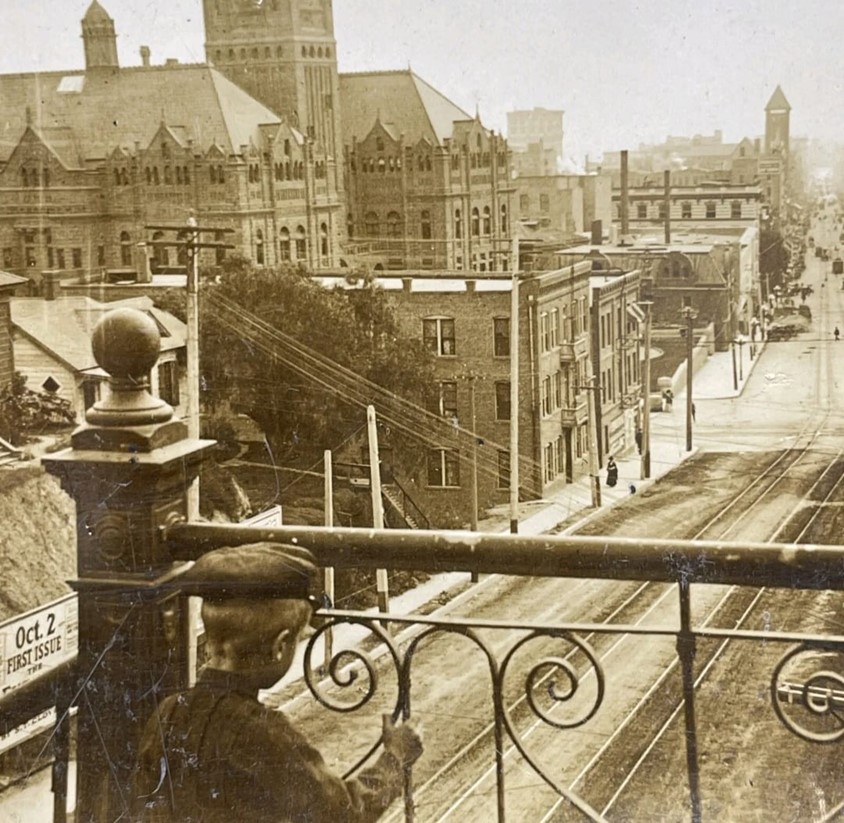
| (ca. 1905)* – A boy gazes out from the top staircase above the Broadway Tunnel toward the intersection of Broadway and Temple Street. |
Historical Notes This photograph captures a quiet moment shortly after the Broadway Tunnel opened in 1901. The tunnel, carved directly through Fort Moore Hill, linked North Broadway to the Civic Center and eliminated one of the steepest grades in downtown. Its construction reshaped traffic patterns and helped extend Broadway northward toward Lincoln Heights. The boy standing on the stairway above the tunnel offers a rare human-scale glimpse of the area before massive redevelopment. Behind him lie the courthouse, boarding houses, and the Temperance Temple, while beneath his feet the new tunnel carried wagons, pedestrians, and streetcars under what had once been a rugged hill. The scene is a reminder of how dramatically Los Angeles altered its landscape to enable growth. |
 |
|
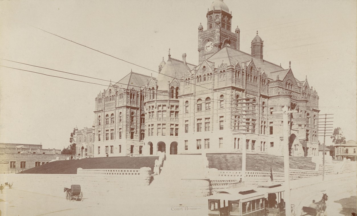
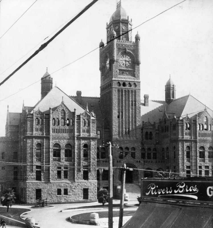
| (ca. 1890)* - View of the Los Angeles County Courthouse shortly after it was built. A 2-car trolley of the Temple Street Cable Railway can be seen on Temple Street heading west toward Broadway. New High (later Spring Street) is on the left. |
Historical Notes Completed in 1891, the red-sandstone courthouse on Poundcake Hill quickly became one of the most recognizable landmarks in Los Angeles. Its Romanesque arches, corner turret, and clock tower dominated the skyline and served the city and county for nearly half a century. The Temple Street Cable Railway, seen here in front of the courthouse, was one of the earliest cable car lines in Los Angeles and linked residents to the city’s expanding street grid. The presence of New High Street (later absorbed into Spring Street) reflects the gradual reorganization of downtown’s street network during this period of rapid urbanization. The courthouse stood until the 1933 Long Beach earthquake left it structurally unsound. Demolished in 1936, its site later became home to the Clara Shortridge Foltz Criminal Justice Center, opened in 1972. |
 |
|
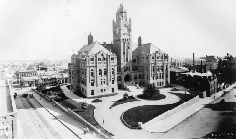
| (1890s)^ - View looking southeast at the corner of Temple Street (left) and Broadway showing the LA County Courthouse. Note the manicured lawn and the newly planted palm trees. This is actually the 6th location of the LA County Courthouse (see below). |
Historical Notes Through more than 150 years the county has used at least eight buildings as its county courthouse. All have been situated within a mile of each other in downtown Los Angeles south of the original plaza in what has for the past 80 years been called the Civic Center. ◆ The first county courthouse was in the adobe Bella Union Hotel, where court was held in rented rooms from 1850 to 1852. |
 |
|
| (1900)^ - Close-up view of the LA County Courthouse located on the S/E corner of Temple Street and Broadway as seen from over the Rivers Bros. Grocery (S/W corner). |
Historical Notes The Red Sandstone Courthouse on Poundcake Hill, completed in 1891, was damaged beyond repair by the Long Beach earthquake of 1933 and demolished in 1936. It is now the site of the Foltz Criminal Justice Center, built in 1972. |
* * * * * |
Main and Winston Streets
 |
|
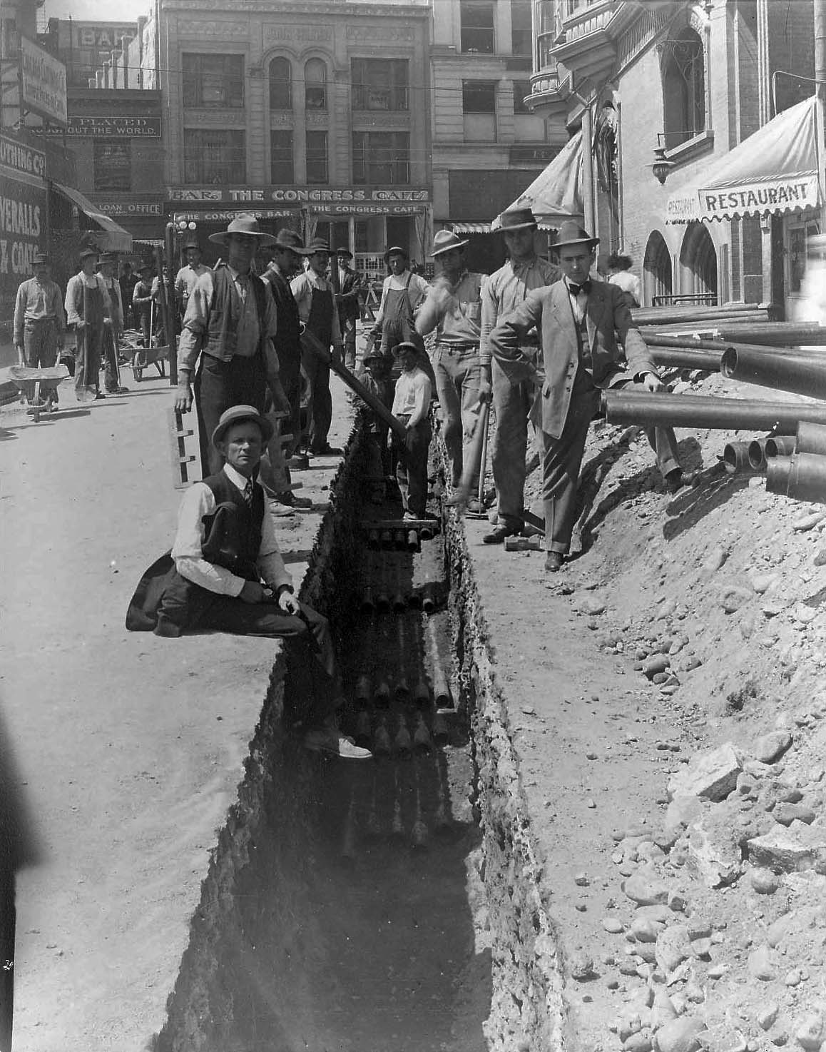
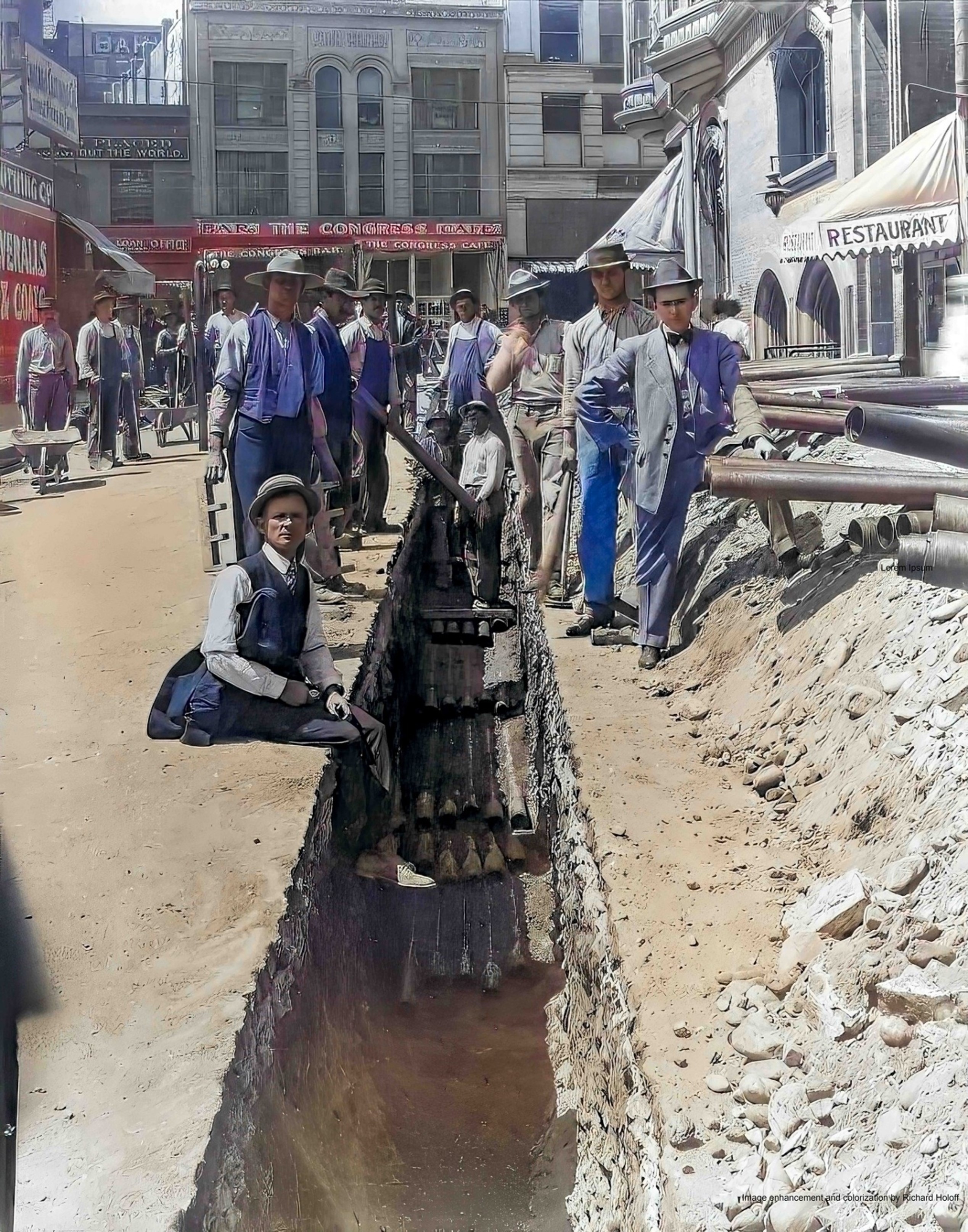
| (ca. 1897)* – View looking northwest on Winston Street toward where it intersects with Main Street showing an Edison Electric crew laying conduit for one of LA’s earliest underground electric distribution systems. The building on the right with the two arched windows and a restaurant is the Main Street Savings Bank Building on the N/E corner of Main and Winston streets. Click HERE to see contemporary view. |
Historical Notes In 1896, West Side Lighting Company was organized by private investors to provide another source of electricity for the city of Los Angeles and fringe areas. In 1897, West Side Lighting merged with the newly established private company, Los Angeles Edison Electric, which owned the rights to the Edison name and patents, especially the underground DC-power rights. The merged company took on the Edison name. An underground system and technology was crucial at this time, since the city voted in a resolution limiting the installation of new overhead utility poles due to excessive overhead wire congestion. Los Angeles Edison Electric installed the first major DC-power underground conduits system in the Southwest. Until the 1930's, three separate electric utilities served Los Angeles. Click HERE to see more in First Electricity in Los Angeles. |
 |
|
| (ca. 1897)^ – View looking northwest on Winston Street toward where it intersects with Main Street showing an Edison Electric crew laying conduit for one of LA’s earliest underground electric distribution systems. The building on the right with the two arched windows and a restaurant is the Main Street Savings Bank Building on the N/E corner of Main and Winston streets. Photo by G. Haven Bishop; Image enhancement and colorization by Richard Holoff. |
 |
|
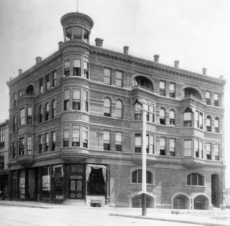
| (ca. 1880s)^ – View looking toward the northeast corner of Main and Winston streets showing the Main Street Savings Bank Building at 426 S. Main Street. |
 |
|
| (ca. 1880s)^ – The Main Street Savings Bank Building located on the NE corner of Main and Winston streets in DTLA, 426 S. Main Street. Image enhancement and colorization by Richard Holoff. |
 |
|
| (1890s)^ - View looking north on Main Street showing horse-drawn carriages, streetcar, and pedestrians all sharing the street. The large building with the awnings on the right is the Government Building, located on the southeast corner of Winston and Main Streets. Further north (N/E corner of Winston and Main) is the Main Street Savings Bank Building. Further in the distance is the Westminster Hotel with tower. |
 |
|
| (1893)^ - United States Government Building, southeast corner of Main Street and Winston Street. |
Historical Notes In June of 1893 the Los Angeles Post Office moved into this building from its location on Broadway near Sixth Street. |
* * * * * |
Main and 5th Street
 |
|
| (ca. 1895)^^ - View of Main Street looking north from 5th Street. The Westminster Hotel can be seen in the distance. The U.S. Government Building which housed the Los Angeles Post Office is the building on the right with the awnings. |
 |
|
| (ca. 1890s)^*# - Close-up view looking north on Main Street from 5th Street. The Westminster Hotel is at center-left (sign on roof line). To its right is the Main Street Savings Bank Building. On far right is the U.S. Government Building |
* * * * * |
Main and 4th Street
 |
|
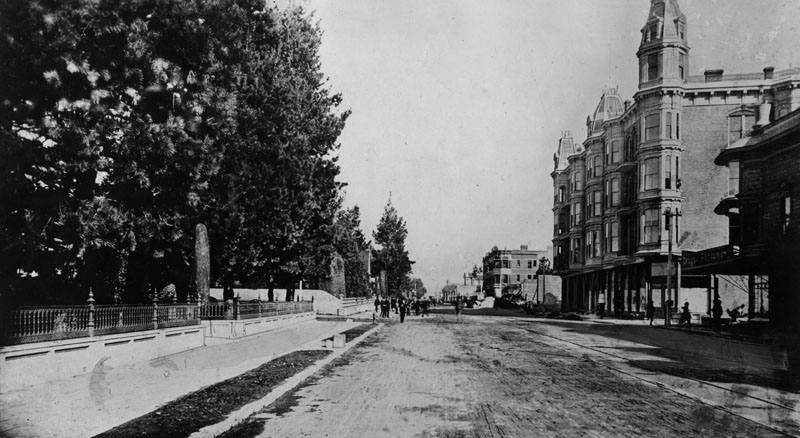
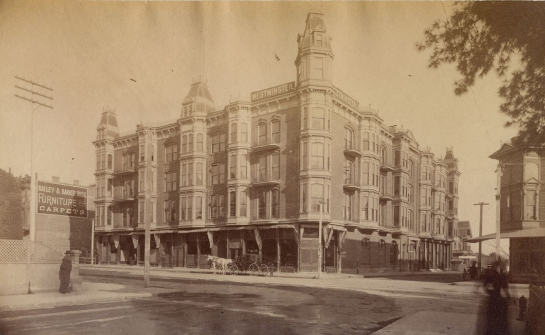
| (ca. 1890)* - 4th and Main looking north. The I. W. Hellman Mansion is on the left and on the right is the Westminster Hotel, designed by Robert B. Young, before it was enlarged. |
Historical Notes This early view shows the growing importance of the Main Street corridor in the late 19th century. The Hellman Mansion, built by banker Isaias W. Hellman, stood on the southwest corner and faced a busy commercial district. Across the street rose the newly built Westminster Hotel, one of the tallest and most impressive buildings in Los Angeles at the time. The dramatic contrast between the grand private residence and the large public hotel captures the moment when Main Street was shifting from a residential area into a major downtown center. |
 |
|
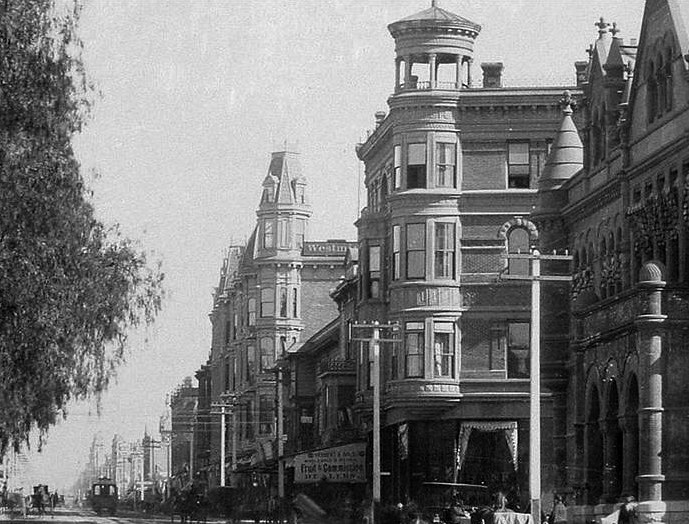
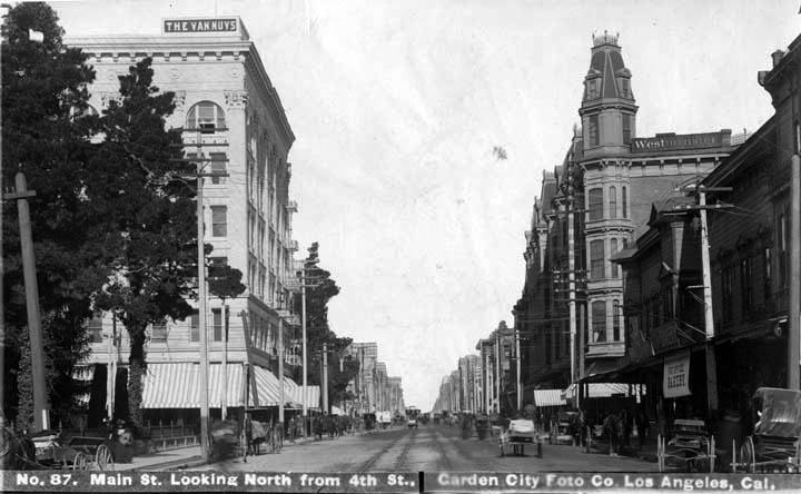
| (ca. 1898)* - View looking north on Main Street at 4th Street. On the N/E corner stands the Westminster Hotel. On the N/W corner is the Van Nuys Hotel (Built in 1895). |
Historical Notes By the late 1890s, this intersection had become one of the busiest in the city. The Westminster Hotel dominated the northeast corner with its tower and ornate Victorian brickwork. On the opposite side, the new Van Nuys Hotel had just opened and brought even more activity to the block. Both hotels were considered among the finest in Los Angeles and helped establish Main Street as an early hotel district before development moved west toward Broadway and Hill Street. |
Then and Now
 |
|
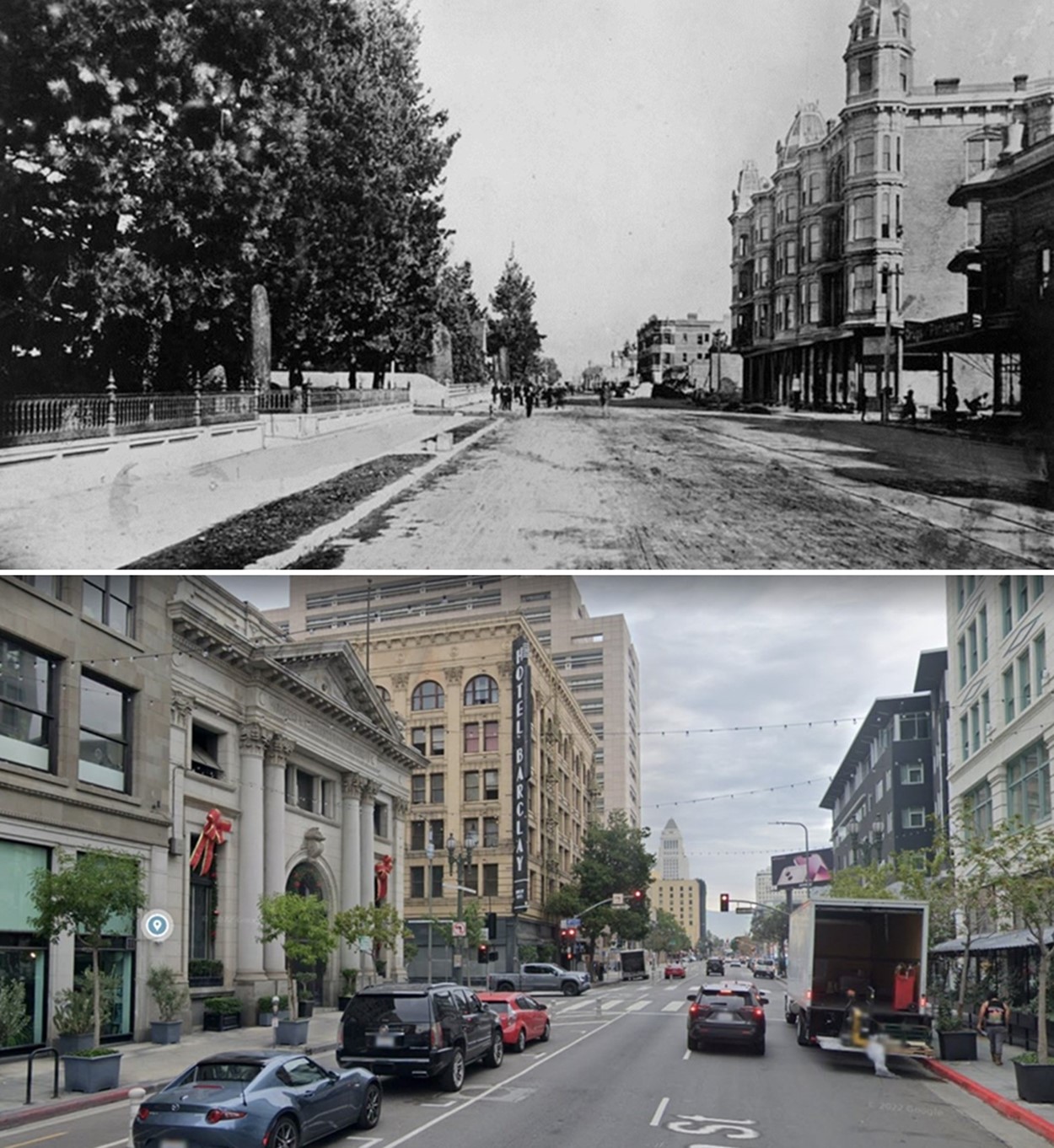
| (1890 vs. 2021)* – Looking north on Main Street toward 4th Street. Photo comparison by Jack J. Feldman. |
Historical Notes The Hellman Mansion once occupied the southwest corner, where the Farmers and Merchants Bank would later be built in 1905. Isaias W. Hellman and former governor John G. Downey founded the bank in 1871, making it Los Angeles’ first successful financial institution. On the northeast corner stood the Westminster Hotel, completed in 1887 and known for its six-story tower and rich Victorian detail. It was long considered one of the city’s grandest hotels until its demolition in 1960. The northwest corner became home to the Van Nuys Hotel in 1895, known today as the Hotel Barclay. The intersection has changed completely, yet its early buildings shaped the growth of downtown Los Angeles. |
 |
|
| (ca. 1895)* - View of the four-story Westminster Hotel on the NE corner of South Main and 4th Streets; horse-drawn carriage in front. Down the street to the left is the N.P. Bailey Furniture store. |
Historical Notes The Westminster Hotel opened in 1887 and quickly became a landmark of Victorian Los Angeles. Its six-story tower made it one of the tallest structures in the city. The hotel stood on land that, around 1870, had been part of a Chinese market district. As the city expanded, the area shifted toward hotels, shops, and streetcar lines. The Westminster continued operating into the mid-20th century, but by the 1930s it had fallen out of fashion. It was finally razed in 1960 as downtown development moved in new directions. |
 |
|
| (1890)* - View looking north on Main Street at 4th Street as seen from the Westminster Hotel. The City Hall Tower (226 S. Broadway) can be seen on the far left and St. Vibiana's Cathedral (Main and 2nd, SE Corner) is on the right. |
Historical Notes From the upper floors of the Westminster Hotel, Main Street revealed the early skyline of Los Angeles. The distant City Hall Tower, then the tallest point on Broadway, and St. Vibiana’s Cathedral, the city’s first Catholic cathedral, marked the limits of the young downtown. The streets below were filled with horses, wagons, and the first generation of streetcars. This view captures a moment when Los Angeles was beginning to grow upward and outward but still held the appearance of a compact Western town. |
 |
|
| (1887)^ - Panoramic view of the Isaias W. Hellman residence in foreground, southwest corner of Main and 4th streets. This would be the future site of the Farmers and Merchants Bank of Los Angeles. |
Historical Notes Isaias W. Hellman was one of the most important early financiers in Southern California. His banking career began informally when he stored customers’ gold and valuables in his shop safe. After a dispute with an intoxicated customer, he formalized his operations and printed slips calling himself a banker. This led to a partnership with William Temple in 1868 and, later, to the founding of the Farmers and Merchants Bank with John G. Downey in 1871. From this corner, Hellman built an empire that funded everything from the Los Angeles Times to early oil drilling. His house stood here until it was moved to make way for the bank’s monumental new building. |
 |
|
| (1895)* - View of the spot where the Isaac & Herman Hellman residence once stood on the corner of 4th and Main Streets. For the move, the house was cut into four sections, with the last section to be moved visible in the center of the image on the left. The house was moved to make way for his family's bank building - Farmers and Merchants Bank of Los Angeles. Dan W. Graybill, standing in the foreground on the right, donated this photograph. A couple street cars are seen traveling on the right (4th Street) in front of the Van Nuys Hotel (under construction). |
Historical Notes The Hellman house was moved in pieces to open the site for the new Farmers and Merchants Bank, which was completed in 1905. The relocation reflected the rapid shift of Main Street from a residential area to a financial and commercial district. At the time of Hellman’s death in 1920, he was regarded as the leading banker on the Pacific Coast. His descendants continued his legacy, and several of his institutions later merged into Wells Fargo and Security First National Bank. |
 |
|
| (ca. 1905)* – View showing the Farmers and Merchants Bank located on the southwest corner of Main and 4th streets. Built in 1905 on the site of the Hellman Residence, the bank was designed by the firm of Morgan and Walls. |
Historical Notes The bank opened with $500,000 in initial capital supplied by 23 prominent businessmen. Its largest investors included Isaias W. Hellman, John G. Downey, and Ozro W. Childs, who would later help found the University of Southern California. The Farmers and Merchants Bank was the first incorporated bank in Los Angeles and became known for its stability during times of economic uncertainty. The building’s Classical design signaled strength and order in the growing financial district. |
.jpg) |
|
| (1906)* - View looking west on 4th Street at the intersection with Main Street. Two men are seen in an open-air car as it travels north on Main Street through the intersection. The Neo-Classic Greek Farmers and Merchants Bank can be seen on the left (S/W Corner) with the Van Nuys Hotel on the right (N/W corner). |
Historical Notes This photograph shows the early mixing of automobiles, streetcars, and horse-drawn vehicles in downtown Los Angeles. The Farmers and Merchants Bank had just opened the previous year and was one of the most solid financial institutions in the region. Across the street, the Van Nuys Hotel continued to attract travelers and long-term residents. The scene captures the changing pace of city life as new technology began to reshape the streets. |
Then and Now
 |
|
| (1906 vs. 2021) – Looking west on 4th Street at Main Street. The Classic Revival style Farmers and Merchants Bank is on the left (S/W Corner) with the Beaux-Arts style Van Nuys Hotel (today Hotel Barclay) across the street on the right. Photo comparison by Jack J. Feldman. |
Historical Notes The two corner buildings remain among the best surviving examples of early downtown architecture. The Farmers and Merchants Bank reflects the era when banks were designed to convey strength and permanence. The Van Nuys Hotel, completed in 1895, was one of the city’s first fireproof hotels and catered to travelers arriving by train and streetcar. Though the surrounding streets have changed dramatically, these buildings preserve the character of Main Street during Los Angeles’ early boom years. |
* * * * * |
City Hall View
 |
|
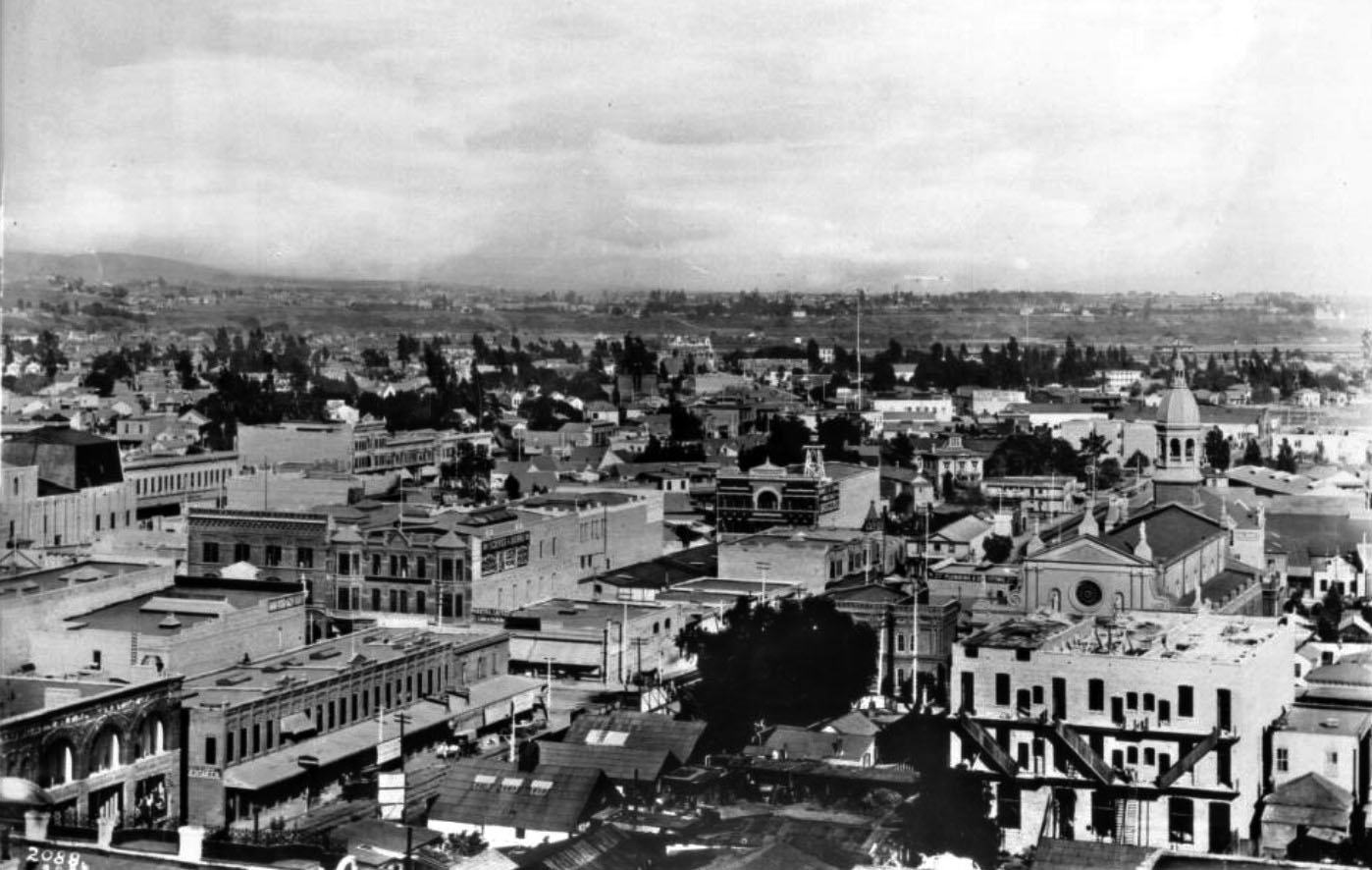
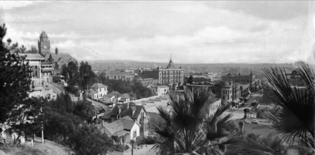
| (1890)* - Panoramic view of downtown Los Angeles as seen from the City Hall Tower (226 S. Broadway) looking east. St. Vibiana's Cathedral is seen at right. |
* * * * * |
Spring and 2nd Street
 |
|
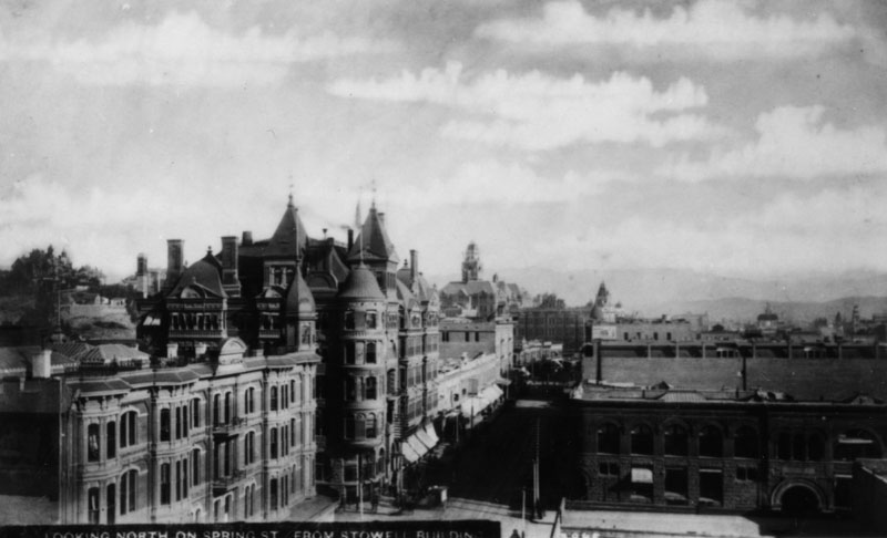
| (ca. 1890)^ - Spring Street looking north from the roof of the Stowell Building at 2nd Street, circa 1890. The Hollenbeck Block/Hotel is the first building on the left, next the Bryson-Bonebrake Block (n/w corner of 2nd and Spring) center the County Courthouse, roof of Phillips Block, Temple Market Block and Baker Block. |
 |
|
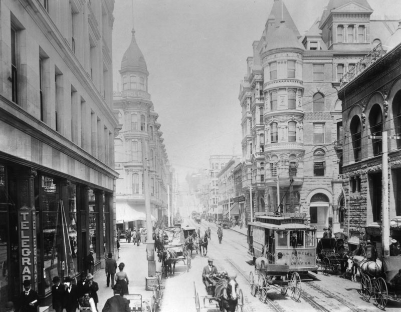
| (ca. 1895)^ - 2nd Street looking west toward Spring Street. The building at close left is the Wilcox Building, at the far left the Hollenbeck Hotel. At far right is the Bryson-Bonebrake Block. Horse-drawn vehicles and streetcars are seen. There is a telegraph office on the left. |
 |
|
| (ca. 1890)^ - The Hollenbeck Hotel sits on the southwest corner of Spring and Second behind trolley lines extending up and down the streets on both sides. On the street are people, a trolley, horses and buggies. Architect, Robert B. Young. |
Historical Notes John Edward Hollenbeck (June 5, 1829 - September 2, 1885) was an American businessman and investor who was involved in the 19th century development of Nicaragua and the city of Los Angeles, California. Arriving in Los Angeles a wealthy man from his investments in Nicaragua in 1876, Hollenbeck purchased land on the east side of the Los Angeles River, and built a large residence with broad verandas and a tower on extensive grounds on Boyle Avenue. He made twenty-seven acquisitions of property by 1880. In 1884 he purchased and developed an urban business district, known as the Hollenbeck Block, within Los Angeles. In 1878 Hollenbeck became a stockholder in the Commercial Bank of Los Angeles, and was elected its president. In 1881, he and other investors organized and established the First National Bank. In 1880, Hollenbeck, with former California Governor John G. Downey, horticulturalist Ozro W. Childs and other associates, persuaded the State of California to purchase 160 acres in Los Angeles to foster agriculture in the southland. The property, then known as Agriculture Park, is now known as Exposition Park, home to the Los Angeles Coliseum and the Los Angeles County Museums. |
 |
|
| (ca. 1888)^##* - View of the Bryson-Bonebrake Block located on the northwest corner of Spring and Second streets. Coulters Dry Goods is to the left, on the southwest corner. |
Historical Notes Two highly influential figures in 1880s Los Angeles, John Bryson, Sr., the 19th mayor, of LA and Major George H. Bonebrake, President of the Los Angeles National Bank and the State Loan and Trust Company, commissioned John Cather Newsom to erect this 126-room bank and office building. It's cost was projected to be $224,000, a staggering sum at the time. Bonebrake was one of the richest men in the city at the time, and he could afford making such an investment. He located the main headquarters of his bank in the Bryson-Bonebrake Block. |
 |
|
| (1890)^## - View of Spring at 2nd Street looking north. The Hollenbeck Hotel is seen on the left and the Bryson-Bonebrake Building is on the right. Horse-drawn carriages are parked in front of the hotel. |
 |
|
| (ca. 1895)^^ - View of Spring Street looking north from 2nd Street where both the Hollenbeck Building and Bryson-Bonebrake Block are seen on the left. The County Courthouse (built in 1891) can be seen at upper-center and the Nadeau Hotel in center of photo. At center-right is the Phillips Block. |
Historical Notes The Nadeau Hotel stood on the southwest corner of 1st and Spring Streets until 1932, when it was demolished to make room for the current Los Angeles Times Building. |
 |
|
| (ca. 1898)^ - View of Spring Street looking south at 2nd Street, one of the busiest blocks in the city at the time. The Los Angeles Theatre (turreted building) can be seen at center-left. The Hollenbeck Building has been raised to four stories. The five-story block at the next corner is the Douglas Block. |
* * * * * |
Spring Street and 3rd Street
 |
|
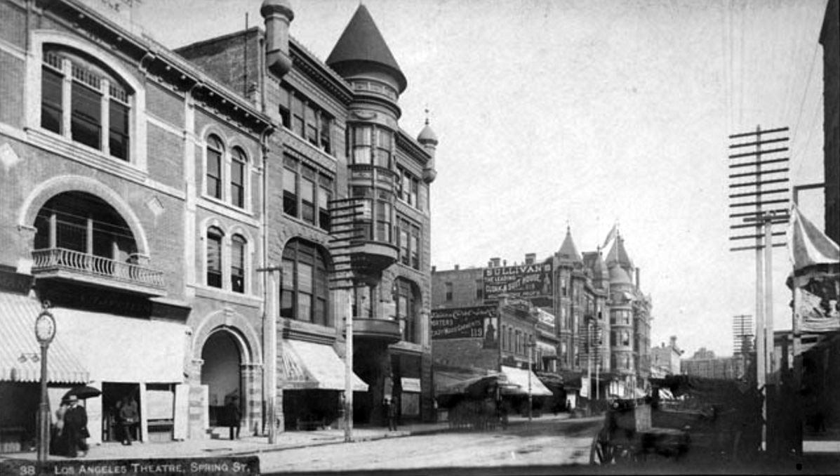
| (ca. 1888)^ – View looking north on Spring Street from near 3rd Street. Horse-drawn carriages are parked on both sides of the street while a streetcar can be seen in the distance. Both the Hollenbeck Building and Bryson-Bonebrake Block can be seen in the distance at Spring and 2nd streets. On the left is the recently built Los Angeles Theatre. Note the turret on its round tower has not been built yet.. |
 |
|
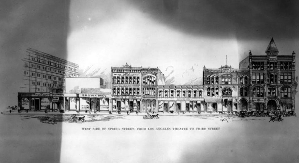
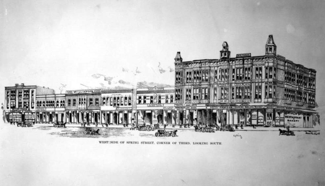
| (1896)^ – Sketch showing the west side of Spring Street from the Los Angeles Theatre (right) to 3rd Street (left). |
 |
|
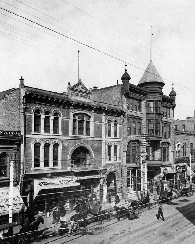
| (1895)^ - View of Spring Street looking northwest. The Los Angeles Theatre, located at 227 S. Spring Street, is on the right. The music hall, on the left, was the former home of Turnverein. Horse-drawn carriages are shown parked in front. |
Historical Notes The Los Angeles Theatre opened in 1888. It was built by William Hayes Perry and the building containing it was known as the Perry Building. |
 |
|
| (ca. 1897)^## – View looking north on Spring Street showing the Los Angeles Theatre (turreted building). The theatre would later be called Orpheum and Lyceum Theatre). The building on the left was later known as Lyceum Hall. In the distance can be seen both the Hollenbeck Building and Bryson-Bonebrake Block at Spring and 2nd streets. |
Historical Notes In 1903 this interesting Richardsonian Romanesque building became the Orpheum - the second home of Orpheum Circuit vaudeville in Los Angeles. Previously they'd been at the Grand Opera House. There were four Orpheum theatres in downtown Los Angeles: ◆ 110 S. Main St. -- Grand Opera House was the home of Orpheum vaudeville from 1894 to 1903. ◆ 227 S. Spring St. -- The Los Angeles Theatre, later called The Lyceum, was known as the Orpheum from 1903 to 1911. ◆ 630 S. Broadway -- Now the Palace Theatre -- this was the Orpheum between 1911 and 1926. ◆ 842 S. Broadway -- Orpheum Theatre from 1926 to Today |
 |
|
| (1896)^ - An architectural drawing of the west side of Spring St. looking south from the corner of 3rd St. |
 |
|
| (ca. 1898)^^ - View of Spring Street looking south from the Stimson Building on the NE corner at Third Street, shortly after it was built. Awnings cover most store fronts looking down Spring Street. |
* * * * * |
Broadway and 4th Street
 |
|
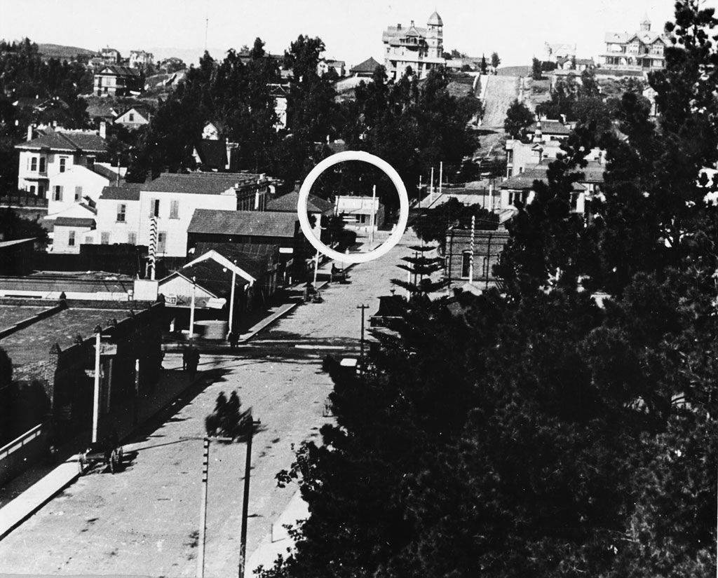
| (1890s)* - Looking west on 4th Street toward Fort Street (later Broadway) and Bunker Hill. The large building in the upper-left is the State Normal School located at Grand and 5th Street. |
 |
|
| (1890s)* - Looking west on Fourth Street toward Bunker Hill. The circle is the intersection of Fourth & Fort Street (now Broadway). |
 |
|
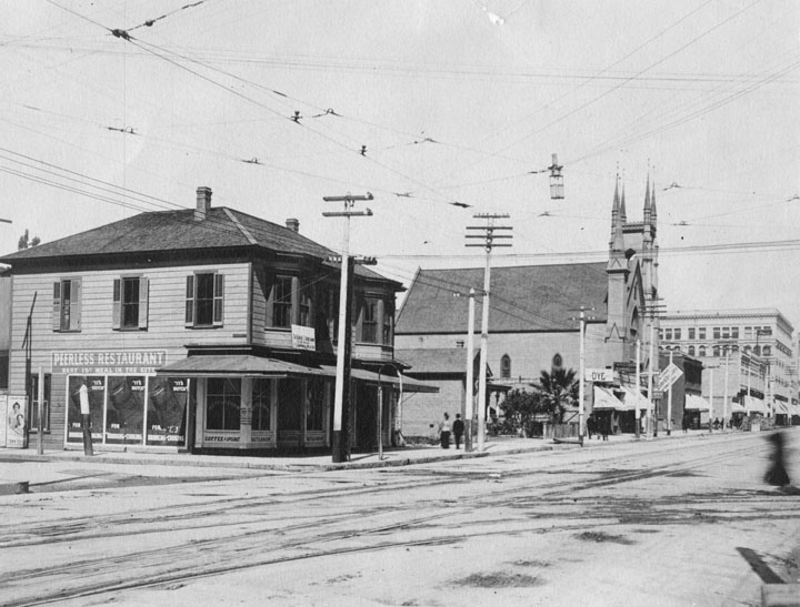
| (1890)^ - Fort Street (now South Broadway), showing the Fort Street Methodist Episcopal Church, replaced by the Homer Laughlin Building in 1916. Also includes the "Peerless" restaurant, featuring a sign that reads "Best 15 cent meal in the City"! |
 |
|
| (ca. 1890)^^ - Panoramic view of downtown Los Angeles looking west from Spring Street and Fourth Street toward Bunker Hill across Broadway between Third Street and Fourth Street. Fort Street Methodist Episcopal Church (later purchased by Homer Laughlin for $63,000 in 1899) stands in the center of the photograph which includes principally dwellings. The Crocker Mansion can be seen in the upper right. The tall pole at the top of Bunker Hill seen in the upper-left is one of Los Angeles’ earliest electric stretlights, standing 150-ft tall. Click HERE to see more in Early L.A. Streetlights. |
 |
|
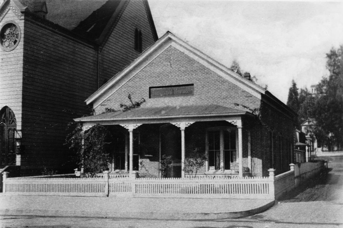
| (ca. 1890)^^ - View showing the Hunter Residence located on Fort Street (later Broadway) near Third Street. The single-story brick house has a small fence surrounding its perimeters. It features a covered porch, large rectangular windows and a symmetric, inclined roof. Above the covered porch is "furnished rooms" sign. The Fort Street Methodist Episcopal Church is to the left of the small house. |
* * * * * |
Bunker Hill
 |
|
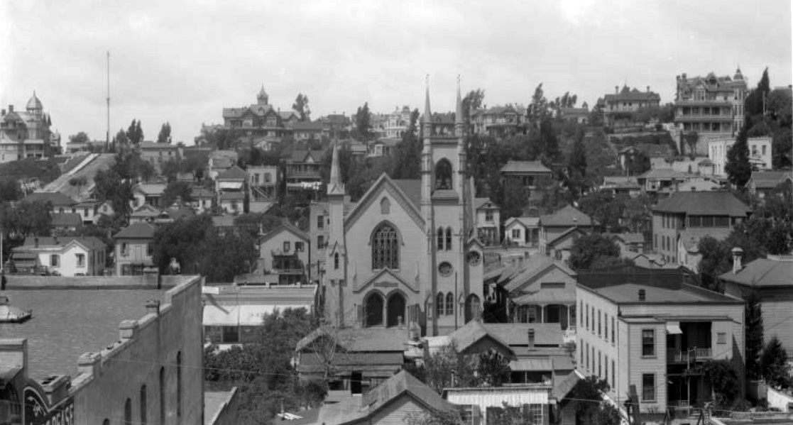
| (ca. 1890)^ - Bunker Hill neighborhood, as seen from east of Hill Street (foreground). 3rd Street (lower center) is to the left of the First Congregational Church (lower right), which later became the Central Baptist Church then lastly the Unitarian Church. The Crocker Mansion is seen in the upper right and the Leonard John Rose (with cupola) residence at Fourth Street and Grand Avenue is present in the upper left. |
Historical Notes In 1867, an enterprising French Canadian immigrant named Prudent Beaudry bought the land atop Bunker Hill -- at the reported cost of $51. Beaudry constructed a system of pipes and steam-powered pumps to deliver water to the hilltop from a reservoir below. He also built roads to connect the hill to the developed flatlands below and laid out streets atop the hill. One of them, which Beaudry named Bunker Hill Avenue in honor of the 100th anniversary of the Revolutionary War battle fought in Boston, eventually lent its name to the entire hilltop community.* In 1868, Prudent Beaudry and his two partners, John Griffen and Solomon Lazard, formed the private Los Angeles Water Company. They would go on and sign a 30 year lease franchise agreement with the City to run its water system (1868 - 1898). Prudent Beaudry also served as the 13th Mayor of Los Angeles from 1874 to 1876. Click HERE to read more in Water in Early Los Angeles. |
 |
|
| (1898)^^ - View of Bunker Hill looking west from Spring Street near 3rd Street. First Congregational Church with its tall spire can be seen at center-right and the Crocker Mansion is at upper center-left. |
 |
|
| (1894)^^ - Panoramic view of downtown Los Angeles, looking east, as seen from the rear deck of the Crocker Mansion . The view is looking toward the intersection of Broadway and Third Street where the Bradbury Building stands on the southeast corner. The streets are busy with horse-drawn vehicles and pedestrians. A pile of construction supplies and debris is visible near the intersection. City Hall is at left on Broadway and the First Congregational Church at lower-left (NE corner of 3rd and Hill). |
Historical Notes Built in 1893, the Bradbury Building was commissioned by LA mining millionaire Lewis L. Bradbury and designed by local draftsman George Wyman. It still stands today and is the oldest building in Downtown LA. Click HERE to see more Early Views of the Bradbury Building. |
 |
|
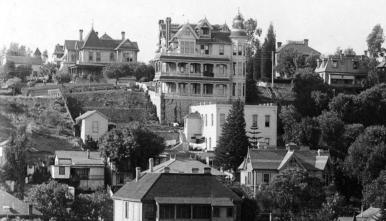
| (1895)#^* – View looking west at 3rd and Hill Streets with the Crocker Mansion seen at the top of Bunker Hill. The southwest corner of 3rd and Hill (lower-right) would become the lower station terminal of Angels Flight. |
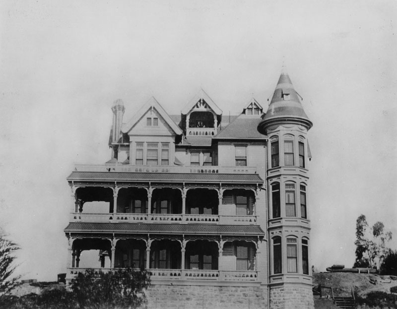
Historical Notes At the turn of the 20th Century, no building dominated Bunker Hill like the Crocker Mansion. Perched high at the corner of Third and Olive, the imposing 3-story Victorian structure overlooked the emerging metropolis for more than 22 years.* |
 |
|
| (1898)^^ - Panorama view from 3rd and Spring streets showing the Crocker Mansion and neighbors on Bunker Hill. |
Historical Notes Construction on the Third Street Tunnel began in 1900, and Mrs. Crocker filed a petition claiming that the mansion was endangered by the street tunnel which was “unsafe, improperly constructed and a veritable death trap.” According to the Los Angeles Times, “the walls of her house are settling, the foundations giving way and the plaster is falling off…Unless something is done, the building is liable to topple into a hole.” The house never did topple and was alive and well in 1902 when Angels Flight began operating and dropping riders off practically on the Crocker doorstep.* |
 |
|
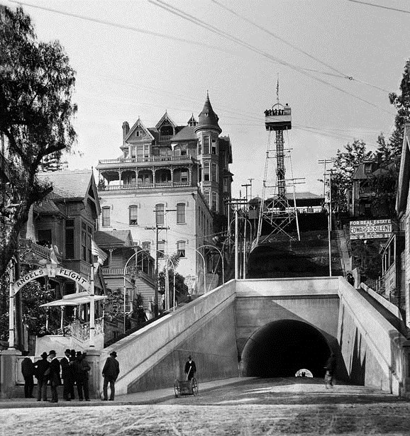
| (1901)^*# - Photo of Angels Flight at the grand opening of the railway, December 31st, 1901. An observation tower was also constructed on top of the hill adjacent to the Crocker Mansion. |
Historical Notes Built in 1901 with financing from Colonel J.W. Eddy, as the Los Angeles Incline Railway, Angels Flight began at the west corner of Hill Street at Third and ran for two blocks uphill (northwestward) to its Olive Street terminus.*^ Click HERE to see more Early Views of Angels Flight. |
 |
|
| (1890s)^ - Rear view of the Crocker Mansion showing the full extent of its wide balconies where you could get a great view of the emerging metropolis of Los Angeles. |
 |
|
| (ca. 1890)^^ - Panoramic view of downtown Los Angeles looking southeast on First Street and Hill Street toward Broadway. City Hall, which is the tall tower with a flagpole, is at center-right. The First Presbyterian Church can be seen at center-left with a spire. |
 |
|
| (ca. 1891)^^ - Panoramic view of Los Angeles from 1st Street and Hill Street looking southeast. The 3-story Highland Villa (n/w corner of 1st and Hill) is on the far left. Also on the left, in the distance, stands Los Angeles County Courthouse with it’s distinctive clock tower. The LA Times Building, located on the northeast corner of 1st Street and Broadway, is seen at center-right between the palms. The large 4-story building at center with the cupola is the Phillips Block, located at 25-37 N. Spring Street. |
 |
|
| (ca. 1890)^^ - Panoramic view of Los Angeles looking east as seen from the top of the Court House tower, showing the orphanage building in the distance. The area in the foreground is densely packed with commercial buildings and many of which boasts Greek or Italian-style architecture. Aliso Street can be seen at left running into the left background. The historic intersection of Main, Temple, and Spring Streets can be seen at lower-center. Trees are sparsely scattered throughout the city, and what appears to be the Los Angeles River can be seen across the background. |
* * * * * |
Hill and 5th Streets
 |
|
| (ca. 1890)^^ - View showing the first building erected on the corner of Fifth Street and Hill Street in Los Angeles. The small, two-story clapboard house is at center. It has a small balcony with an open doorway at center, as well as a covered porch on the first floor. Large vines have grown up the side of the porch, hiding much of the front of the house from view. Four people are on the sidewalk in the foreground, including two young children at left and a girl and a woman walking at center. |
Historical Notes The building, the home of Mary E. Taft, was moved to face Fifth Street. Later this block would become part of the center of Los Angeles' financial district.^^* |
* * * * * |
Grand and 2nd Street (S/W Corner)
 |
|
| (1890)^ - Photo taken from the southwest corner of 2nd Street and Grand Avenue, looking north on Grand. It shows a modest one-story home. A woman stands on the steps that lead to the entrance of the house and three other people are standing in the garden, all looking toward the photographer. Visible behind tall trees, a larger, more elaborate Victorian home can be seen. |
* * * * * |
Flower and 8th (S/E Corner)
 |
|
| (1890)^- View showing the First English Lutheran Church, located at the southeast corner of Flower and 8th Streets in Los Angeles, shown soon after its construction in 1890 before the streets were paved. The Abbotsford Inn is visible behind the church on the left side and a few residences are seen in the background on the right. |
Historical Notes Abbotsford Inn was converted into a hotel by Abbot Kinney, best known as the developer of Venice. The building, designed by Robert B. Young, was erected in 1887 by D. W. Hanna as Los Angeles College or Hanna College. After the college failed, Kinney took it over.^ |
* * * * * |
Broadway and 10th Street (now Olympic Blvd)
 |
|
| (1890)^^ – View looking north on Broadway from 10th Street (Olympic Blvd. today). At least two craftsman-style buildings with chimneys are visible in the background left of the street, partially obscured by trees and other vegetation. The street is unpaved and what appear to be several horse-drawn carriages and/or trolleys are moving along it too quickly to be photographed with clarity. A telephone pole is visible to the right, and what appears to be a pile of cut tree branches is in the lot next to the buildings. Note the tall pole in the center of the photo. It is 150-ft tall and is one of Los Angeles' First Electric Streetlights. |
Historical Notes In 1932, the entire length of the 10th Street, from East L.A. to Santa Monica, was renamed Olympic Boulevard for the 10th Summer Olympics being held in Los Angeles that year. *^ Click HERE to see the same view in 1926. Click HERE to see the same view in 2015. |
* * * * * |
Broadway and 8th Street (N/E Corner)
 |
|
| (ca. 1897)+** – View showing the northeast corner of 8th Street and Broadway. A woman and young girl are seen standing in front of the Victorian house. Another woman is seated in a horse-drawn carriage. Click HERE to see contemporary view. |
Pasadena
 |
|
| (ca. 1890)^ - Postcard view showing Pasadena and Mount Lowe in the San Gabriel Mounains as seen from the Hotel Raymond. |
 |
|
| (ca. 1890)*#* - View of Colorado Boulevard, then named Colorado Street, looking east to Marengo Avenue. Horse-drawn wagons with displaying america flags appear to be in a parade (possibly 4th of July). |
 |
|
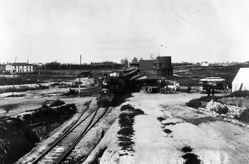
| (1890)^ - View showing the Raymond Station in South Pasadena. A locomotive with cars, stand ready, outside the station. A horse-drawn vehicle, parked alongside of the station, would shuttle guests to the Raymond Hotel. |
Historical Notes The Raymond Hotel guests invariably arrived by train, the mainline Santa Fe which stopped at Raymond Station at the bottom of the hill. Many had private cars that would park on the side spur near the station. All guests were ferried by a horse-drawn bus to the hotel at the top of the hill. Later, much to the dismay of many guests, the old station closed down in deference to a newer station built up the tracks closer to downtown Pasadena. Guests were then forced to take an auto bus the extra distance to the hotel. |
Click HERE to see more in Early Views of Pasadena. |
* * * * * |
Alhambra
 |
|
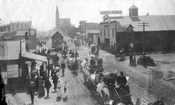
| (ca. 1890)^ - Photograph of Alhambra, Garfield and Main Street ca. 1890. A horse drawn street car is in front of the elaborate Alhambra Hotrel. The building on the opposite corner is named the Jones Building and was erected in 1887. |
Historical Notes Alhambra was founded as a suburb of Los Angeles in 1903. It existed as an unincorporated area during the mid-19th century. The first school in Alhambra was Ramona Convent Secondary School built on hillside property donated by the prominent James de Barth Shorb family. Thirteen years before the city was incorporated, several prominent San Gabriel Valley families interested in the Catholic education of their daughters established the school in 1890. The city's first public high school, Alhambra High School, was established in 1898, five years before the city's incorporation. The Alhambra Fire Department was established in 1906. On July 11, 1903, the City of Alhambra was incorporated. Alhambra is named after Washington Irving's book Tales of the Alhambra, not after the Alhambra palace itself.*^ |
 |
|
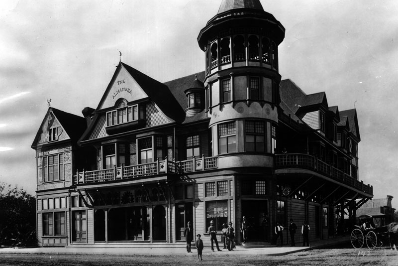
| (1898)^- This was one of the big hotels in Alhambra in 1898. Early settlers made their homes in Alhambra, gateway to the San Gabriel Valley, because of the water works. |
Historical Notes The elegant Alhambra Hotel stood at the northwest corner of Garfield and Main. This ornate structure was one of the earliest commercial buildings having been built in 1888 and which featured a billiards hall, barbershop, and restaurant. Unfortunately, the building burned down in 1908.*##* |
 |
|
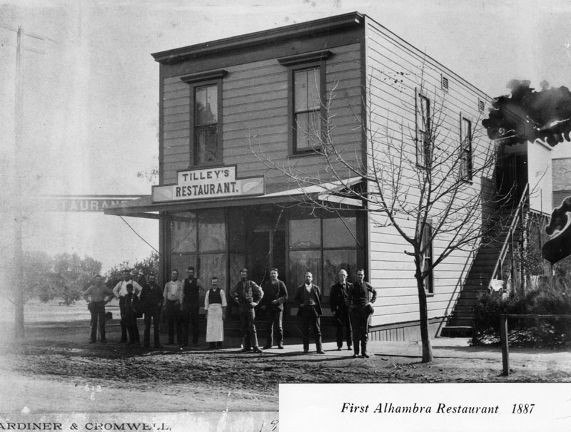
| (1887)^ - Alhambra's first restaurant was named "Tilley's" and was located in this two story wood frame building with a sidewalk and unpaved street. |
Historical Notes Tilley's Restaurant opened in 1885. It was built by H. W. Stanton at the corner of Main and Garfield, the building was first used as a post office and grocery. The upstairs hall was used as a church, school, community meetings, and entertainment gathering place. H. W. Stanton was the first storekeeper, postmaster, teacher, telephone agent, land subdivider and promoter. After subdividing several ranches he became wealthy and retired. He took a trip around the world, but upon his return to Alhambra found that the boom had gone bust, and he too was broke.^#*# |
 |
||
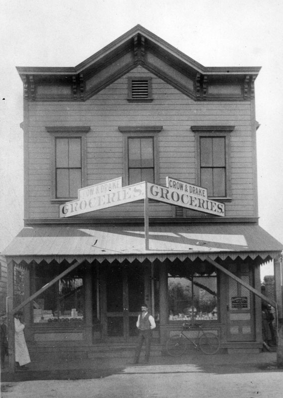
| (1898)^ - An unidentified man (possibly one of the owners) stands at the front door of the Crow & Drake Groceries, two-story building located on So. Garfield Ave. It was the first general merchandise store in Alhambra in 1898. |
 |
|
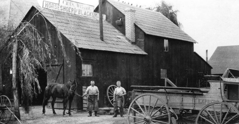
| (1890)^ - Two men and a horse stand outside a building in Alhambra with a sign on the roof identifying the owner as Charles Winter, horseshoer and blacksmith. The shop opened in 1885 and was located at 4 W. Main Street. |
* * * * * |
Wolfskill Ranch - Arcade Station - Arcade Palm
 |
|
| (ca. 1880)^ - Full frame lithograph photo of the orange and lemon groves on the Wolfskill Ranch, residence of William Wolfskill. The Los Angeles and Independence Railroad Station can be seen in the background. The Southern Pacific Arcade Station would later be built on the Wolfskill Ranch. |
Historical Notes William Wolfskill, a native of Kentucky, came to California in 1831 and settled in Los Angeles in 1836. In March 1838, Wolfskill purchased a 100-acre lot bounded by 3rd to 9th streets and San Pedro to Alameda streets, which he named Wolfskill Ranch, and built a large adobe (known as "Wolfskill Adobe") located at 239 Alameda, between 3rd and 4th streets. In 1839 Wolfskill became a major grape producer when he planted the first vineyard of table grapes in California. Two years later, in 1841, he planted his first 2-acre plot of citrus behind his adobe, between 4th and 6th streets east of Alameda. In a short period of time, Wolfskill's farm had increased to 28-acres of planted citrus with over 2,500 orange trees. By 1862 he owned 3/4 of all the orange trees in California and was the biggest orange grower in the United States - for which he is considered the father of early California citrus industry.^ |
 |
|
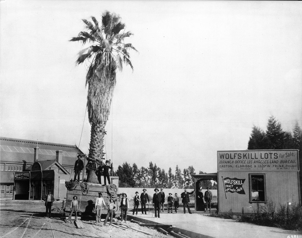
| (1889)^^ - View of a palm tree being moved to the front of the Arcade Depot on Fifth Street and Central Avenue on land that was once occupied by the Wolfskill Adobe. |
Historical Notes In 1888, the Southern Pacific Railroad built the Arcade Depot in competition with the Santa Fe Railroad. Santa Fe R.R. would open the La Grande Station at 2nd Street and Santa Fe Avenue just five years later, in 1893. The Arcade Depot replaced the adobe house of William Wolfskill and its surrounding orange grove, the largest in Southern California.^ |
 |
|
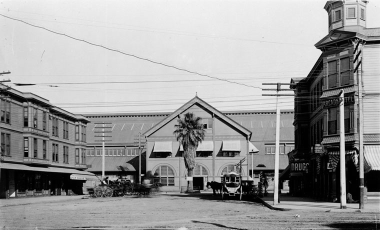
| (ca. 1890s)^ - View looking east along a street leading to the Southern Pacific Railroad Arcade Station in the background. This turn-of-the-century view shows street railway cars, horse-drawn vehicles, and what appears to be an early automobile behind the pole in the center foreground. |
Historical Notes The first automobile in Southern California appeared in 1897. It was built in a shop on Fifth Street in Los Angeles by S.D. Sturgis for J. Philip Erie. Erie became the first to drive an automobile on Los Angeles roads. By 1904, 1,600 cars were cruising the streets of Los Angeles. The maximum speed limit was 8 mph in residential areas and 6 mph in business districts.^#* |
 |
|
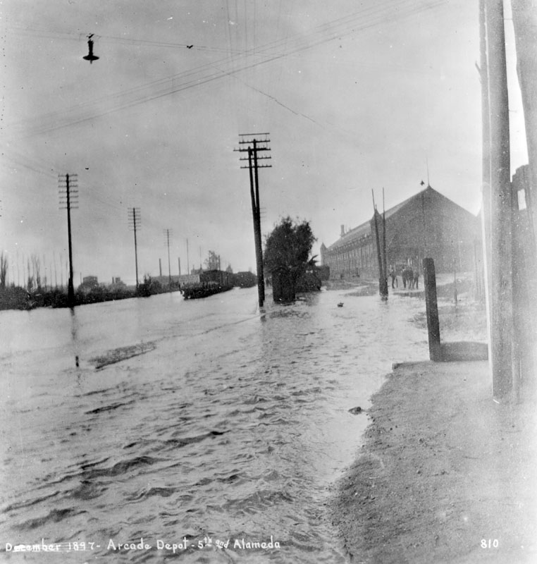
| (1897)^ - A river of water on Alameda Street looking south from 4th Street in December, 1897, when rain measured 6.53 inches. Seen is the Southern Pacific Railroad Arcade Station. |
 |
|
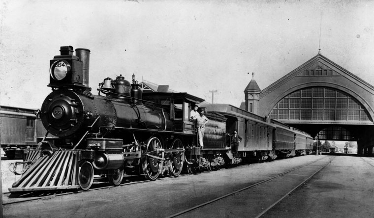
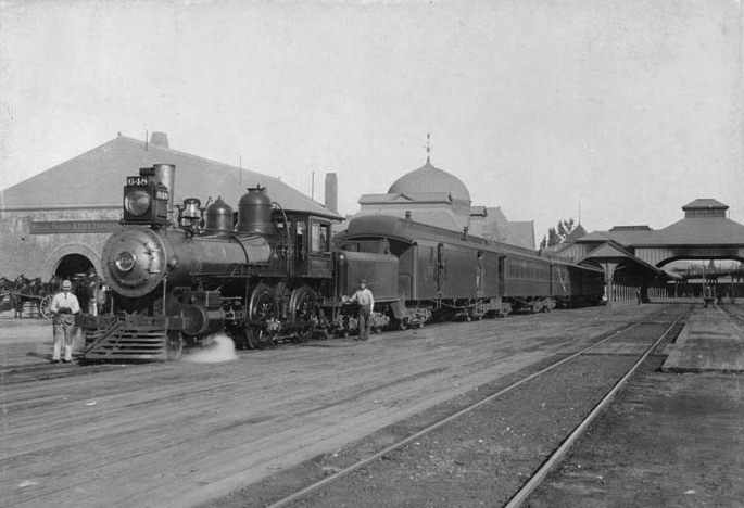
| (1891)^ - Southern Pacific steam engine no. 1364 heads the train at the Arcade Station at Alameda between 4th and 5th St. |
Historical Notes The Arcade Station was the second station built by Southern Pacific in Los Angeles (and first one built primarily for passenger service). Built in 1889 and used until 1914 when it was replaced by larger SP Central Station. It was demolished shortly thereafter. |
 |
|
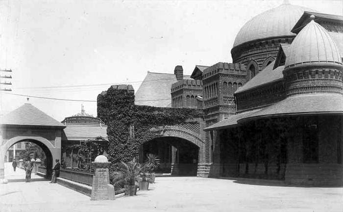
| (n.d.)^ - Interior view of an empty Arcade Depot. The trains appear to be sitting outside the building. |
 |
|
| (ca. 1890)^## - View showing over a dozen horse-drawn wagons waiting for the next train to arrive at the Southern Pacific Arcade Depot. |
 |
|
| (1896)^## – Close-up view of the large palm tree standing in front of the Arcade Depot. Horse-drawn wagons are parked in front of the station. |
 |
|
| (1908)^^ - Close-up view of the Arcade Depot with it's now-famous palm tree standing tall in front of the main entrance. Horse-drawn carriages can be seen waiting for the arrival of passengers. |
Historical Notes In 1914, the Southern Pacific Railroad replaced the Arcade Station with the Central Station, a larger and more modern railroad passenger depot. The Union Pacific Railroad moved its Downtown Los Angeles passenger terminal to Central Station in 1924 after its original passenger depot just south of First Street on the east side of the Los Angeles River was destroyed by fire.*^ |
 |
|
| (1914)^ - Horse and buggies are parked outside the Arcade Station in its last year of operations at Alameda between 4th and 5th St. The singular Arcade palm tree can be seen in front of the station, the same tree seen being planted in the earlier 1889 photo. |
Historical Notes Amazingly, the original Arcade Depot palm is still alive. It was replanted at a location in front of the Los Angeles Coliseum where it stands today. It along with the Longstreet Palms are considered to be the oldest trees in the City of Los Angeles.^*# |
 |
|
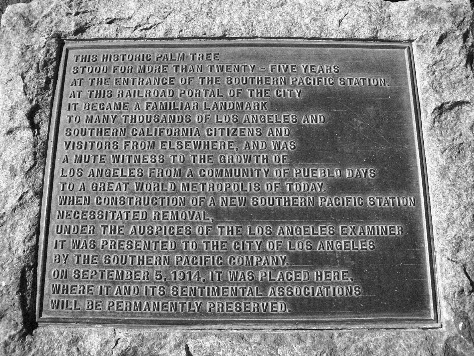
| (n.d.)#*#* - Plaque commemorating the Arcade Depot Palm as the "Mute witness to the growth of Los Angeles". Both plaque and Arcade Palm are situated in front of the LA Memorial Coliseum. |
Historical Notes The plaque sits in front of the Exposition Park entrance leading to the coliseum. It reads: “This historic palm tree stood for more than twenty-five years at the entrance of the Southern Pacific Station. At this railroad portal of the City it became a familiar landmark to many thousands of Los Angeles and Southern California citizens and visitors from elsewhere, and was a mute witness to the growth of Los Angeles from a community of Pueblo days to a great world metropolis of today. When construction of a new Southern Pacific Station necessitated removal, under the auspices of the Los Angeles Examiner it was presented to te City of Los Angeles by the Southern Pacific Company. On September 5, 1914, it was placed here, where it and its sentimental associations will be prmanently preserved.” |
* * * * * |
La Grande Santa Fe Station
_1893.jpg) |
|
| (1893)^ - View looking eastward from Santa Fe Avenue at 2nd Street. La Grande Santa Fe Depot is at right, located on the corner of 2nd and Santa Fe. |
Historical Notes Santa Fe opened La Grande Station on July 29, 1893 and it was unique for Southern California in its Moorish-inspired architecture. The station was located at 2nd Street and Santa Fe Ave, just south of the First Street viaduct built in 1929 and on the west bank of the LA River.*^ |
 |
|
| (1890s)^^ - External view of the La Grande Santa Fe Station. Horse-drawn carriages are parked at the curb waiting for passengers. |
Historical Notes The Moorish-inspired La Grande railroad station was used as a passenger terminal for Atchison, Topeka and Santa Fe Railway.^ |
 |
|
| (ca. 1894)^## - View of the front entrance to the La GrandeSanta Fe Depot showig the detail of its Moorish-style domes. |
Historical Notes Many Hollywood movies were filmed at the stylish station. Laurel and Hardy's film Berth Marks (1929) was one of the first sound movies shot on location. Other movies that used Santa Fe's La Grande Station included Choo Choo 1931 (Our Gang - Little Rascals), Lady Killer, 1933 with James Cagney, Swing Time 1936 (Fred Astaire) and Something to Sing About 1937 (James Cagney).*^ |
 |
|
| (1890s)*^ - A passenger train is stopped at the La Grande Station as two men are seen posing for the camera. |
 |
|
| (1893)^*^# – View showing passengers lining up to board the Overland Train at Los Angeles' La Grande Station. |
.jpg) |
|
| (1899)^*^# – Panoramic view showing a train leaving the La Grande Station. Note the tall poll in the background (center-left). It was one of Los Angeles’ first streetlights and was 150 ft. tall. Click HERE to see more in Early LA Streetlights. |
* * * * * |
Spring Street
 |
|
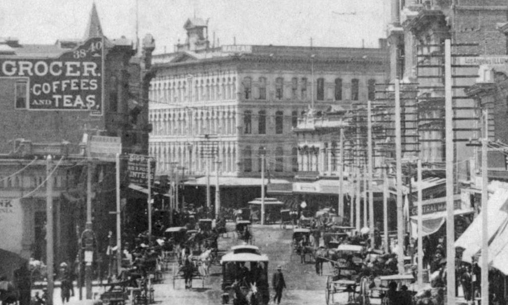
| (1880s)^*# - View looking south on a congested Spring Street towards 1st Street with the Nadeau Hotel standing on theSW corner. Horse-drawn wagons and trolleys share the road. Pedestrians are seen walking on sidewalks along numerous telegraph poles. To the left is a large sign that reads: CROCER, COFFEES AND TEAS. To the lower right a smaller sign reads: CENTRAL MARKET. |
Historical Notes The Central Market was a retail meat makret located at 149-51 Spring Street. It was owned by Simon Maier, brother of Joseph Maier of the Maier and Zobelin Brewery. Interesting Fact: The Central Market was located next door to the undertakers (per the 1894 Sanborn Map).^*# |
 |
|
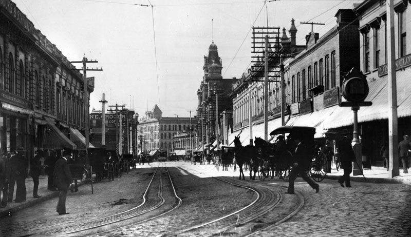
| (ca. 1890s)^ - North Spring Street looking south from Temple in the 1890s approximately 10 years after the previous photo was taken. Horse-drawn vehicles are seen mainly parked along the curbs while pedestrians cross the cable car tracks. The two largest building seen in the distance are the Nadeau Hotel (SW corner of Spring and 1st) and the more ornate Phillips Block (25-37 N. Spring Street). |
 |
|
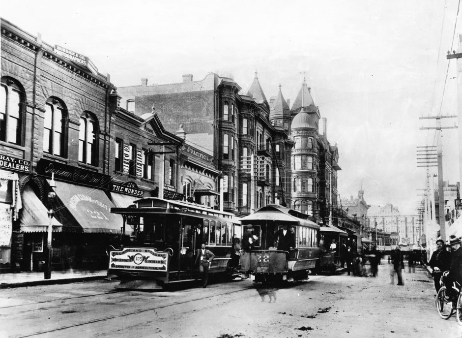
| (ca. 1891)^^ - View looking north on Spring Street from Third Street showing The Fourth Street & Broadway streetcar standing idle with its driver looking on at center as two other streetcars pass by. The Bryson Block with its multiple spires can be seen in the distance on the NW corner of Second and Spring streets. Businesses seen include the Wonder (219 South Spring Street), Burdick & Company, and the Parisian Cloak and Suit Company at 221 South Spring. |
* * * * * |
Spring and 8th Street
 |
|
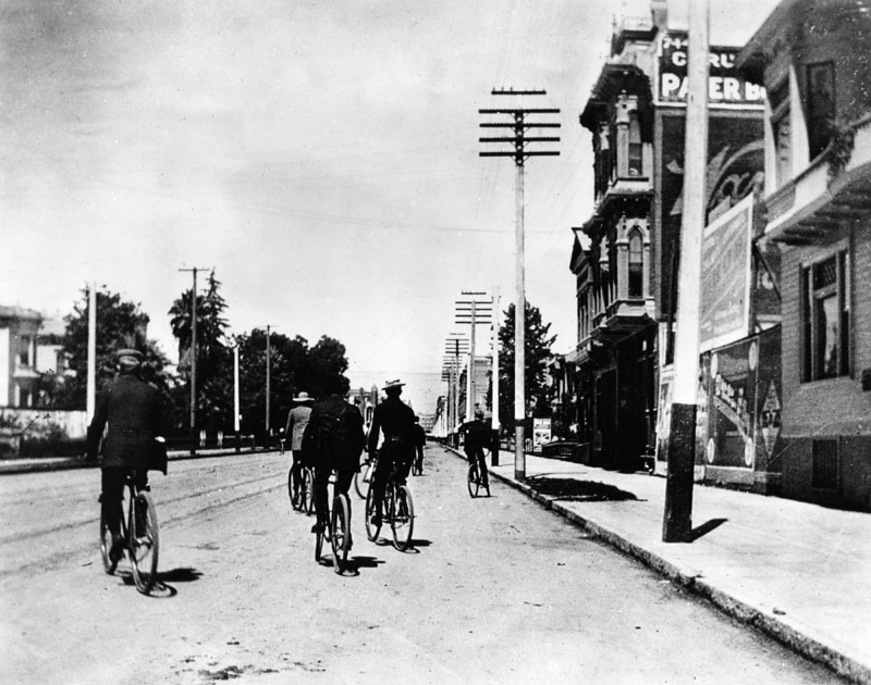
| (1899)^ - A view of bicycle riders on Spring Street riding north near 8th St. On the right side (east side of Spring) a sign for the Corum Paper Box Factory is visible on the side of a building. |
* * * * * |
San Fernando Valley
 |
|
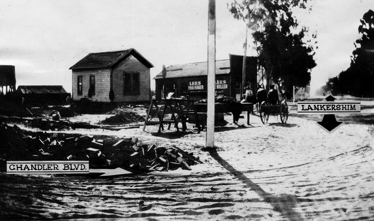
| (ca. 1891)^ - This was the intersection of Lankershim and Chandler as it appeared in the late 19th Century. Click HERE to see more in Early Views of the San Fernando Valley. |
Historical Notes Lankershim Boulevard was named for the town of Lankershim (first called Toluca, now North Hollywood) and its founding family, the Lankershims. Isaac B. Lankershim grew wheat on a wide swath of the Valley floor on his Lankershim Ranch. North Hollywood was established by the Lankershim Ranch Land and Water Company in 1887. It was first named Toluca before being renamed Lankershim in 1896 and finally North Hollywood in 1927. Chandler Boulevard was originally a leg of Sherman Way, it was renamed for land developer and Los Angeles Times publisher Harry Chandler.^* |
 |
|
| (ca. 1890s)^^ - Photograph of Chatsworth Park and its live oak trees, San Fernando Valley. Beyond a lone oak tree in the foreground, piles of wood are stacked between two pairs of railroad tracks. Four buildings are visible in the center of the field. Grids of newly planted and some mature oak trees border the buildings. Mountains are visible beyond the distant rocky hills. |
Historical Notes In the late 1800s the San Fernando Valley was divided into thirteen ranches, seven of which were located in the southern half of the valley and six in the northern half. The Granger Ranch, owned by Benjamin F. Porter, became Chatsworth Park. Click HERE to see more in Early Views of the San Fernando Valley |
* * * * * |
National Soldiers’ Home — Sawtelle Veterans Home |
(Later West Los Angeles VA Medical Center) |
The National Soldiers’ Home in Sawtelle — later known as the Sawtelle Veterans Home and today the West Los Angeles VA Medical Center — became one of the most significant federal veterans’ facilities in the American West. Established in 1888 as the Pacific Branch of the National Home for Disabled Volunteer Soldiers, it provided housing, medical care, and community for former servicemen at a time when no national veterans’ healthcare system yet existed. The campus stood on more than 600 acres of land donated in 1887 by Arcadia Bandini de Baker and John P. Jones, who stipulated that the property be permanently dedicated to veterans. Its favorable climate, open space, and agricultural potential made it ideal for long-term care. Over time, the home helped shape the surrounding community of Sawtelle, Los Angeles, and played a key role in the evolution of federal veterans’ services that ultimately led to today’s Department of Veterans Affairs system. |
 |
|
| (ca. 1892)* - Pacific Branch of the National Soldiers’ Home in present-day Sawtelle, showing early barracks and the chapel at left. This view captures the campus shortly after establishment, when it stood amid open ranch land west of Los Angeles. |
Historical Notes This early panoramic view captures the Soldiers’ Home during its formative years, when the campus was still emerging from open ranch land. Temporary structures initially housed residents while permanent barracks, hospital wards, kitchens, and support buildings were erected. The wide spacing between buildings reflected both fire safety concerns and the belief that fresh air and open landscapes supported health and recovery. The chapel visible at left quickly became the spiritual and social heart of the campus. Religious services, lectures, concerts, and ceremonies were regularly held there, reinforcing a sense of community. At a time when many veterans had limited family support, the home provided not only shelter and medical attention but also a structured social environment that mirrored military life. |
 |
|
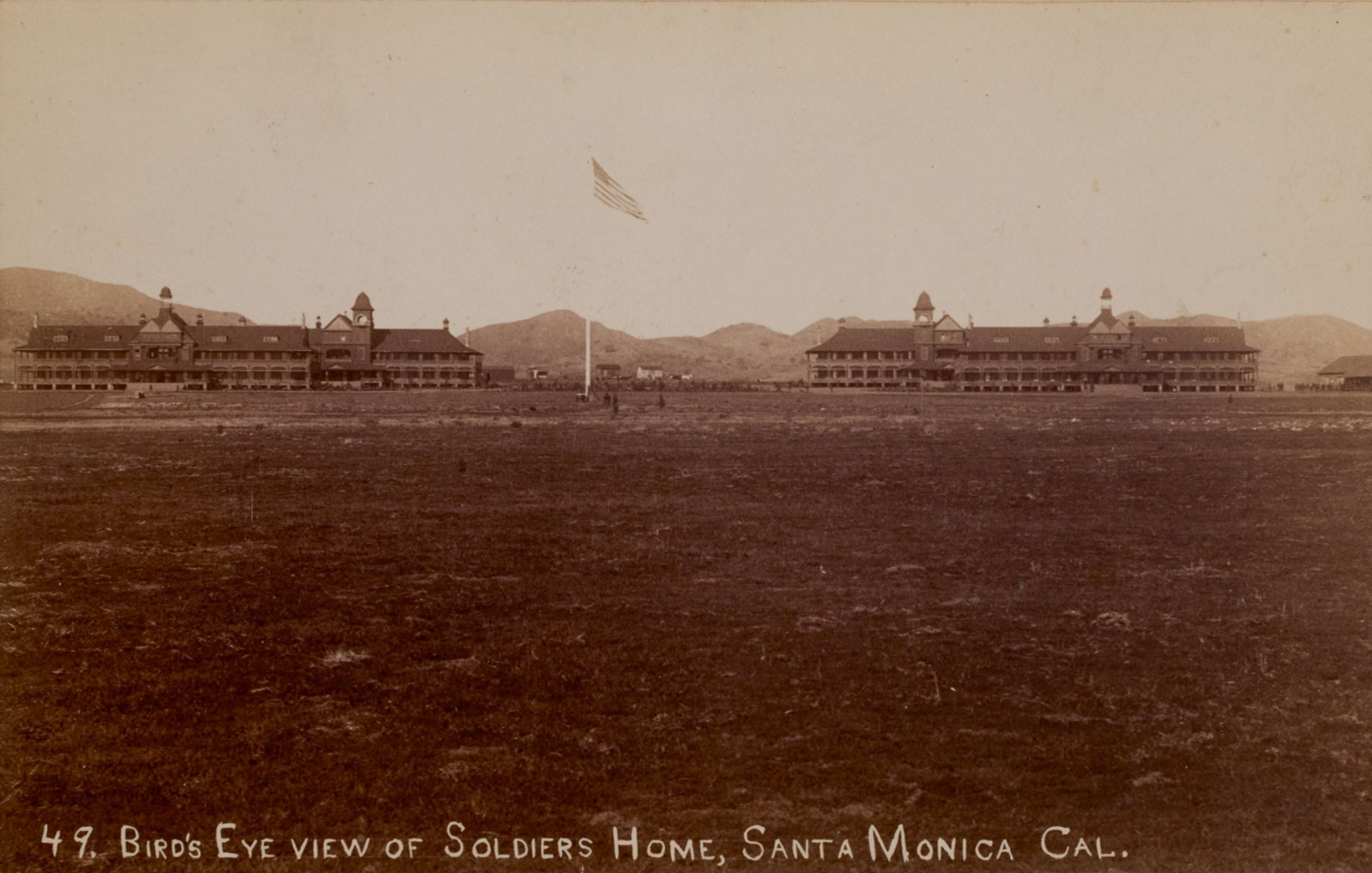
| (ca. 1888)* - Bird’s-eye view of the National Soldiers’ Home near present-day Sawtelle. Many early images like this were labeled “Santa Monica” because Sawtelle had not yet developed as a town and Santa Monica was the nearest well-known place name. |
| Historical Notes
Bird’s-eye views like this were often created for promotional and commemorative purposes, presenting the Soldiers’ Home as an orderly and dignified national institution. The symmetrical layout, landscaped grounds, and prominent flagpole symbolized federal commitment to those who had served. The surrounding land was still largely undeveloped, underscoring how remote the location initially felt. Yet the presence of the home soon attracted workers, merchants, and families, laying the groundwork for the nearby community that would later become Sawtelle. In this way, the Soldiers’ Home acted as both a care facility and a catalyst for regional development. |
 |
|
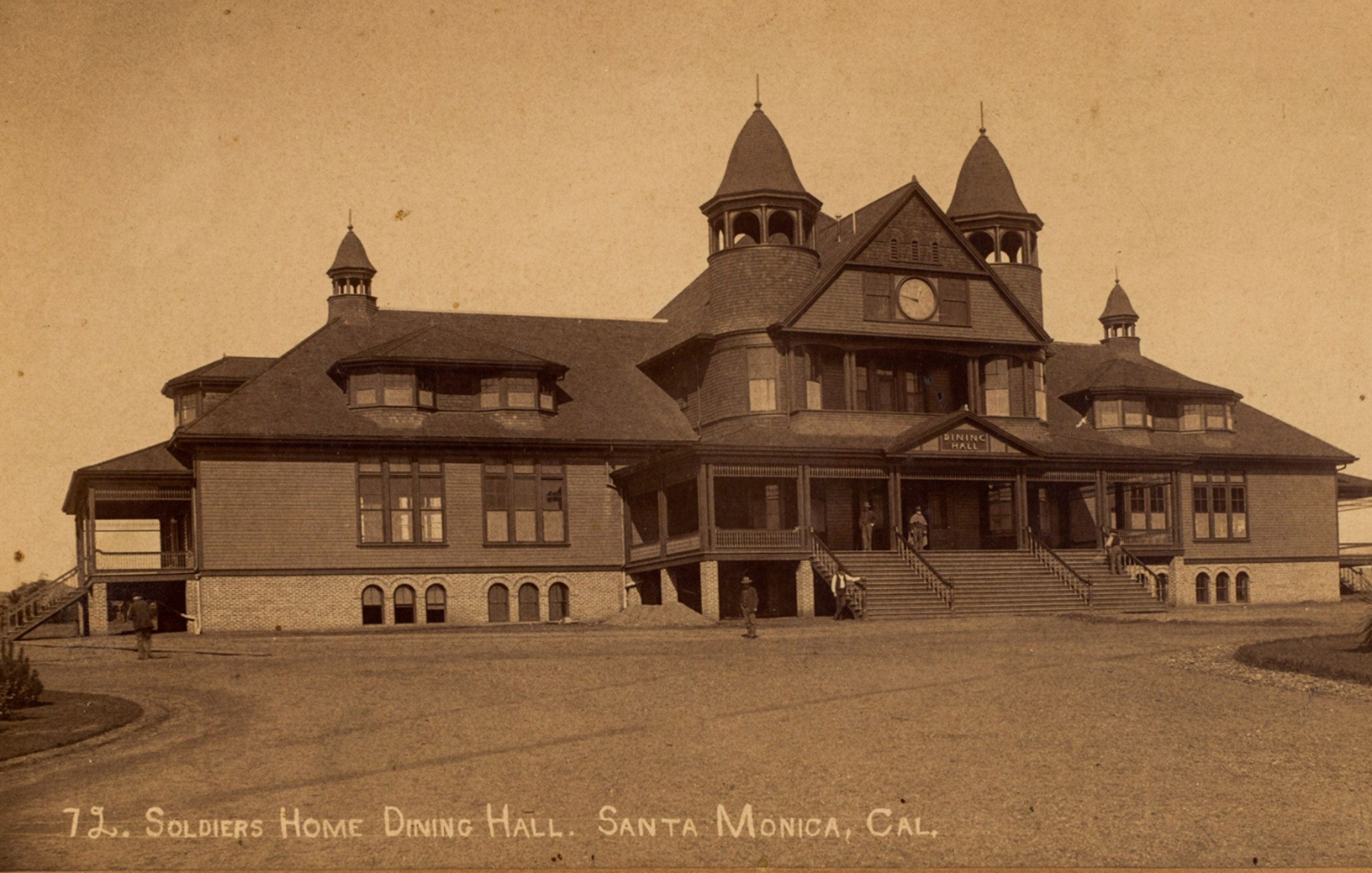
| (ca. 1888)* – Soldiers’ Home dining hall near present-day Sawtelle, where hundreds of resident veterans took meals on a strict daily schedule. Period captions sometimes identified the location as “Santa Monica,” reflecting regional naming conventions before Sawtelle was established as a community in the 1890s. |
| Historical Notes
The dining hall was one of the most important communal spaces on campus. Meals were served on a regular schedule, reinforcing discipline and routine familiar to former soldiers. Large institutional kitchens prepared food for hundreds of residents, often using produce and livestock raised on the grounds. Agriculture was a key part of daily life at the home. Veterans who were physically able frequently worked in gardens, orchards, or dairies, which helped supply the facility while also providing purposeful activity. This work was seen as therapeutic and contributed to the home’s goal of promoting dignity and self-sufficiency. |
 |
|
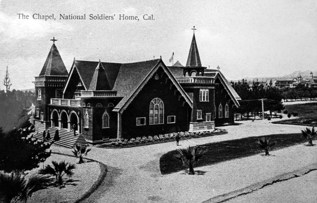
| (ca. 1900)* - Wadsworth Chapel at the Soldiers’ Home in Sawtelle, a multi-denominational place of worship that also served as a social and ceremonial center for veterans and the surrounding community. |
Historical Notes Constructed around 1900, the Wadsworth Chapel served as a multi-denominational place of worship and gathering. Its architecture reflected popular Mission Revival influences of the era, connecting it visually to Southern California’s Spanish heritage. Services were open to veterans of all faiths. Beyond religious use, the chapel hosted weddings, funerals, memorials, and community programs. After suffering damage in the 1971 Sylmar earthquake, it was closed for safety reasons and gradually deteriorated. In recent decades, preservation advocates have pushed for its restoration as an important historic resource. |
 |
|
| (1892)* - Veterans of the Pacific Branch marching in formation near the central flagpole at the Soldiers’ Home in Sawtelle, reflecting the military structure and discipline that remained part of daily life for many residents. |
Historical Notes Scenes like this show how life at the Soldiers’ Home retained elements of military structure. Uniforms, formations, and ceremonies reinforced identity and camaraderie among residents. Many veterans had served in the Civil War, Indian Wars, or Spanish-American War and carried lasting physical or emotional wounds. The National Home system, created by Congress in 1865, represented one of the first federal efforts to systematically care for disabled veterans. It marked a shift from reliance on local charity to national responsibility, laying groundwork for future veterans’ benefits and healthcare programs. |
 |
|
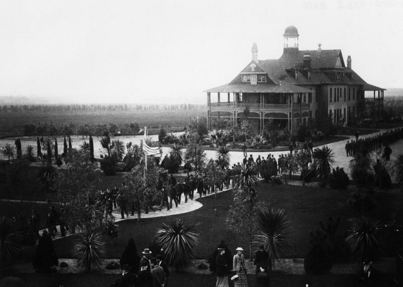
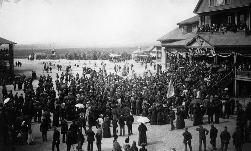
| (1892)* - A large gathering on the grounds of the National Soldiers’ Home in Sawtelle, likely during a ceremony or special visit. The campus often hosted public events that drew both veterans and civilians. |
| Historical Notes
Large gatherings were common at the Soldiers’ Home, especially during holidays, inspections, and special visits. Civilians frequently attended events, making the campus a regional attraction as well as a veterans’ facility. These occasions strengthened ties between veterans and the broader community. Public interest in the home also helped sustain political support for federal funding, as citizens could directly observe the government’s commitment to former servicemen. |
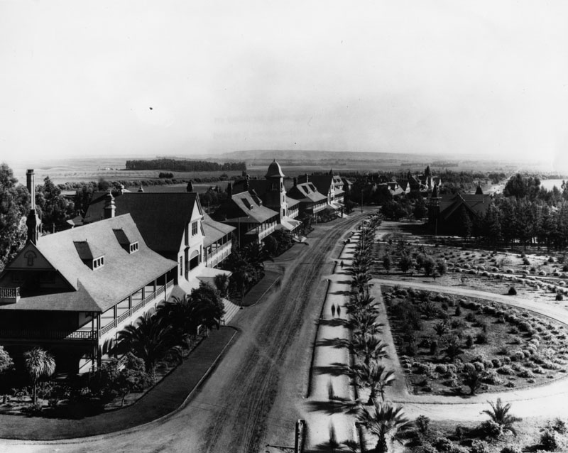 |
|
| (ca. 1890s)* - Street view on the Soldiers’ Home grounds in what would become Sawtelle, showing the spacious layout and rural surroundings that once characterized the campus. |
| Historical Notes
This view shows the campus when it still felt isolated from the growing city of Los Angeles. Broad roads and open land emphasized the self-contained nature of the facility. The home included not only housing and hospitals but also workshops, recreation areas, and agricultural zones. The presence of the Soldiers’ Home strongly influenced nearby settlement. The town of Sawtelle later took its name from the home’s manager, Thomas H. Sawtelle. The community eventually incorporated and was annexed into Los Angeles in 1922, but its origins are closely tied to the veterans’ facility. |
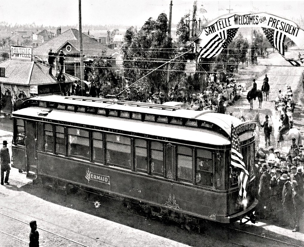 |
|
| (1901)* - Electric streetcar at Sawtelle and Santa Monica Boulevard during President McKinley’s 1901 visit, with a banner reading “Sawtelle Welcomes Our President.” Rail lines connected the Soldiers’ Home with Los Angeles and Santa Monica. |
| Historical Notes
Rail connections were crucial to the home’s accessibility. Electric streetcars linked Sawtelle with Los Angeles and Santa Monica, allowing visitors, staff, and dignitaries to reach the campus efficiently. The banner welcoming President McKinley shows how significant his visit was to the community. Transportation improvements helped transform the area from remote outpost to connected suburb. The rail lines also contributed to regional growth patterns that shaped West Los Angeles in the early 20th century. |
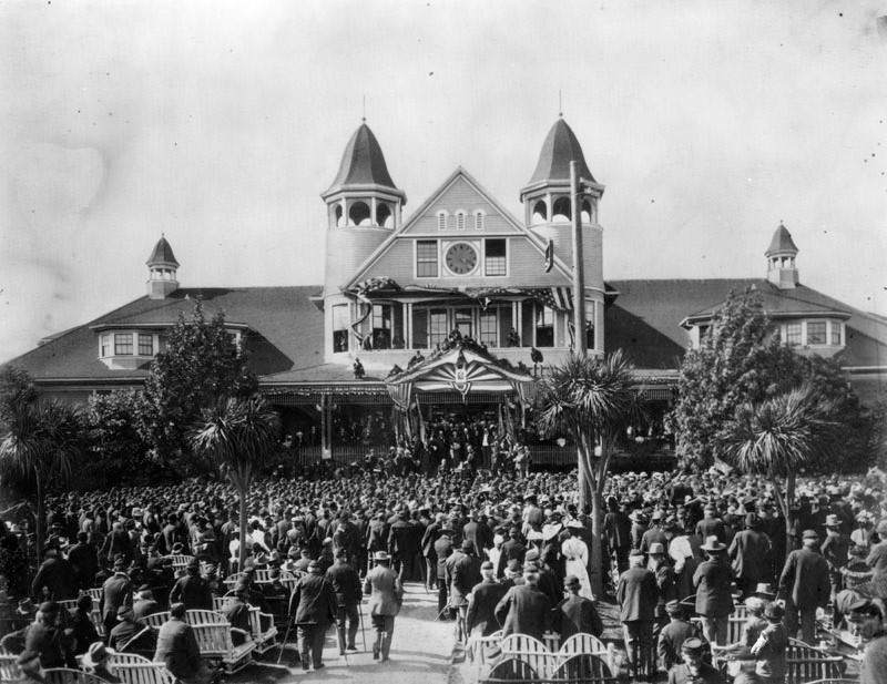 |
|
| (1901)* - President William McKinley near the entrance to the Soldiers’ Home in Sawtelle during his May 9, 1901 visit, underscoring the national importance of the veterans’ facility. |
| Historical Notes
President William McKinley’s May 9, 1901 visit underscored the national importance of the Soldiers’ Home. Presidential attention validated the institution and highlighted federal responsibility toward veterans. At the time, the resident population included veterans from multiple conflicts, and demand for care was rising. McKinley’s appearance reflected broader public respect for veterans and reinforced the home’s role as a national asset. |
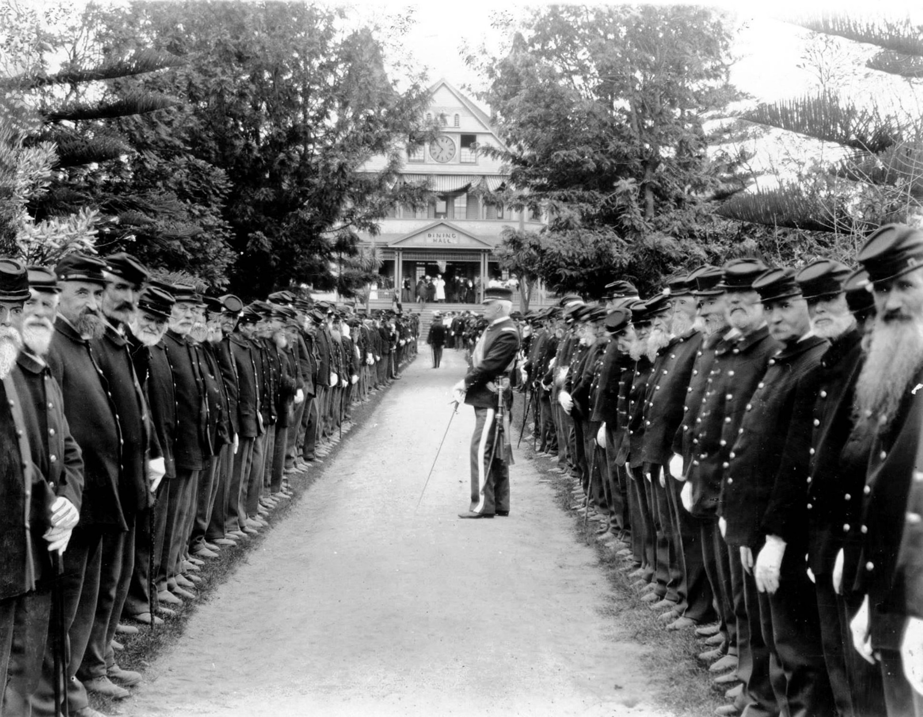 |
|
| (1905)* - Memorial Day review at the Soldiers’ Home in Sawtelle, with many participants believed to be Civil War veterans. Such ceremonies honored fallen comrades and reinforced bonds among residents. Photo by C. C. Pierce. |
Historical Notes Memorial Day ceremonies at the Soldiers’ Home were deeply meaningful. Many participants had lost comrades in war, and the observances honored both the fallen and the living. Parades, speeches, and flag ceremonies fostered remembrance and unity. By the early 20th century, the Soldiers’ Home was already part of a growing federal system of veterans’ care. In 1930, consolidation of veterans’ programs led to creation of the Veterans Administration. New hospital construction followed, and by the late 1930s the Wadsworth hospital complex represented a more modern medical approach. Although many early buildings were removed in the 1960s, the site continued its mission, with the modern VA medical center opening in 1977. |
Legacy of the Sawtelle Veterans Campus |
For more than a century, the Sawtelle veterans campus has remained dedicated to the care of former servicemen and women. From Civil War veterans to today’s generation, the property reflects a continuing national commitment to those who served. Its history is not only about buildings and photographs, but about the evolving ways America has honored and cared for its veterans. |
* * * * * |
5th Street and Towne Avenue - Downtown LA |
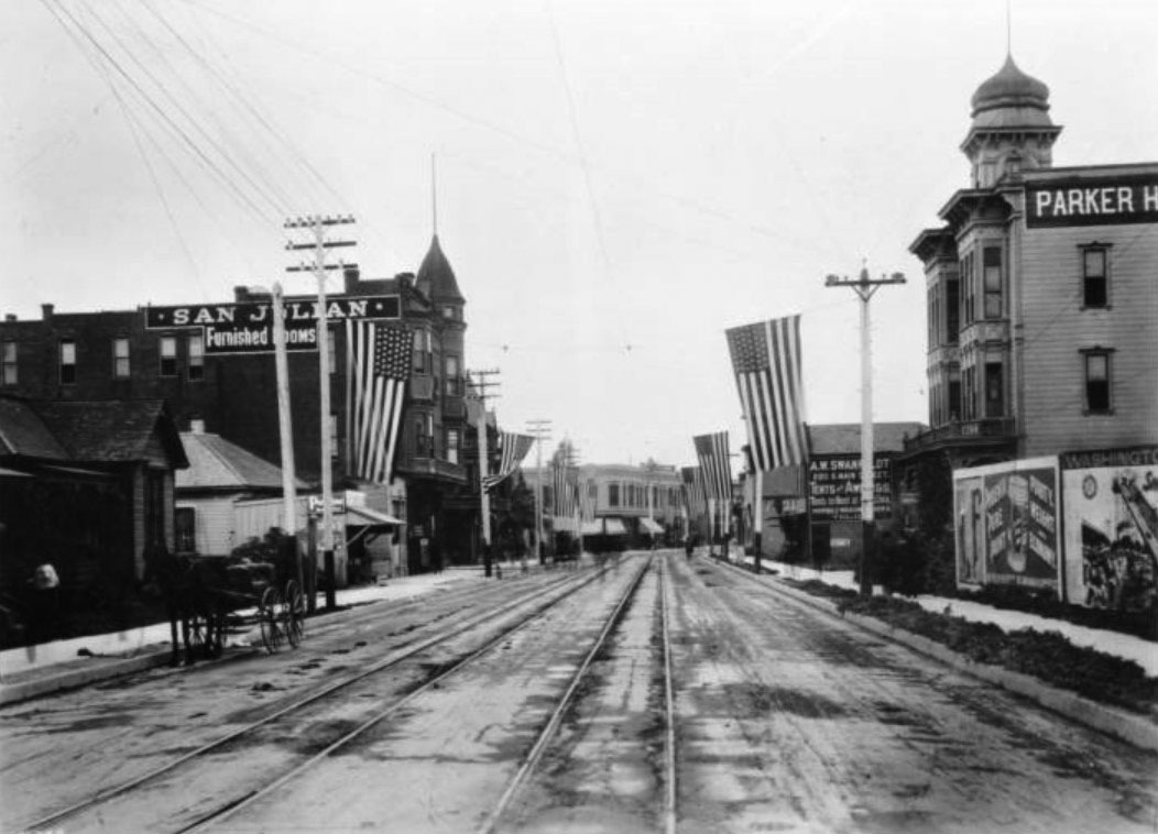 |
|
| (1891)* – View looking west on Fifth Street from Towne Avenue with several large American flags hanging from wires strung across the street. |
Spring and 5th Street
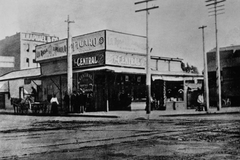 |
|
| (1886)^ - An early picture of the southeast corner of Spring and 5th St. when the building was occupied by Central Saloon. It later became the location of the Security Building. |
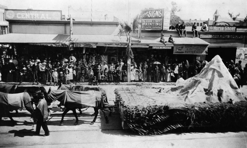 |
|
| (1892)^ - Several mules or horses pull a flatbed past the crowds watching at the southeast corner of Spring and 5th Street. |
Then and Now
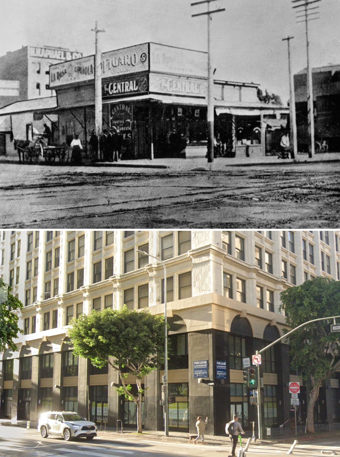 |
|
| (1886 vs 2023)* – Looking at the SE corner of Spring and 5th streets in DTLA showing the Central Saloon, today the site of a mixed-use commerical/residential building. Photo comparison by Jack J. Feldman. |
* * * * * |
Broadway and 5th Street
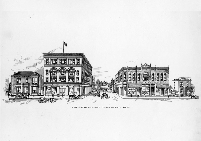 |
|
| (ca. 1880s)^ - A sketch of the west side of Broadway, at 5th Street. Building signs read "Hawley King & Co.", "L.A. Lighting", and "Perry Electrical Works." |
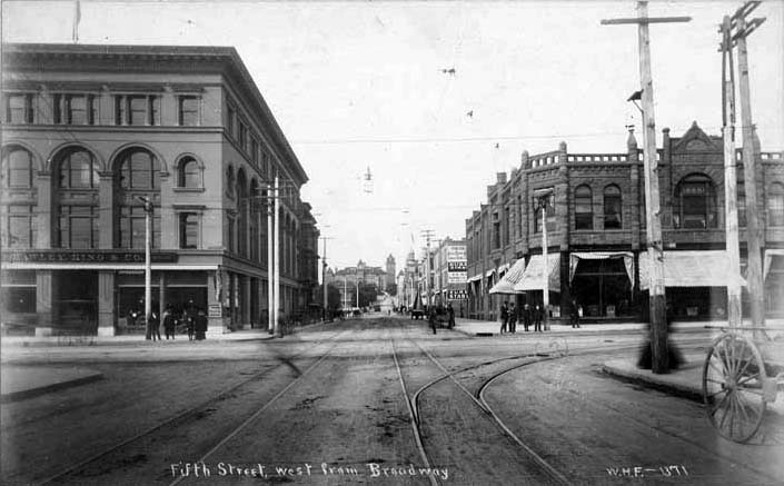 |
|
| (1891)* - View looking west on 5th Street at Broadway. In the distance can be seen the State Normal School located at 5th and Grand. |
Then and Now
.jpg) |
|
| (1891 vs 2021)* - Looking west on 5th Street at Broadway. Photo comparison by Jack J. Feldman. |
Grand and 5th Street
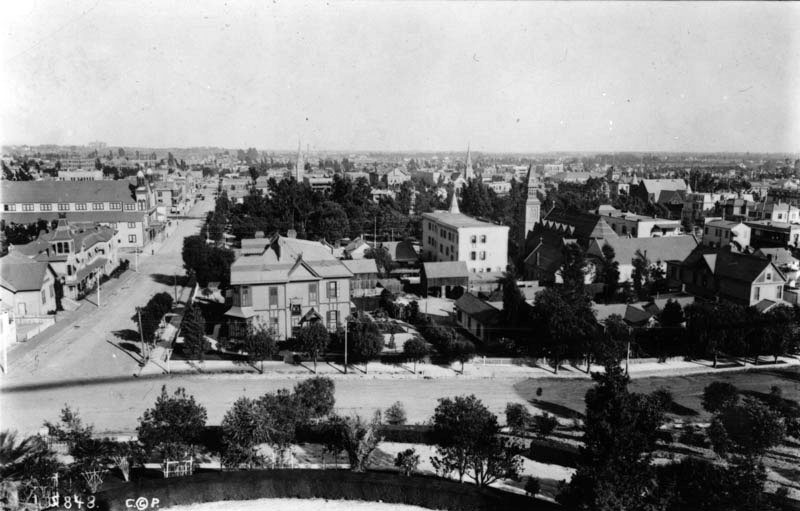 |
|
| (1890)^ - View is seen from the east side of the Normal School. 5th Street is on the left; Grand Avenue is in the foreground. St. Paul's Pro-Cathedra (Episcopal) is on the right-center. Hazard's Pavilion is on the left-center. 6th Street park (later Pershing Square) is in the center. |
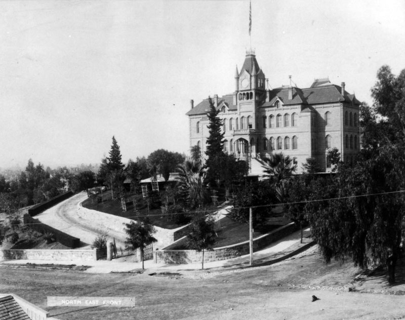 |
|
| (ca. 1893)^ - Southwest corner view of the State Normal School, located at Grand and 5th Street. A long and winding driveway is located on the left side of the entrance, and a long flight of stairs (barely visible) is on the right; the school sits impressively on the last knoll of Bunker Hill, aptly dubbed "Normal Hill". |
Historical Notes In 1880, with a population of 11,000, Los Angeles was a gas-lit pueblo trying to convince the state to establish in Southern California a second State Normal School, like the one already existing in San Jose, some 300 miles to the north. In March of the following year, the State Assembly approved the establishment of such a school. A group of enthusiastic citizens, over 200 of whom contributed between $2 and $500, purchased a site less than a mile from the business section. Soon the towering Victorian form of the school rose from an orange grove that, today, is the site of the Central Los Angeles Public Library.^ UCLA's roots are intertwined with that of the State Normal School. Click HERE to see the connection in Early Views of UCLA. |
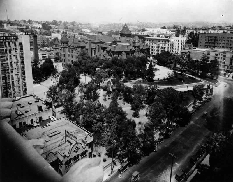 |
|
| (ca. 1913)^ - Aerial view of the State Normal School, located at Grand Avenue and 5th Street. Because the school sat impressively on the last knoll of Bunker Hill, aptly dubbed "Normal Hill", there were two ways to get to the main entrance: either taking the long and winding driveway located on the left side, or a long flight of stairs on the right (partially covered by the trees), which was parallel to 5th Street. The large white building on the middle left is the Bible Institute, later to become the Church of the Open Door/Biola Institute, that was located on Hope Street; the Key West Rooms and Apartments is visible on the lower left. |
Historical Notes After the demolition of this structure (1924), 5th Street was straightened and the remainder of the site was eventually occupied by the L.A. Public Library. Click HERE to see Construction of the Central Libary. |
* * * * * |
Hill and 2nd Street
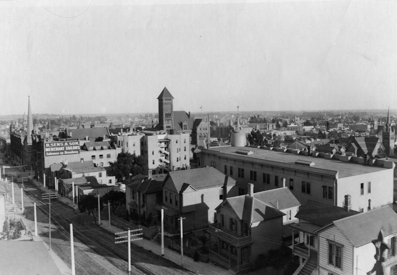 |
|
| (ca. 1892)^ - View showing 2nd and Hill Streets (at lower-left) looking east from near Olive Street. Mostly a residential area, there are a few commercial buildings, including one housing O.C. Sens, merchant tailors, entrance on Broadway. The 1888 City Hall at 226 So. Broadway is seen at center. The First Presbyterian Church with its impressively tall spire stands at left on the southeast corner of 2nd Street and Broadway. |
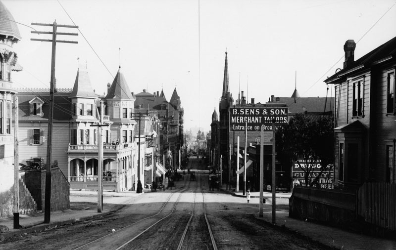 |
|
| (1894)^ - View showing an unpaved 2nd Street looking east from Hill Street. Utility poles and streetcar tracks face a mix of residential and commercial buildings. People relax on wide verandas in the Queen Anne Revival building on the northeast corner across from B. Sens & Son, merchant tailors, who advertise their "Entrance on Broadway." Pedestrians, deliveries and horse and buggy traffic make for a busy street. The First Presbyterian Church with its tall spire can be seen in the distance on the SE corner of Broadway and 2nd Street. |
Then and Now
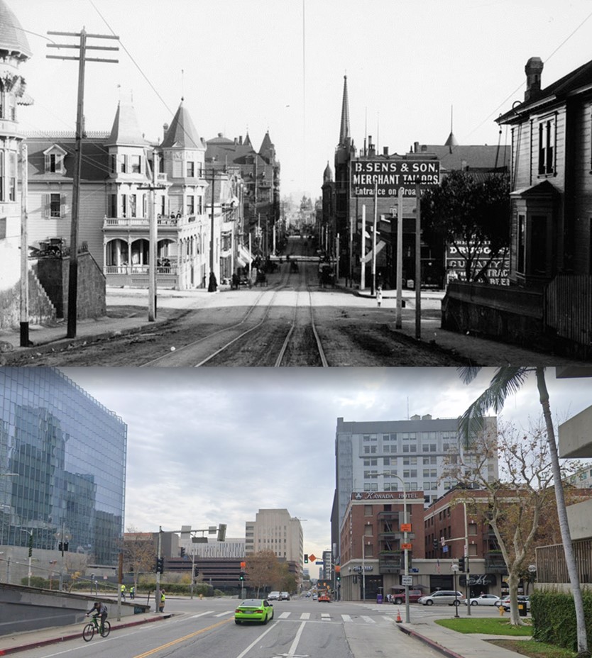 |
|
| (1894 vs 2021)* - Looking east on 2nd Street toward Hill Street. Photo comparison by Jack J. Feldman. |
 |
|
| (ca. 1910)* – Looking at Los Angeles Fire Department's Engine Co. No. 3 on the west side of Hill Street, just south of 2nd Street. A three-horse-drawn steam pumper stands in front of the station. In the background, the Victorian-style Locke Hotel & Annex sits atop the hill at the northwest corner of 2nd and Hill Streets. Note the beautiful A 5-globe streetlight in front of the station. It was called a 'Winslow' Llewellyn Electrolier. |
Historical Notes The file card for the above photo reads: Photo of Joaquin "Louis" Constantine seated on Los Angeles Fire Department's Engine Co. No.3, a 1907 Metropolitan 1,000 GPM Steam Pumper and the largest of its day. Photo circa 1910. The Los Angeles Fire Department's Engine Company No. 3 has a rich history dating back to its establishment in 1887. Initially located at Main and First Streets, the company moved several times, reflecting the city's rapid growth and evolving firefighting needs. By 1910, Engine Company No. 3 operated out of a station on South Hill Street and was equipped with advanced apparatus for the time, including a 1907 Metropolitan 1,000 GPM steam pumper, one of the largest of its era. In 1910, the LAFD was transitioning into a modernized force. The department had recently annexed areas like San Pedro and Hollywood, incorporating volunteer firefighters and motorized equipment. Engine Company No. 3 played a critical role during notable incidents that year, including responding to the devastating Los Angeles Times bombing on October 1, which caused significant casualties and destruction. |
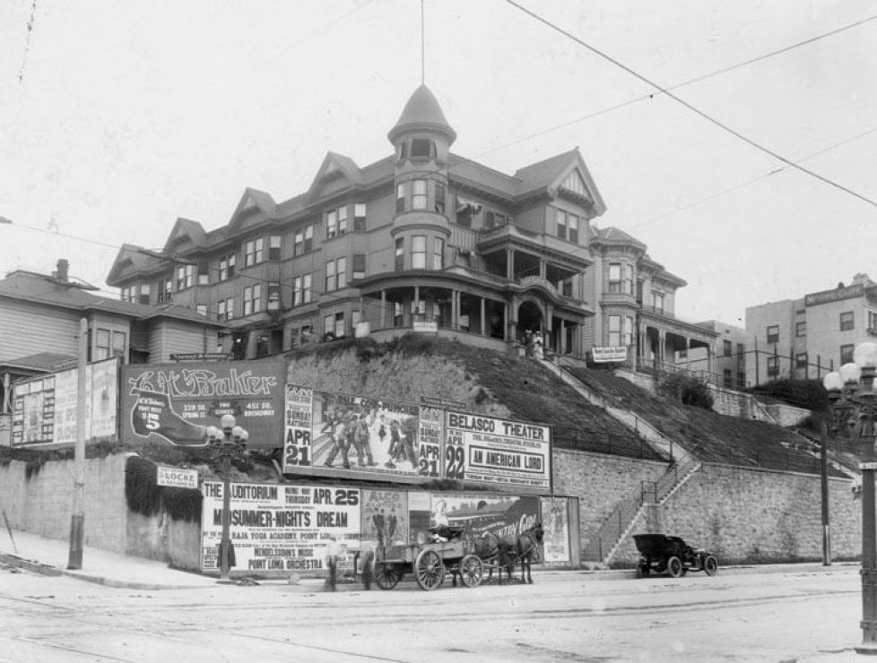 |
|
| (1906)* - The Locke Hotel & Annex sit up on the hill on the NW corner of 2nd and Hill streets while advertising placards are pasted all over the wall at street level. Adds for "Midsummer nights dream" at the Auditorium, "An American lord" at the Belasco Theater, "G.H. Baker" shoes stories, etc. |
Historical Notes In the early 1900s, the Locke Hotel and Annex stood prominently on the northwest corner of Hill and 2nd Streets in downtown Los Angeles, atop Bunker Hill. Located at 139 S. Hill Street, the hotel overlooked 2nd Street as it climbed Bunker Hill, with Hill Street extending toward the 1st Street tunnels. This bustling area was a vibrant part of the city's Victorian-era development, featuring horse-drawn wagons, electric streetcars, and pedestrians navigating the steep streets, with the Locke Hotel and its annex representing the architectural and cultural growth of Los Angeles during its transition into a major urban center. |
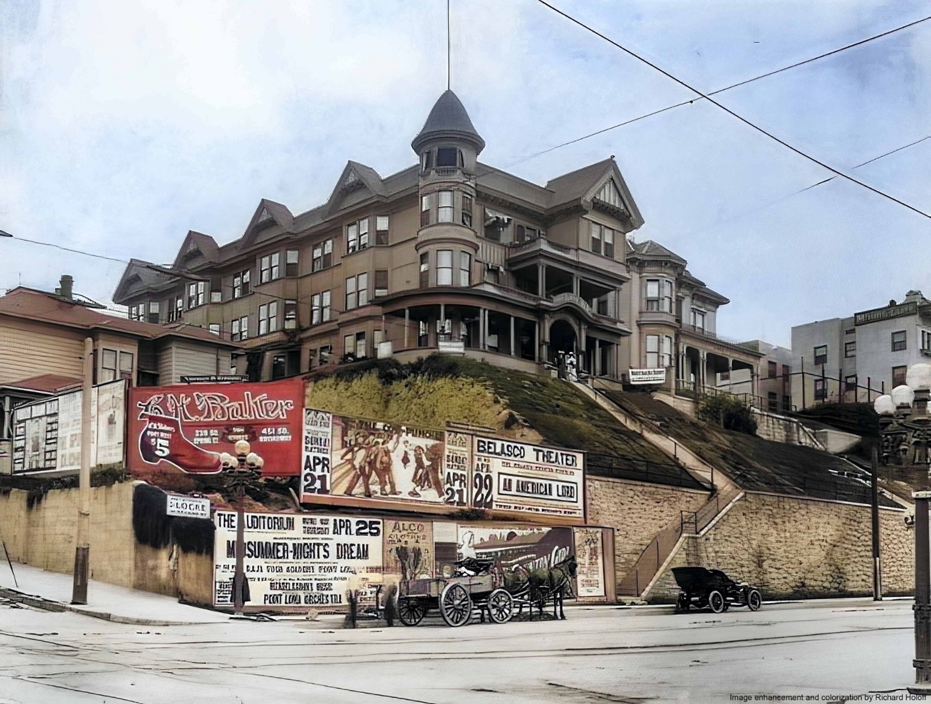 |
|
| (1906)* - The Locke Hotel & Annex sit up on the hill on the NW corner of 2nd and Hill streets while advertising placards are pasted all over the wall at street level. Adds for "Midsummer nights dream" at the Auditorium, "An American lord" at the Belasco Theater, "G.H. Baker" shoes stories, etc. Image enhancement and colorization by Richard Holoff. |
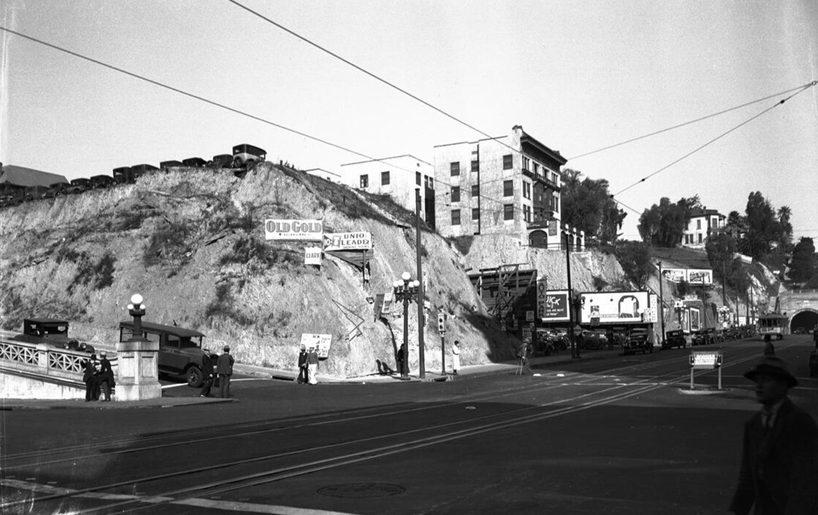 |
|
| (1932)* – Looking north on Hill Street at 2nd Street showing cars parked on the hill where the Locke Hotel once stood. The 4-story building in the center of the photo is the Moore Cliff Apartments. In the distance on the right is the Hill Street Tunnel. |
Historical Notes The Locke Hotel and Annex had its time and place but has been gone for over 100 years—I believe since 1924. The site was a parking lot both before and after the hill seen above was removed." |
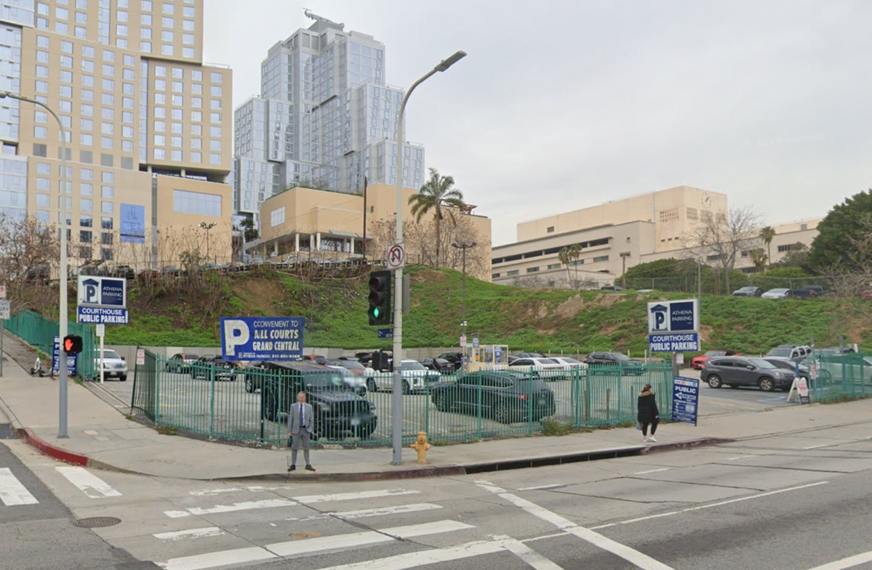 |
|
| (2023)* – Contemporary view of the northwest corner of Hill and 2nd Streets, now a parking lot where the Locke Hotel and Annex once stood. |
Historical Notes As of early 2025, construction has begun at the above site on an expansion of the Colburn School of Music & Dance, designed by architect Frank Gehry. Gehry, known for the Disney Concert Hall and The Grand LA, continues to shape Bunker Hill’s skyline, further cementing its status as an architectural landmark in Los Angeles. The Locke Hotel and Annex had its time and place but has been gone for over 100 years—I believe since 1924. |
Then and Now
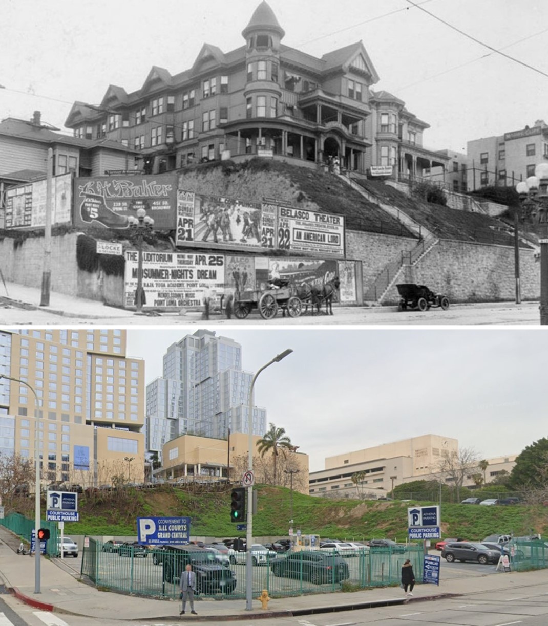 |
|
| (1906 vs. 2023)* – A ‘Then and Now’ comparison of the Locke Hotel and Annex at the northwest corner of Hill and 2nd Streets in Downtown Los Angeles, now the site of a parking lot. Photo comparison by Jack J. Feldman. |
Then and Now
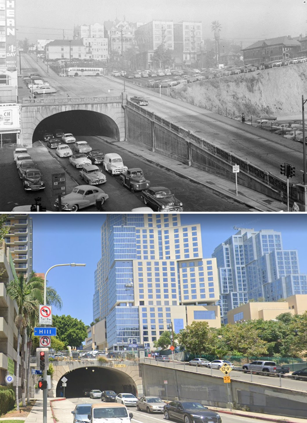 |
|
| (1950s vs 2022)* - Looking west on 2nd Street from Hill Street towards the Second Street Tunnel and Bunker Hill. Photo comparison by Jack J. Feldman. |
* * * * * |
Broadway (Downtown LA)
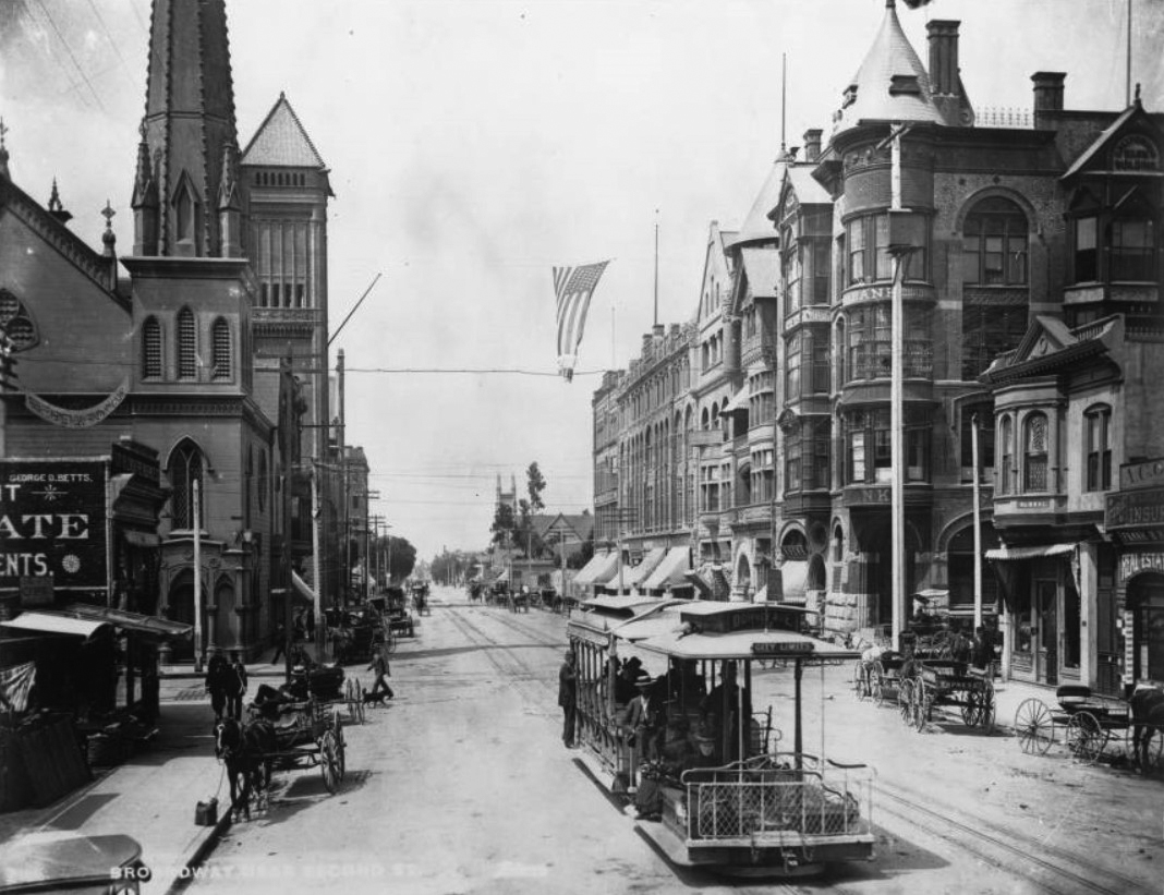 |
|
| (ca. 1893)* – View looking south on Broadway showing the First Presbyterian Church on the southeast corner of Second Street and Broadway (left) with City Hall several lots behind it. The California Bank Building stands on the southwest corner on the right. |
Historical Notes Three main cable car companies operated in Los Angeles between 1885 and 1902: a) Second Street Cable Railroad (1885-1889): It ran along Second Street, up Bunker Hill, to Second and Texas (now Belmont) Street. b) Temple Street Cable Railway (1886-1902): This line extended 8,725 feet between Spring Street and Belmont Avenue. c) Los Angeles Cable Railway (1889-1902): The most ambitious system, it operated about 25 miles of routes, connecting downtown Los Angeles to areas now known as Lincoln Heights, Echo Park/Filipinotown, and the Pico-Union district. The cable car seen in the above image belonged to the Los Angeles cable Railway. The Downey Avenue line, now known as North Broadway, was a key route that connected various parts of Los Angeles. It extended from Ninth and Grand View, through Ninth, Figueroa, Sixth, Hill, Fourth, Broadway, First, Spring, Marchessault, Main, San Fernando, Olympia, Downey (N. Broadway), Chestnut (now Avenue 20), Pasadena, Daily, to Avenue 33. |
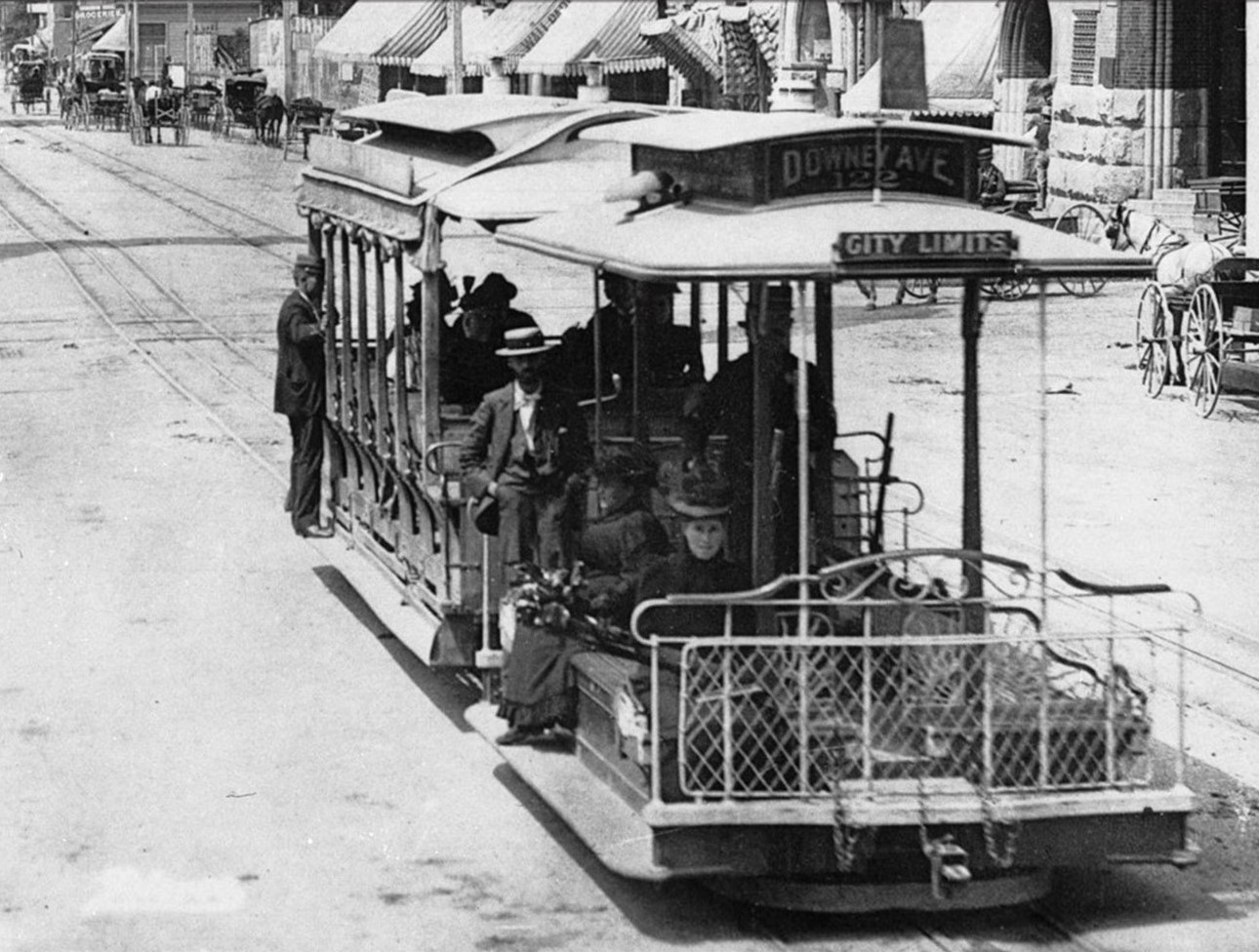 |
|
| (1889)* – Close-up view of previous photo showing a cable car heading north on Broadway at 2nd Street. |
Historical Notes Cable cars soon became obsolete after engineers perfected an newer streetcar technology: the electric railway. Whereas cable railways constantly ran their engines at full power—regardless of how many cars were active on the line—to pull the heavy steel cables, the newer railways delivered electricity directly to motors located on the streetcars themselves. Cables lasted only a few years before needing replacement and were costly to bury; overhead catenary wires were inexpensive by comparison. By 1896, much of the city's cable car trackage had been converted to electricity and incorporated into a growing electric railway network. In 1902, a mere 16 years after the city hailed its first cable railway as a technological wonder, the last of L.A.'s cable cars rolled down Temple Street and into obscurity.* |
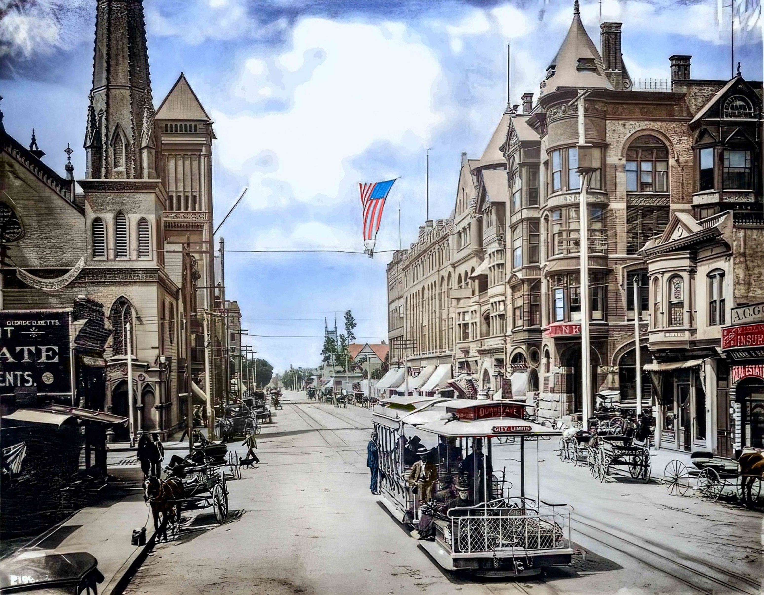 |
|
| (1889)* – View looking south toward the intersection of Broadway and 2nd Street showing a cable car full of passengers in the foreground. Horse-drawn vehicles are parked along the curb on both sides of the street. On the SE corner (left) stands the First Presbyterian Church with the 1888-built City Hall situated further south at 226 S. Broadway. To the right, on the SW corner, is the California Bank Building. In the distance can be seen Fort Street Methodist Episcopal Church, located on the west side of Broadway between 3rd and 4th streets. Note: Broadway was known as 'Fort Street' until 1890. Photo by Charles C. Pierce; Image enhancement and colorization by Richard Holoff. |
Then and Now
.jpg) |
|
| (1889 vs 2022)* - Looking south on Broadway at 2nd Street. Photo comparison by Jack J. Feldman. |
Historical Notes Click HERE to see more Early Views of the intersection of Broadway and 2nd Street in the 1880s. |
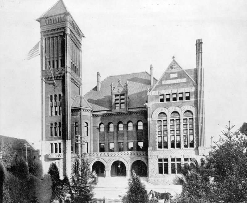 |
|
| (ca. 1889)^ - Exterior view of the Old City Hall, located at 226 Broadway. This was Los Angeles' third City Hall. |
Historical Notes Los Angeles’ third City Hall was erected in 1888 at 226-238 South Broadway. This grand Romanesque edifice of marble and red sandstone building stood for 40 years until 1928 when the present day City Hall was completed. |
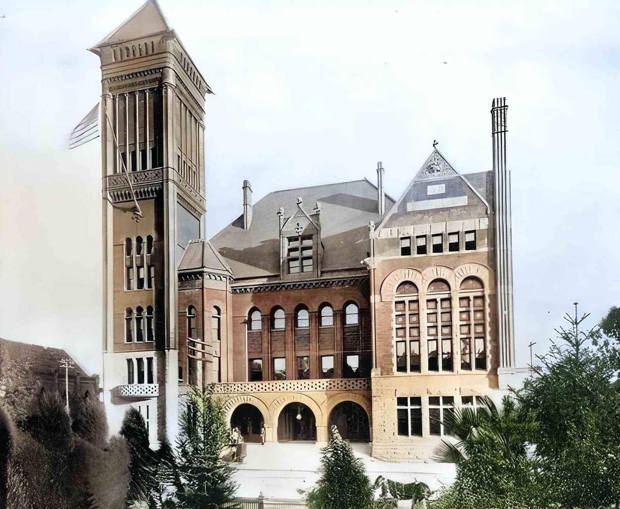 |
|
| (ca. 1889)* - Los Angeles City Hall from 1888 until 1928, located at 226 Broadway. AI image enhancement and colorization by Richard Holoff |
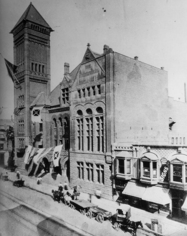 |
|
| (1895)^ - Exterior view of the third City Hall, built in 1888, adorned with banners. Horse-drawn wagons are parked in front. |
Historical Notes The following historical timeline lists the buildings used by City Council, also known as City Hall, since 1850, when Los Angeles was incorporated as a municipality: ◆ 1850 - 1853 - used rented hotel and other buildings for City meetings ◆ 1853 - rented adobe house (aka Rocha Adobe) on Spring Street - across from current City Hall (now parking lot for Clara Shortridge Foltz Criminal Justice Center). The buliding was shared with the County who used it as a Court House. ◆ 1861 - moved into John Temple's Clocktower Market Building, but only stayed for less than a year before the County Court House moved-in ◆ 1861 - 1884 - relocated back to the Rocha Adobe and stayed for over 20 years ◆ 1884 - 1888 - moved to new City Hall Building at South Spring Street and West 2nd Street (site of current Los Angeles Times Building) ◆ 1888 - 1928 - moved to new Romanesque Revival Building on 226-238 South Broadway between 2nd Street and 3rd Street; demolished in 1928 and now site of parking lot between LA Times Parking structure and 240 Broadway. ◆ 1928 - moved to current City Hall Building |
.jpg) |
|
| (1895)^ - The view looking south on Broadway from 2nd Street. City Hall tower can be seen on the left. The California Bank Building is at right on the SW corner. |
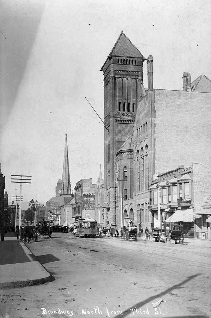 |
|
| (ca. 1895)^ - View of Broadway looking north from Third Street. |
Historical Notes City Hall (1888-1928) dominates the right of the picture. Several other landmarks of the day can also be seen here. The tower of Los Angeles High School is partially visible to the left of the power poles. The clock tower in the distance is that of the Los Angeles County Court House. The tall spire next to that belongs to the First Presbyterian Church at the SE corner of Broadway and Second Street. And, the gothic structure just barely visible between City Hall and the Crocker Building (with the two bay windows) is Los Angeles' first Jewish synagogue (B'nai B'rith Temple). |
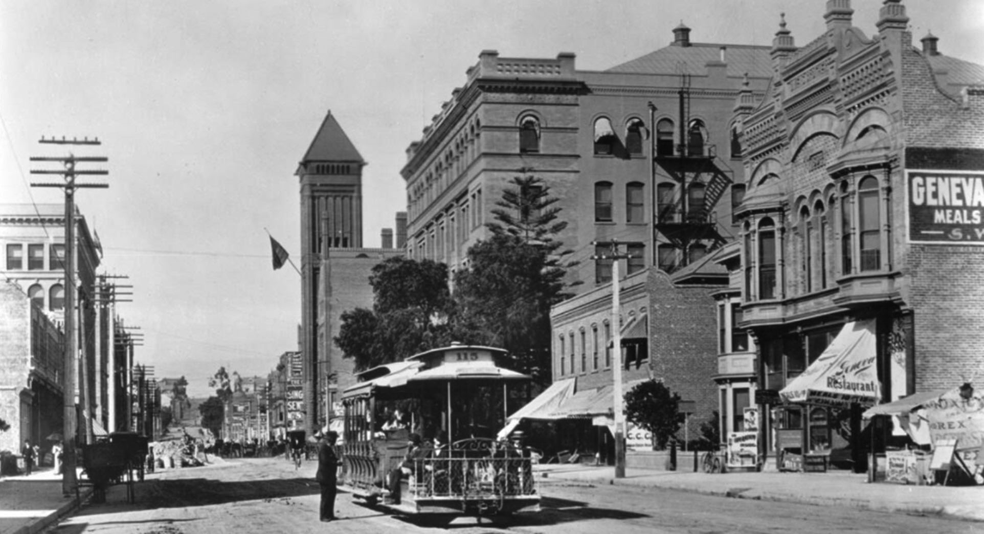 |
|
| (1898)* - View of Broadway looking north from mid-block between 3rd and 4th Streets Street. A man in a hat stands to the left of a stopped streetcar at center which advertised "West Lake Park" on its marquee. Horse-drawn carriages are parked along the sidewalk to the left. To the right, commercial buildings line the street displaying signs, while the tower of the old City Hall can be seen farther down, an American flag extending from its front. |
Historical Notes This photo was taken mid-block, between 3rd and 4th Streets, approximately where the present-day Grand Central Market is located (in the 1896 Homer Laughlin Building). The large building in the upper middle-right is the Bradbury Building. The multi-story structure in the upper left (north-west corner Broadway and 3rd Street) is the 1895-built Byrne Building, the second oldest building in downtown Los Angeles, right behind the Bradbury Building (1893). |
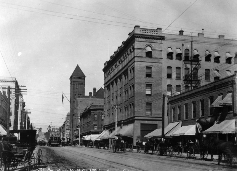 |
|
| (ca. 1900)^ - A view of Broadway looking north toward 3rd Street. Trolleys as well as horses and carriages are seen on the street. City Hall can be seen down the street on the right (tall tower and flag). The Bradbury Building is the large building on the right located on the NE corner of 3rd and Broadway. |
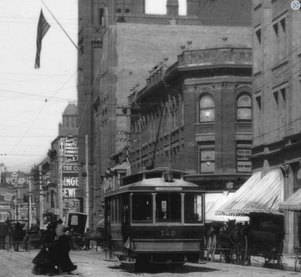 |
|
| (ca. 1900)* - Looking north on Broadway past 3rd Street. The Rindge Block stands on the northeast corner of Broadway and 3rd, while a portion of the Bradbury Building is visible on the right at the southeast corner. In the background, the building with the flagpole is Los Angeles City Hall. |
Historical Notes The Rindge Block, also known as the Rindge Building, was constructed in 1898 and is located at 248-260 S. Broadway, at the northeast corner of Broadway and 3rd Street. In 1899, it was sold to Frederick H. Rindge, often referred to as the "King of Malibu." Over time, the upper floors were removed, leaving only the ground floor, which is currently occupied by an El Pollo Loco restaurant. |
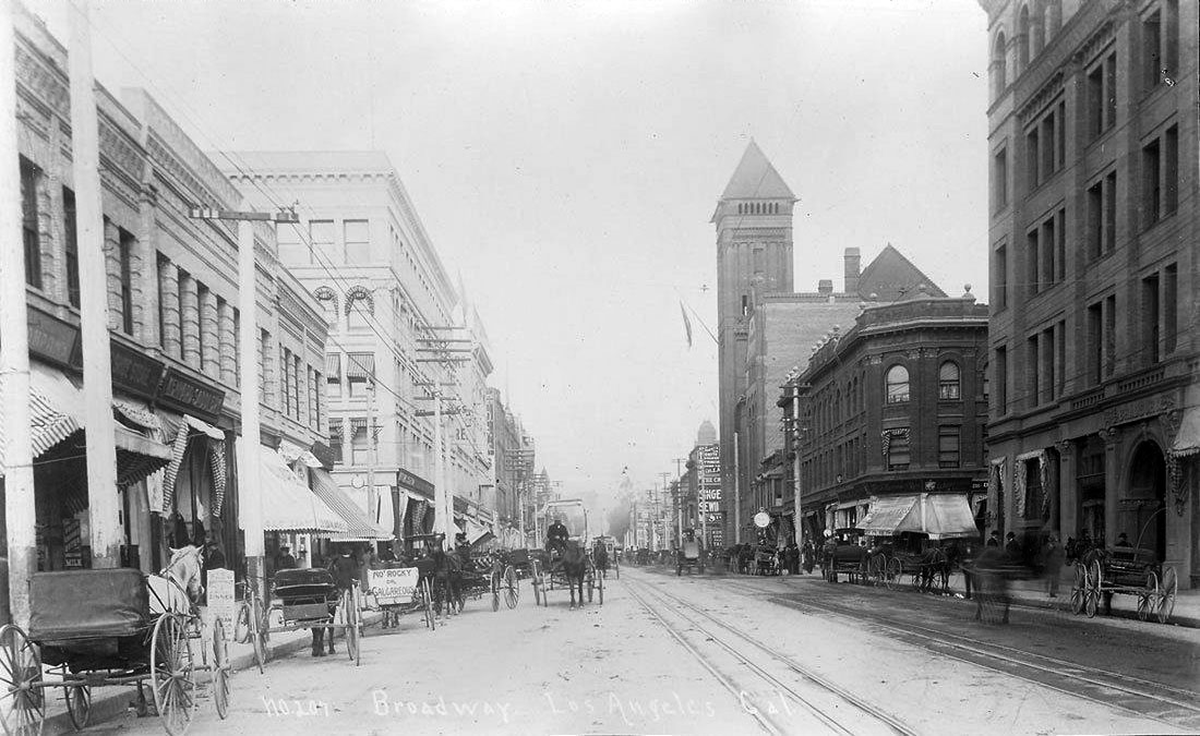 |
|
| (ca. 1900)* - Looking north on Broadway toward 3rd Street. In the distance, the tall tower of Los Angeles City Hall (1888–1928) rises above the streetscape. On the right, at the southeast corner, stands the Bradbury Building. Horse-drawn wagons fill the street, while streetcar tracks run down the center. |
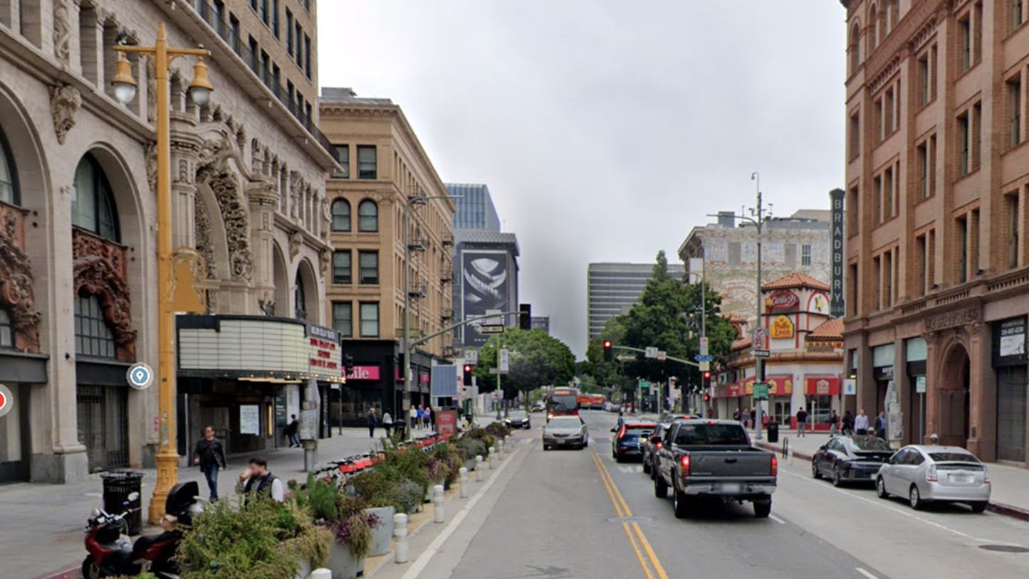 |
|
| (2024)* – Looking north on Broadway toward 3rd Street. On the right, at the southeast corner, stands the 1893-built Bradbury Building, the oldest commercial building in downtown Los Angeles. |
Historical Notes Two of the oldest buildings in downtown Los Angeles stand at the intersection of Broadway and 3rd Street. On the right, the famous Bradbury Building, completed in 1893, occupies the southeast corner. At center-left is the Byrne Building, built in 1895, making it the second-oldest surviving commercial building in downtown. On the far left is the ornate Million Dollar Theater Building, constructed in 1918. |
Then and Now
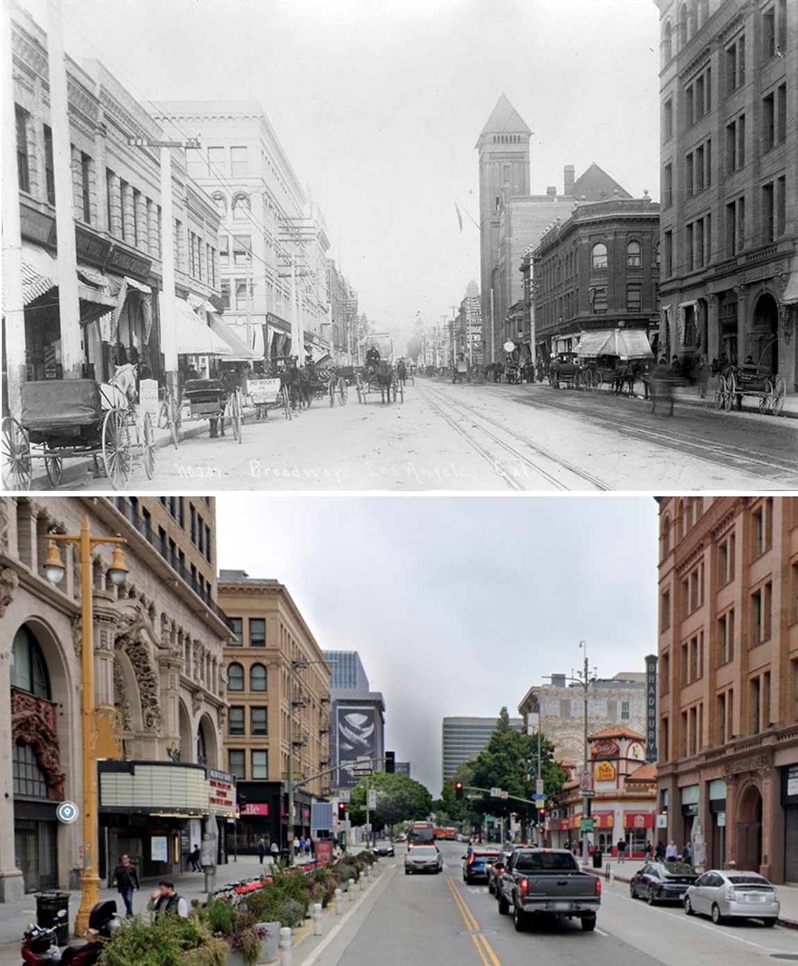 |
|
| (1900 vs. 2024)* – A ‘Then and Now’ comparison of Broadway looking north toward 3rd Street. Two of downtown Los Angeles' oldest buildings stand at this intersection. On the right, at the southeast corner, is the iconic Bradbury Building, completed in 1893. At center-left stands the Byrne Building, built in 1895, the second-oldest surviving commercial building in downtown. Photo comparison by Jack J. Feldman. |
* * * * * |
Broadway Panoramic as seen from LA County Courthouse
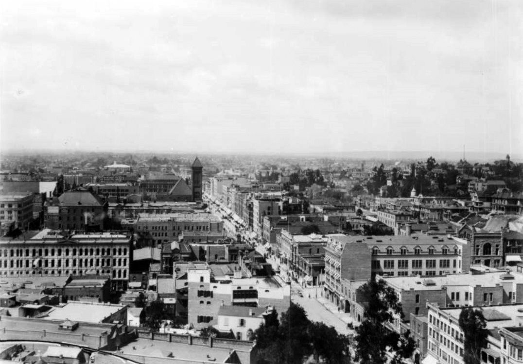 |
|
| (ca. 1900)* - Panoramic view looking south on Broadway from the LA County Courthouse. City Hall is the tallest structure in the distance. |
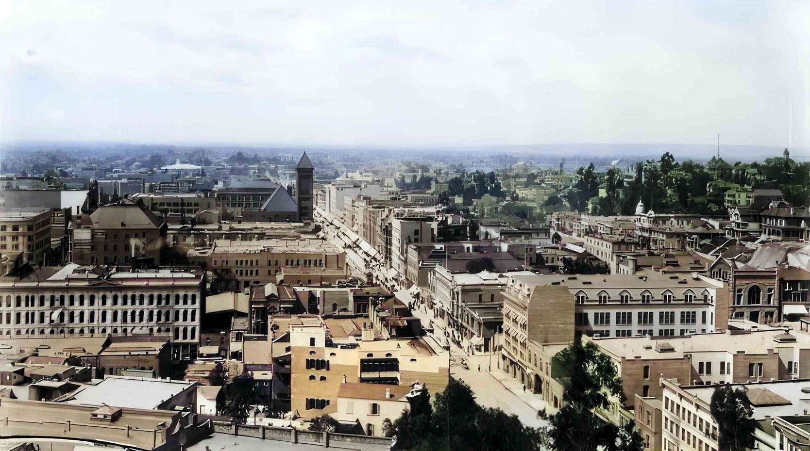 |
|
| (ca. 1900)* - Panoramic view looking south on Broadway from top of LA County Courthouse with City Hall seen as the tallest structure in the distance. AI enhancement and colorization by Richard Holoff |
* * * * * |
Westlake Park
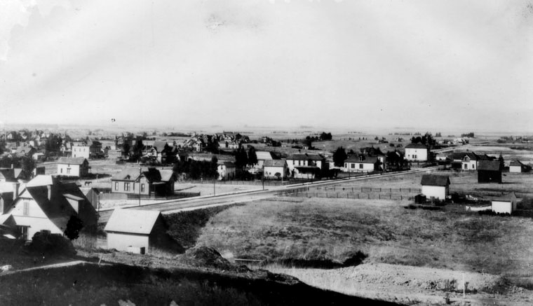 |
|
| (1880s)^ - View looking southwest showing 6th Street (dirt road) as it heads west towards Westlake Park (now MacArthur Park). As seen, this was the edge of the City at the time, around where Alvarado Street is today. |
Historical Notes Initially, the area where Westlake Park was developed was a swampland and had been used as a city dump. However, by the 1890s, it had been transformed into a desirable vacation destination, surrounded by luxury hotels. The park was named after Henricus Wallace Westlake, a Canadian physician who had moved to Los Angeles and donated part of his land for the creation of the park. |
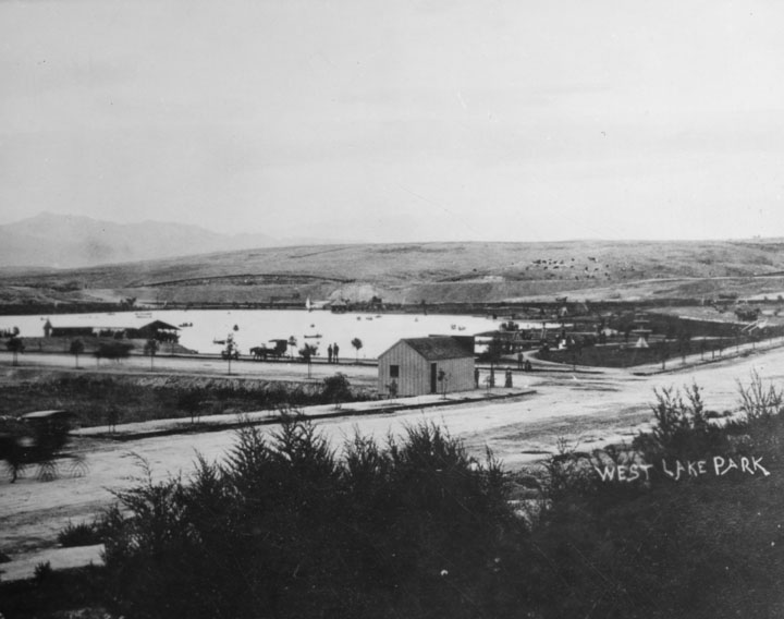 |
|
| (ca. 1880s)^ - Panoramic view looking northwest showing Westlake Park (now MacArthur Park) at the intersection of 7th and Alvarado streets. Alvarado runs diagonally from lower-left to center-right. The surrounding hills are devoid of homes and trees. The building on the far left is the boathouse. |
Historical Notes The park, originally named Westlake Park, was built in the 1880s, along with a similar Eastlake Park, whose lake is artificial. Westlake Park was renamed MacArthur Park on May 7, 1942; Eastlake Park was renamed Lincoln Park. Both Westlake Park and Eastlake Park (as well as Echo Park) were built as drinking water reservoirs connected to the city's systems of zanjas (small conveyance channels/trenches). When the city abandoned the non-pressurized zanja system for a pressurized pipe system, these smaller, shallow reservoirs located at low points no longer provided much benefit. They were then converted into parks. |
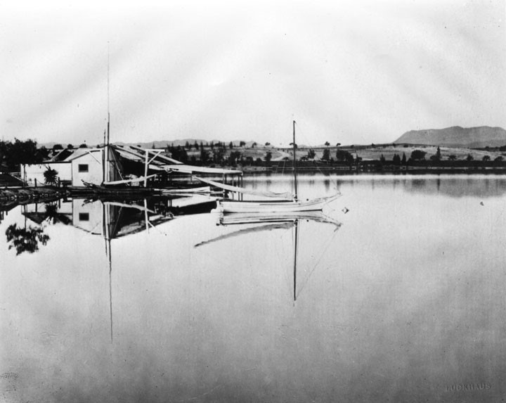 |
|
| (1880s)^ - View looking northwest of Westlake Park and its boathouse. The Hollywood Hills stand in the background (top-right). |
Historical Notes Westlake Park, originally created in the 1880s, was developed on what had been a swampland and neighborhood dump, transformed into a public park featuring a natural lake connected to Los Angeles’ early water system, the Zanja Madre. |
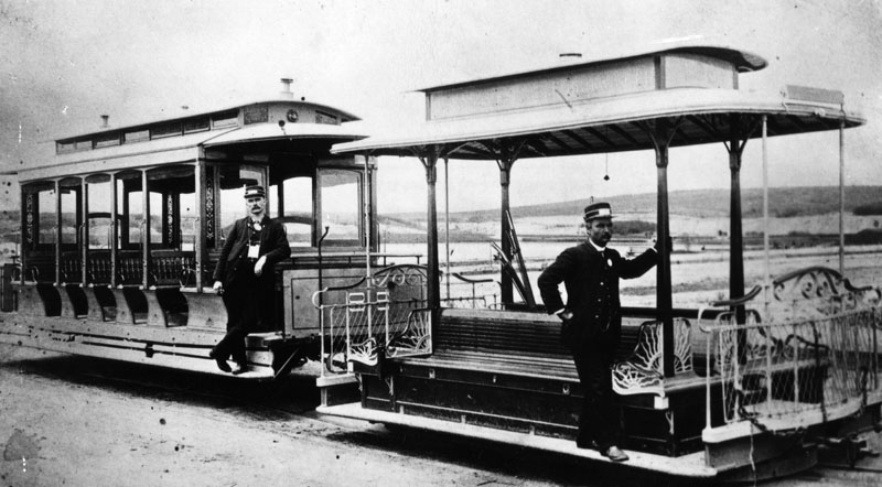 |
|
| (ca. 1880s)^ - Cable cars parked in front of Westlake Park with two conductors posing for the camera. This was the last stop on the cable railway route that started in downtown Los Angeles. |
Historical Notes In the 1880s, Los Angeles had a cable car route running west from downtown along 7th Street to Westlake Park, which was then emerging as a popular destination. This line was part of the Los Angeles Cable Railway system and provided direct service from the city center to the park, helping to open up the area for residential and recreational use. The cable car powerhouse was located near 7th Street and Grand Avenue, supporting the operation of this important transit corridor. This early cable line played a key role in connecting Westlake Park to downtown Los Angeles before the widespread adoption of electric streetcars. |
jpg.jpg) |
|
| (ca. 1890)^ - View of Westlake Park looking north with the Holywood HIlls in the background. A lone sailboat is in the center of the lake. The City's new park's landscape is begining to take form. On the right can be seen a tropical tree and a palm. |
Historical Notes Westlake Park was not designed by a single, well-known landscape architect. Instead, its creation in the 1880s was the result of civic initiative, particularly led by Los Angeles Mayor William Workman, who campaigned to transform the area from a dump into a public park and secured city council support for its establishment in 1886. The physical transformation was managed by a construction team that improved the site by bringing in water from the city's zanja system, raising the lake level, and planting trees and shrubs-often donated by the state forestry board or sourced locally. The landscaping in the early years was described as "ad hoc," rather than the work of a prominent designer, and the park's development was shaped by community effort and gradual improvements rather than a single visionary plan. |
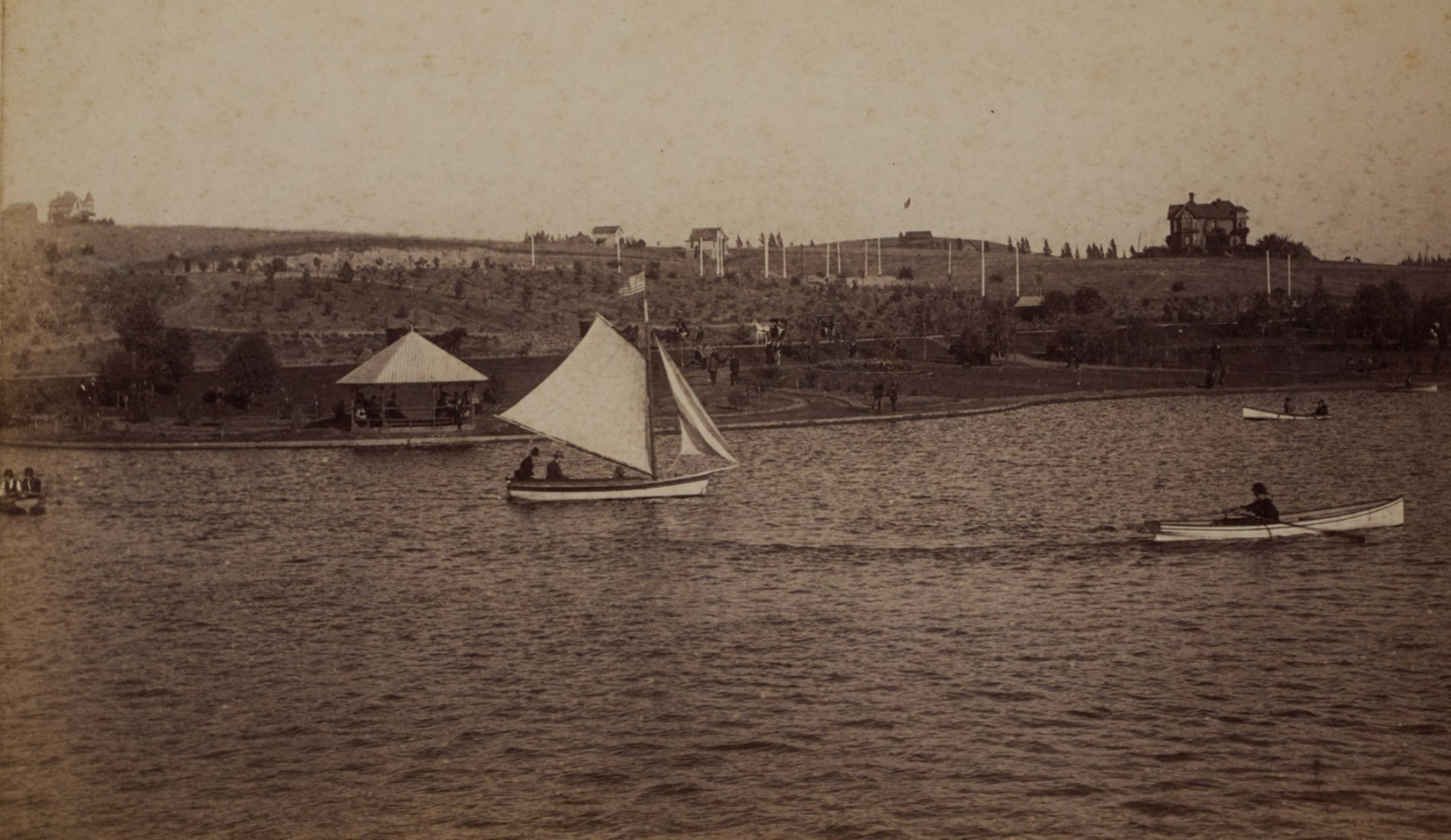 |
|
| (ca. 1890)* – View of Westlake Park looking north, showing a sailboat, rowboat, and canoe on the lake, with people gathered in a gazebo along the shore. In the distance, horse-drawn carriages and several homes can be seen on the hillside overlooking the lake. Photo by Michael A. Wesner, from the Ernest Marquez Collection. |
Historical Notes By 1890, recreational boating and sailing had become central attractions at Westlake Park, with the newly completed lake covering about 20 of the park’s 35 acres. The park quickly became a popular destination for boating parties, and citizens donated boats for public use, including rowboats, canoes, and sailboats. Plans for a handsome boathouse were underway as the park opened, and the lake was large enough to host rowing and even small regattas, with shallow edges designed for children’s safety and palm-lined drives encircling the water. Simultaneously, the park’s scenic appeal and growing reputation as an urban oasis spurred the development of large homes on the hills to the north. By the early 1890s, multi-story Victorian residences were rising above the lake, taking advantage of the sweeping views and proximity to the fashionable new park. The area experienced a real estate boom, with prominent local families building substantial homes and the neighborhood quickly becoming one of Los Angeles’ most desirable residential districts. This blend of recreational amenities and upscale housing established Westlake Park as both a social center and a catalyst for the city’s westward expansion in the 1890s. |
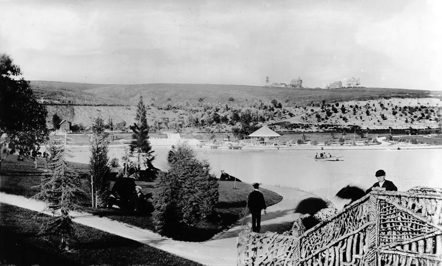 |
|
| (ca. 1892)^^ - View of Westlake with two very large homes seen top of the hill in the background. |
Historical Notes In the mid-19th century the area was a swampland; by the 1890s, it was a vacation destination, surrounded by luxury hotels. |
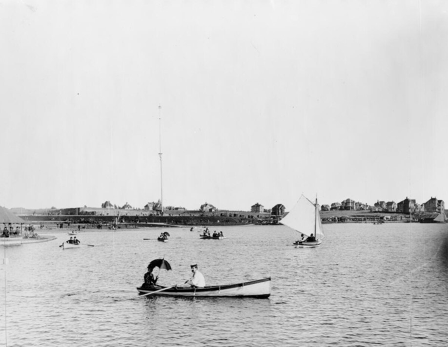 |
|
| (1890s)* - A sailboat and several row boats are seen on the lake at Westlake Park. The hillside is beginning to be filled with new homes. The very tall pole in the background is one of the city’s new streetlights (150-ft tall). Click HERE to see more in Early Los Angeles Street Lights. |
Historical Notes In the 1890s, Westlake Park was a newly established and rapidly popular public space in Los Angeles, having opened to the public around Thanksgiving 1890. Originally a neighborhood dump and alkaline swamp, the site was transformed through civic efforts, including water brought in from the city’s zanja system to raise the lake level and reduce alkalinity. The park featured a natural lake surrounded by landscaped grounds with eucalyptus and oak trees, tropical foliage, and a palm-lined promenade. It quickly became a fashionable destination, accessible by two streetcar lines connecting it to downtown and other parts of the city. By the mid-1890s, Westlake Park was celebrated as the city’s premier open-air resort, offering amenities such as boating with rentable sailboats from a three-story Victorian boathouse, refreshment kiosks, and a bandstand that attracted large concert crowds. |
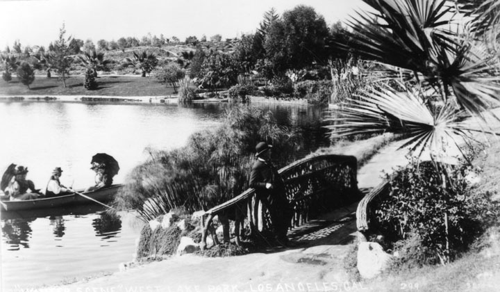 |
|
| (1890s)^ - View of Westlake Park (later MacArthur Park). In this scene we see, on the left, a small group in a row boat, while on shore a man lounges on the rustic foot bridge nearby. |
Historical Notes Surrounding the park, an upscale residential neighborhood developed, attracting prominent Angelenos including newspaper publisher Harrison Gray Otis. The park’s popularity helped spur real estate growth, with subdivisions and elegant homes rising in the area. Despite some failed attempts to expand the parkland in the mid-1890s, Westlake Park remained a central civic and social hub, often described as the “Champs-Élysées of Los Angeles” in the early 20th century. Its transformation from a neglected swamp into a beloved urban oasis marked a significant chapter in Los Angeles’ development and reflected the city’s evolving landscape and social fabric during that era. |
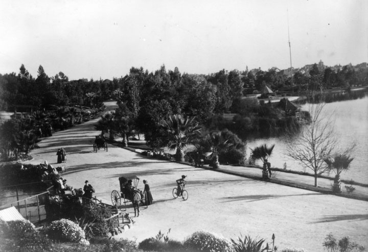 |
|
| (ca. 1890s)^ - Early view of Westlake Park showing horse and carriages and bicycles on the dirt road that surrounded the lake. A 150-foot tall streetlight can be seen in te upper right of photo. |
Historical Notes In the 1890s, landscaping at Westlake Park was a challenging but transformative process. The site had originally been a marshy, alkaline swamp and neighborhood dump, which required significant intervention to become a lush urban park. A key early step was the construction of a pipe to bring fresh water from the city’s zanja system, raising the lake’s water level and reducing its alkalinity, making the environment more hospitable for plant life. Initial landscaping efforts were somewhat ad hoc, relying on locally sourced shrubs and plants. Around the park’s perimeter, eucalyptus and oak trees-donated by the state forestry board-were planted, and palms were introduced along promenades to create a graceful, shaded environment for visitors. Over time, tons of fertilizer and imported topsoil helped dense tropical foliage take root around the lake, contributing to the park’s reputation as a verdant oasis in the growing city. |
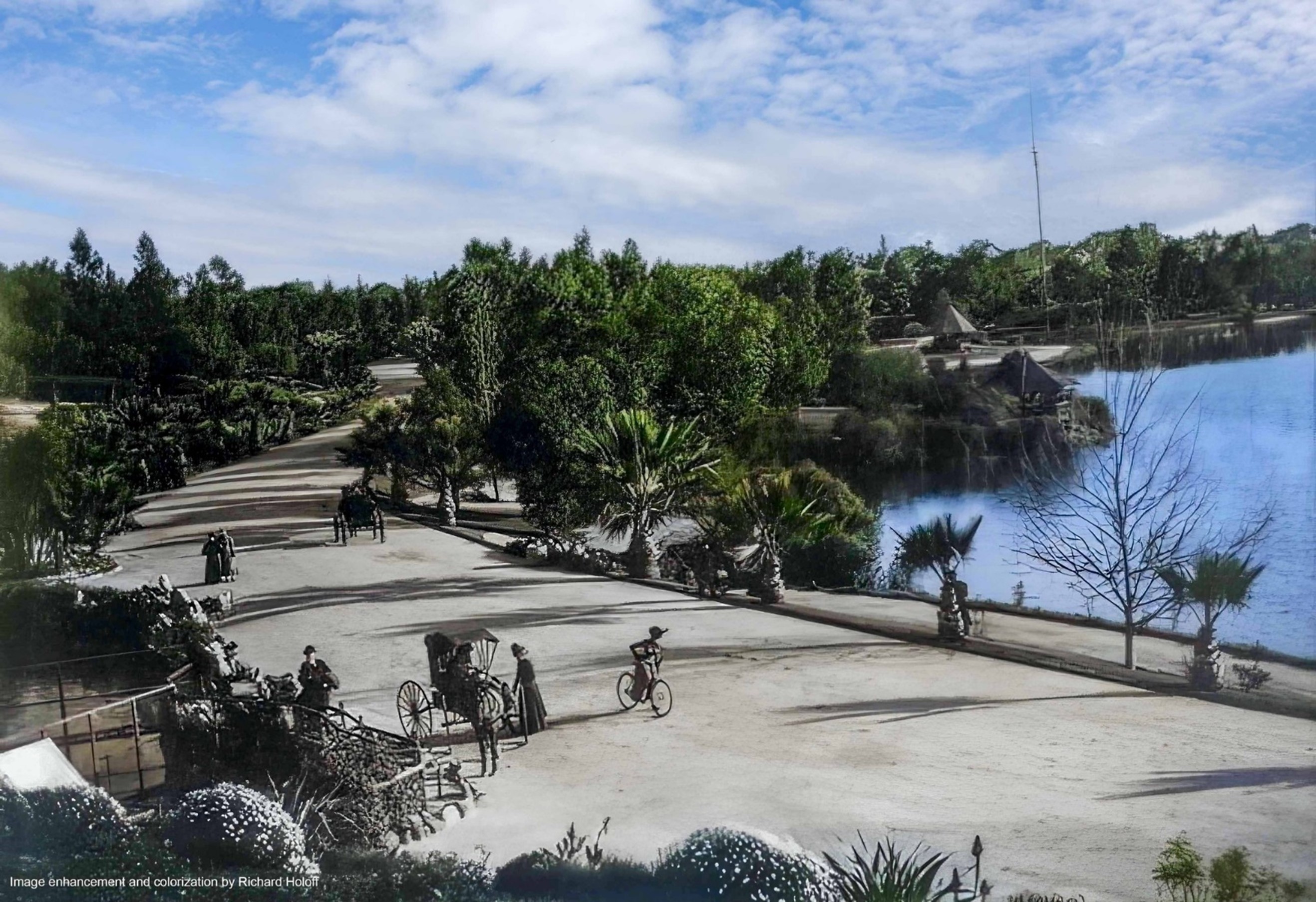 |
|
| (ca. 1890s)^ - Early view of Westlake Park showing horse and carriages and bicycles on the dirt road that surrounded the lake. A 150-foot tall streetlight can be seen in te upper right of photo. Image enhancement and colorization by Richard Holoff |
Historical Notes By the mid-1890s, the park’s grounds featured neatly trimmed lawns, walkways, and various garden areas including a cactus and succulent garden, as well as rustic wooden bridges over small water features. The landscaping was designed to accommodate recreational activities such as boating on the lake and strolling along palm-lined alleys. The park’s improvements were overseen by landscape gardeners familiar with other Los Angeles parks, and included embankments made of redwood planks to stabilize the lake’s edges. These efforts turned Westlake Park into a popular and picturesque retreat, attracting thousands for concerts, boating, and social gatherings, and helping to spur upscale residential development in the surrounding neighborhood. |
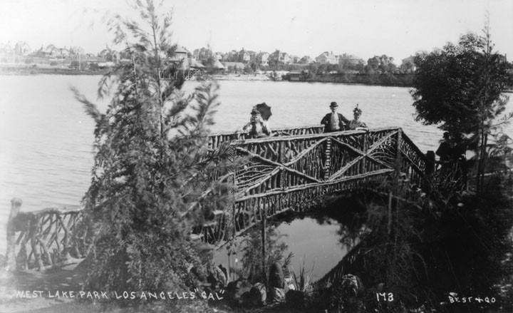 |
|
| (1890s)^ - View of three people on a foot bridge at Westlake Park. The woman at center is holding a parasol. |
Historical Notes Westlake Park featured several rustic footbridges constructed primarily of logs and stones, designed to blend naturally with the park’s landscaped ravines and water features. These footbridges were part of the park’s early efforts to create picturesque and accessible walking paths around the lake and through the varied terrain. The rustic style of these bridges complemented the naturalistic landscaping approach of the time, which emphasized informal plantings and integration with the existing topography. Some of these footbridges were designed or inspired by landscape architects experienced in park design, helping visitors cross small ravines and streams within the park while enhancing its scenic charm. The footbridges contributed to the park’s recreational appeal by connecting walking trails and offering vantage points over the lake and gardens. They were part of broader improvements in the early 1890s, which included embankments made of redwood planks around the lake and the planting of eucalyptus, oak, palms, and tropical foliage. These bridges helped establish Westlake Park as a favored urban retreat, facilitating leisurely strolls and boating activities, and supporting its reputation as one of Los Angeles’ premier open-air resorts of the era. |
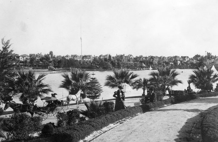 |
|
| (ca. 1895)^ - View of Westlake Park (now MacArthur Park) circa 1895. Transportation was still mostly by horse and carriage (lower left of picture) and ladies carried parasols to shade themselves from the sun. Multi-story homes fill the hill on the other side of the lake. A 150-foot tall streetlight stands in front of the row of homes. |
Historical Notes Wilshire Boulevard formerly ended at the lake on its west side, but in 1934 a berm was built for it to cross and link up with the existing Orange Street (which ran from Alvarado to Figueroa) into downtown Los Angeles. Orange Street was renamed Wilshire and extended east of Figueroa to Grand Ave. This divided the lake into two halves; the northern one was subsequently drained. |
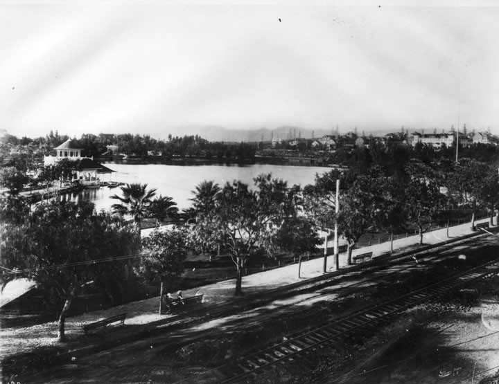 |
|
| (ca.1908)^ - View looking north from near the southeast corner of Westlake Park, close to the intersection of Alvarado and 7th Streets. A tree-lined walkway with benches runs along the park’s edge. Trolley tracks follow an unpaved Alvarado Street, while oil derricks dot the hills beyond the lake. In the distance, the Hollywood Hills rise along the horizon. At upper right, the West Lake Hotel (aka Park View Hotel) overlooks the lake, offering scenic views of the park. |
Historical Notes In 1890, Edward Doheny struck oil south of Angelino Heights and Echo Park, triggering the city’s first oil boom. Soon, hundreds of wells were pumping away in a wide belt stretching roughly south of Temple Street. For decades the wells would change the landscape of the City. Click HERE to see more in 1890s Oil Boom. In the early 1890s, a cable car line operated by the Los Angeles Cable Railway Company ran from downtown Los Angeles at Second and Spring Streets to Westlake Park, following a winding route via Olive Street, First Street, Bonnie Brae, Ocean View Avenue, Westlake Avenue, Sixth Street, Alvarado Street, and finally Seventh Street, terminating at the southeastern corner of the park at Seventh and Alvarado. This cable line was short-lived, as it was converted to electric streetcar operation by the mid-1890s. By the early 1900s, the Los Angeles Railway operated an electric streetcar line that ran directly along Seventh Street from downtown to Westlake Park, providing a more straightforward and efficient connection to the area. Thus, while the original cable car route approached Westlake Park via Alvarado Street, the later and more prominent electric streetcar service used Seventh Street as its main corridor to the park. |
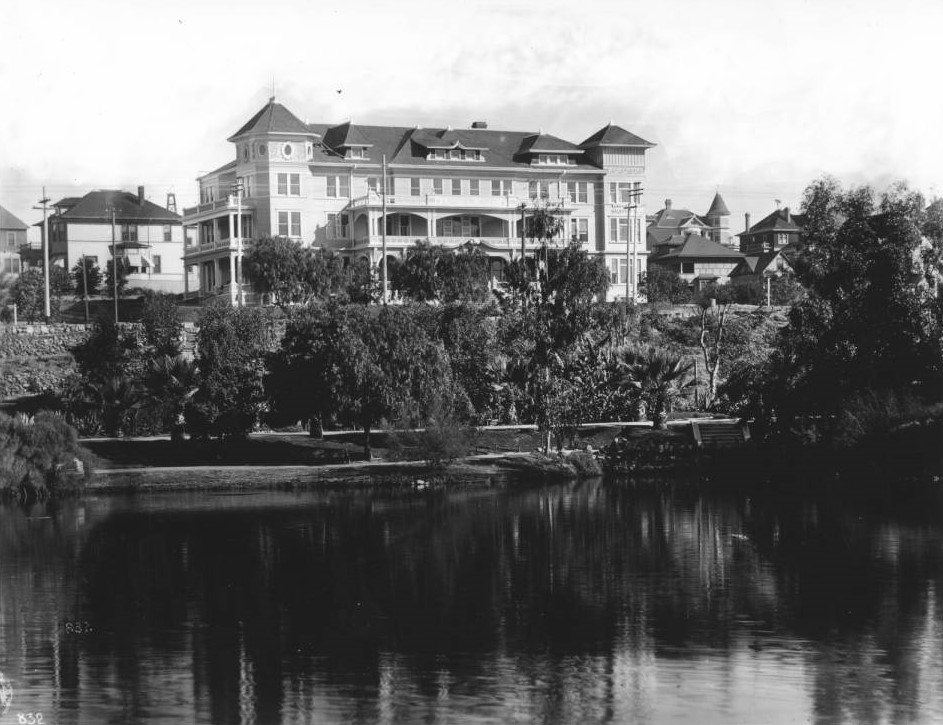 |
|
| (ca. 1908)* – View showing the Lake View Hotel (aka Park View Hotel) sitting on an embankment overlooking Westlake Park (later MacArthur Park). Other buildings, mostly homes, are visible beside the hotel. |
Historical Notes The Lake View Hotel, also known as the Park View Hotel, was a distinguished three-story establishment built in 1908 at 2216 West Sixth Street in Los Angeles. Perched on an embankment overlooking Westlake Park (renamed MacArthur Park in 1942), the hotel offered guests picturesque views of the tree-lined lake and landscaped grounds. Featuring approximately 55 rooms, large windows, and a grand staircase, it stood as an early example of upscale urban hospitality in the rapidly developing Westlake neighborhood, which was renowned for its elegant residences and proximity to downtown. The hotel attracted affluent visitors seeking comfort and leisure near the popular park. However, the construction of Wilshire Boulevard through the area in the 1930s significantly altered the landscape, leading to the demolition of many early structures, including the Lake View Hotel. |
 |
|
| (1908)* - Postcard view showing a tour bus filled with people including young children on the bank of Westlake Park. Writing at bottom reads: "Seeing Los Angeles" - Feb. 24th - "Lakeview" above (referring to the Lake View Hotel, seen in upper-right. |
Historical Notes Westlake Park was renamed MacArthur Park on May 7, 1942. Click HERE to see more Views of Westlake Park (MacArthur Park) in the 1920s + |
* * * * * |
Alvarado Street and Ocean View Ave (Westlake)
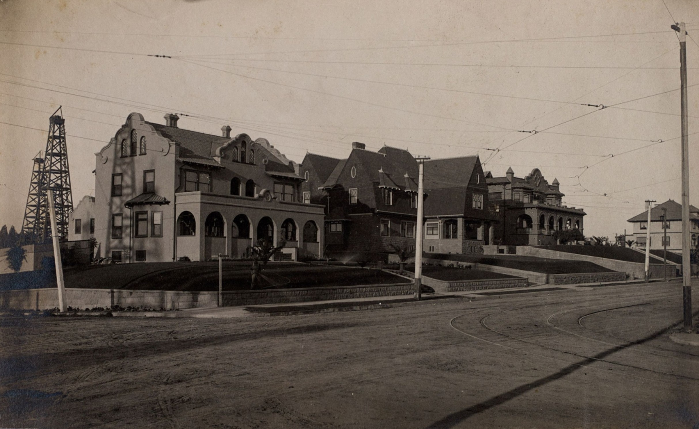 |
|
| (ca. 1900)* – View of the northeast corner of Alvarado Street and Ocean View Avenue in the Westlake Park neighborhood of Los Angeles. A Mission Revival house stands on the corner, with oil wells visible on the left in the background. Photo from the Ernest Marquez Collection. |
Historical Notes The oil wells seen above were part of the Los Angeles Oil Field. Discovered in 1890 and made famous by Edward Doheny’s successful well in 1892, it was once California’s top-producing oil field, accounting for more than half of the state’s oil in 1895. At its peak in 1901, approximately 200 separate oil companies operated there. Today, the field is entirely overbuilt with dense residential and commercial development. |
 |
|
| (ca. 1900)* – A woman drives a horse-drawn carriage through the Westlake Park neighborhood of Los Angeles. In the distance, oil wells and a Mission Revival-style house are visible on Ocean View Avenue, near Alvarado Street. Photo from the Ernest Marquez Collection. |
Historical Notes Around 1900, the Westlake district of Los Angeles was a prestigious residential area centered around scenic Westlake Park (now MacArthur Park), lined with grand homes and attracting affluent residents. However, its character came under threat when oil prospectors pushed westward from the booming Los Angeles City Oil Field. By the mid-1890s, derricks had appeared near Ocean View Avenue and Alvarado Street, just blocks from the park, creating tension between industry and residential life. Residents feared that oil drilling would drive down property values and ruin the neighborhood’s appeal, prompting them to push for legal restrictions. |
 |
|
| (1909)* – Early map of the Westlake area of Los Angeles, highlighting the intersection of Alvarado Street and Ocean View Avenue. Source: Library of Congress. |
Historical Notes In response to residence’s concerns, the Los Angeles City Council passed a 1897 ordinance banning oil wells within 1,600 feet of Westlake Park—one of the city’s first zoning-style regulations. Oil operators resisted, calling the measure unconstitutional, and enforcement was spotty at first. But after protests and legal action by neighborhood associations, the city stood firm. By 1898–1899, drilling was effectively stopped within the protected zone, preserving Westlake’s residential integrity. Property values stabilized, and the area avoided being overrun by industrial development, unlike other parts of the city affected by the oil boom. |
 |
|
| (1906)* – Map showing the Los Angeles Oil Field in the Westlake area of Los Angeles. Map source: Library of Congress. |
Historical Notes As the oil threat subsided, Westlake thrived as a showcase for Mission Revival architecture—a style rooted in California’s Spanish colonial past and popular among the city’s elite. Wealthy residents built stately stucco homes with red tile roofs and arched verandas, often overlooking the park. Notable examples included General Harrison Gray Otis’s mansion, “The Bivouac,” and other large homes along 7th Street and Alvarado. These homes reflected both the affluence and cultural aspirations of their owners and helped solidify Westlake’s reputation as a stylish, regionally inspired residential enclave at the dawn of the 20th century. |
* * * * * |
More Historical Early Views
Newest Additions
Early LA Buildings and City Views
History of Water and Electricity in Los Angeles
* * * * * |
Please Support Our CauseWater and Power Associates, Inc. is a non-profit, public service organization dedicated to preserving historical records and photos. We are of the belief that this information should be made available to everyone—for free, without restriction, without limitation and without advertisements. Your generosity allows us to continue to disseminate knowledge of the rich and diverse multicultural history of the greater Los Angeles area; to serve as a resource of historical information; and to assist in the preservation of the city's historic records.
|
References and Credits
* DWP - LA Public Library Image Archive
^ LA Public Library Image Archive
^* The Valley Observied: Street Name Origins; Timeline of Valley History
^# Chatsworth Historical Society
#^ Huntington Digital Library Archive
*# Publications of the Historical Society of Southern California, Volume 9: Eternity Street
***Los Angeles Historic - Cultural Monuments Listing
+**Facebook.com: Old Photos of Los Angeles
*^*California Historical Landmarks Listing (Los Angeles)
*#*KCET: When L.A.'s Most Famous Streets Were Dirt Roads
*^#Public Art in LA: Campo Santo
*##Metro.net - Los Angeles Transit History
^##California State Library Image Archive
**#The Cable-Car-Guy.com: The Los Angeles Railway; Temple Street Cable Railway
^^#CSULB - A Visit to Old LA: Hamburger Dept. Store; Overhead Line Congestion on Spring
^*#Noirish Los Angeles - forum.skyscraperpage.com; Arcade Palm Tree; Spring St. Central Market; Adams and Figueroa; Westminster Hotel; Angels Flight; Robinson Manison and Teed Street; Main and 4th; Hollenbeck Park
#^*Flickr.com: Michael Ryerson
^#*LA Almanac: First Automobile in Southern California
^#^Historic Hotels of Los Angeles and Hollywood (USC - California Historic Society: Van Nuys Hotel
**^History Matters: Calle de los Negros, 1880s
^^*LA Fire Department Historical Archive
^^^LA Times: The Gush of Oil Was Music to 'Queen's' Ears; Gas-powered carriage didn't have much speed to burn
****Theeastsiderla.com: Angelino Heights Oil Boom
***^TheZephyr.com: O.T. Johnson
***#Historicechopark.org: Echo Park Lake
#***Photos of Vintage Los Angeles: Facebook.com
++^^Boyle Heights History Blog: Hollenbeck Park
*^^*Los Angeles Past: City Hall (ca. 1895)
^*^*KCET - El Aliso: Ancient Sycamore Was Silent Witness to Four Centuries of L.A. History
^*^#Facebook.com - Bizarre Los Angeles
*^#*Automobile Club of Southern California
*#**Mojave Desert.net: Remi Nadeau
*#^*USC Facebook.com
*###Nuestra Señora Reina de los Angeles Asistencia Gallery
^#*#Electronic Scrapbook of Alhambra History
*##^The Street Railway History of Los Angeles - erha.org
^##*Pacific Coast Architecture Database (PCAD): Bryson-Bonebrake Block
^###Exposition Park History - Expositionpark.org
^^##UC Irvine - The White City by Miles Clement
^**^Wikipedia Images: Early L.A. Oil Wells
#^^*Early Downtown Los Angeles - Cory Stargel, Sarah Stargel
#^*^Calisphere: University of California Image Archive
#*#*Walk N Ride LA: Exposition Park
#*#^LAPL-El Pueblo de Los Angeles Historical Monument Photo Archive
#*^^The Department Store Museum: J. W. Robinson's
#**#On Bunker HIll: Larronde Block and Residence; Crocker Mansion
#*^#Google Maps
*#*#*Flickr.com: Views of Los Angeles
*^ Wikipedia: Arcadia Bandini de Stearns Baker; Bunker Hill; Prudent Beaudry; Jonathan Temple; Los Angeles High School; Joseph Widney; Pershing Square; Port of Los Angeles; Belmont High School; Hollenbeck Park; Ducommun; Isaias W. Hellman; Abel Stearns; Sawtelle Veterans Home; Arcade Station; Alhambra; Fort Moore; History of Santa Monica; History of Los Angeles; Burbank; Mt. Lowe Railway; Los Angeles City Oil Field; La Grande Station; MacArthur Park; Los Angeles Athletic Club; Western Avenue; History of Los Angeles Population Growth; Garvanza, Los Angeles; Highland Park; Cawston Ostrich Farm; Arroyo Seco; History of Santa Monica; Los Angeles and Independence Railroad; Pío Pico; John Edward Hollenbeck; Alvarado Terrace Historic District; Sawtelle, Los Angeles; Angelino Heights; Angels Flight
< Back